The Hounds Run Hike at the McIntyre Wild Area near Trout Run, Pennsylvania is a moderate 0.6-mile out-and-back bushwhack of a walk that leads upstream along Hounds Run, in hopes of finding waterfalls.
Hike Description
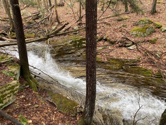
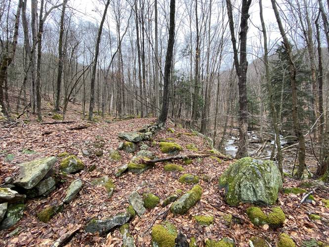
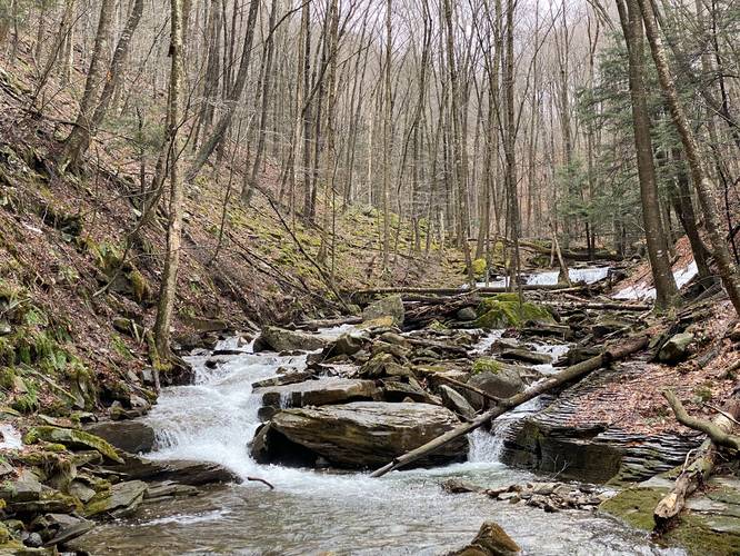
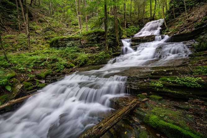
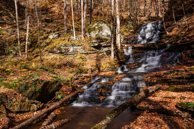
This attempted hike to reach Hounds Run Falls begins at the small parking turnout next to Hounds Run and heads up the left-hand side of the creek. This was tracked in late-March 2021, so the water level was a bit too high to reach Hounds Run Falls; however, there are several nice small cascades along the way, despite this uneven and rocky terrain.
This track follows no real trail and hikers will need to both pass through brush, follow the creek upstream, and probably even get their feet wet to actually reach the waterfall. I stopped around 0.3-miles in when I could see, what looked like a waterfall of about 10-feet tall and 20-feet wide, but was too far downstream to get a good picture.
Plan for plenty of bushwhacking, especially once the leaves and overgrowth fill in. Also plan for steep creek banks, rocky terrain, and deep creek crossings. Hikers should come prepared with waders or at least gear to change out into after getting soaked by Hounds Run creek - if you plan to reach Hounds Run Falls.
Pets
Dogs are allowed, but it's probably best to leave them at home. Unless you have a large dog, off-leash, that's used to 2-foot deep creeks, don't bring your dog. I had my small 20lbs dog and it made traversing upstream more difficult.
Parking
Hikers will find parking at the coordinates provided. The lot is large enough to fit about 3 vehicles, max. Additional parking can be found just up the street near Yellow Dog Rd.
Warning
Rattlesnakes: While rare, the Timber Rattlesnake lives in this area and tends to come down to creeks to cool down or hunt between the end of April through the end of September. Watch your step and give any rattlesnake you see some space.
Hike Description
This attempted hike to reach Hounds Run Falls begins at the small parking turnout next to Hounds Run and heads up the left-hand side of the creek. This was tracked in late-March 2021, so the water level was a bit too high to reach Hounds Run Falls; however, there are several nice small cascades along the way, despite this uneven and rocky terrain.
This track follows no real trail and hikers will need to both pass through brush, follow the creek upstream, and probably even get their feet wet to actually reach the waterfall. I stopped around 0.3-miles in when I could see, what looked like a waterfall of about 10-feet tall and 20-feet wide, but was too far downstream to get a good picture.
Plan for plenty of bushwhacking, especially once the leaves and overgrowth fill in. Also plan for steep creek banks, rocky terrain, and deep creek crossings. Hikers should come prepared with waders or at least gear to change out into after getting soaked by Hounds Run creek - if you plan to reach Hounds Run Falls.
Pets
Dogs are allowed, but it's probably best to leave them at home. Unless you have a large dog, off-leash, that's used to 2-foot deep creeks, don't bring your dog. I had my small 20lbs dog and it made traversing upstream more difficult.
Parking
Hikers will find parking at the coordinates provided. The lot is large enough to fit about 3 vehicles, max. Additional parking can be found just up the street near Yellow Dog Rd.
Warning
Rattlesnakes: While rare, the Timber Rattlesnake lives in this area and tends to come down to creeks to cool down or hunt between the end of April through the end of September. Watch your step and give any rattlesnake you see some space.