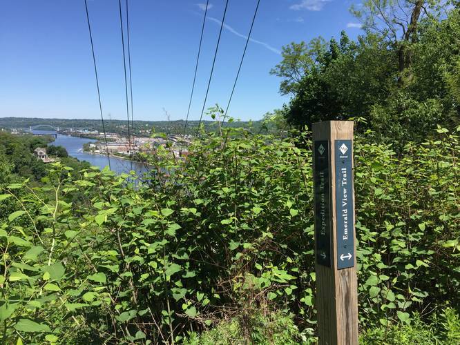
The George and Guy Trail at Emeral View Park in Pittsburgh, Pennsylvania is a moderate 0.8-mile one-way hike with spectacular views of the city. The trail descends from the top of Mount Washington and continues on its slopes down to Horner Street and eventually reaches the Greenleaf Trail.
This trail is technically part of the Emerald View Trail; however, since it has a its own distinguished name and has spectacular views of downtown Pittsburgh and the rivers, it deserves its own section on the site.
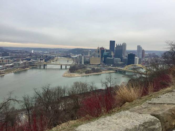
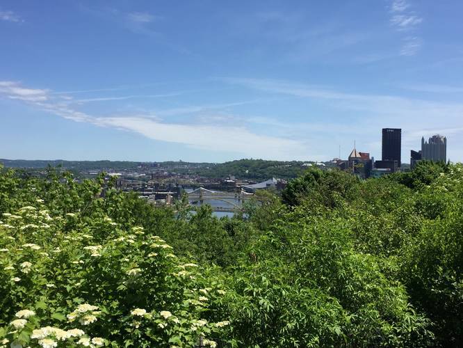
From the trailhead, you'll get amazing views of downtown Pittsburgh. Hike down the hill and follow the switchbacks that lead into the woods along the slopes of Mt Washington. You'll follow the trail as it skirts along steep ledges with interesting rock formations along the hill. As you hike along the slopes of Mt Washington, there's not much to see until you reach the western section of the trail where the views open up once again. From there you'll see the West End Bridge, the Ohio River, and neighborhoods across the way.
Finally, at the bottom of the western switchbacks, you'll reach the Greenleaf Trail, which you can use to hike back towards parking. Note that you'll need to hike along the streets to reach your parking spot.
Parking: Parking can be found further down Sweetbriar Street, but be mindful of the driveways and parking signs. There are no trails that loop back to Sweetbriar Street, so you'll need a mobile device so find your way from the Greenleaf Trail parking area back to where you parked.
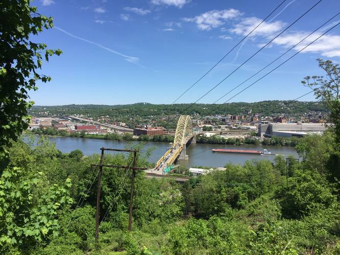
Lookout Point: Along this trail there are really just two main lookout points. One lookout is obvious and sits at the eastern trailhead, where you can also find parking nearby. The second lookout point is located along the western terminus of the trail, close to the switchbacks that initially lead up the hill. This lookout point gives you views of the Ohio River and the West End Bridge. The further you hike up the switchbacks, the better the views are.
Hazards: The trail follows the slopes of Mt Washington, so in certain areas, there are essentially cliffs right to the side of the trail with at least 30-foot drops, if not more. You must be careful and watch your footing, especially after its rained, due to slipping in mud or tripping. Watch your step and stay away from the ledges.
Pets: Dogs are allowed on this trail, but must be leashed.
Biking: Biking is technically allowed, but not recommended due to the very steep cliff-like sections of the trail where you could easily ride off and get seriously injured.
Summit: Listed Mt Washington as a 'summit' despite it being a hill and there being no actual summit marker. This was listed since there really aren't many 'mountain summits' near Pittsburgh due to the plateau-like geography of the area.
This trail is technically part of the Emerald View Trail; however, since it has a its own distinguished name and has spectacular views of downtown Pittsburgh and the rivers, it deserves its own section on the site.
From the trailhead, you'll get amazing views of downtown Pittsburgh. Hike down the hill and follow the switchbacks that lead into the woods along the slopes of Mt Washington. You'll follow the trail as it skirts along steep ledges with interesting rock formations along the hill. As you hike along the slopes of Mt Washington, there's not much to see until you reach the western section of the trail where the views open up once again. From there you'll see the West End Bridge, the Ohio River, and neighborhoods across the way.
Finally, at the bottom of the western switchbacks, you'll reach the Greenleaf Trail, which you can use to hike back towards parking. Note that you'll need to hike along the streets to reach your parking spot.
Parking: Parking can be found further down Sweetbriar Street, but be mindful of the driveways and parking signs. There are no trails that loop back to Sweetbriar Street, so you'll need a mobile device so find your way from the Greenleaf Trail parking area back to where you parked.
Lookout Point: Along this trail there are really just two main lookout points. One lookout is obvious and sits at the eastern trailhead, where you can also find parking nearby. The second lookout point is located along the western terminus of the trail, close to the switchbacks that initially lead up the hill. This lookout point gives you views of the Ohio River and the West End Bridge. The further you hike up the switchbacks, the better the views are.
Hazards: The trail follows the slopes of Mt Washington, so in certain areas, there are essentially cliffs right to the side of the trail with at least 30-foot drops, if not more. You must be careful and watch your footing, especially after its rained, due to slipping in mud or tripping. Watch your step and stay away from the ledges.
Pets: Dogs are allowed on this trail, but must be leashed.
Biking: Biking is technically allowed, but not recommended due to the very steep cliff-like sections of the trail where you could easily ride off and get seriously injured.
Summit: Listed Mt Washington as a 'summit' despite it being a hill and there being no actual summit marker. This was listed since there really aren't many 'mountain summits' near Pittsburgh due to the plateau-like geography of the area.