The Greenleaf Trail, which is the west end section of the Emerald View Trail, at the Emerald View Park in Pittsburgh, Pennsylvania is a moderate 0.5-mile one-way trail that begins on Greenleaf Street and runs to the western terminus of the George and Guy Trail with views along the way.
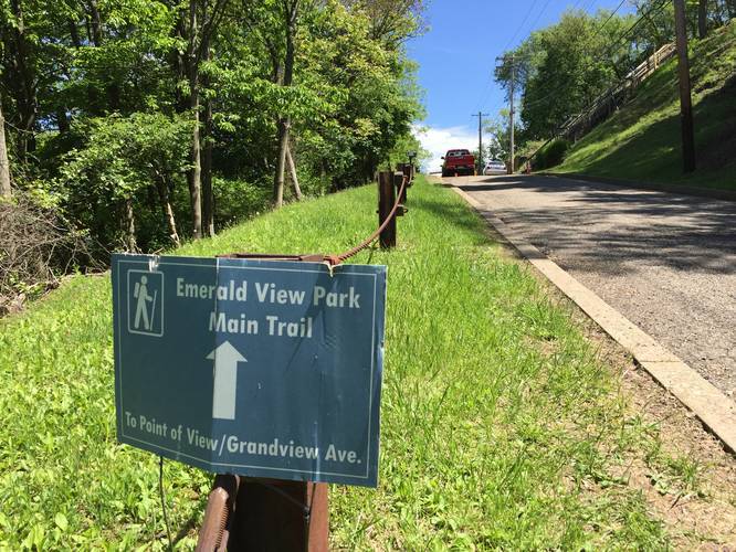
This trail is technically part of the Emerald View Trail, but this section was added to the site as it's own trail due to the awesome views you get of the West End and Elliott in Pittsburgh. The trail starts off at the parking lot along Greenleaf St and takes the immediate right-hand turn at the trail sign.
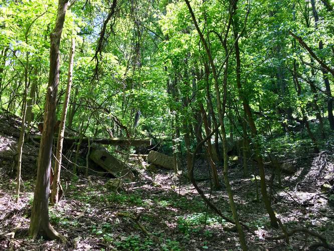
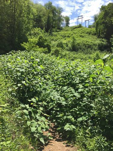
The trail then heads downhill, which can be steep in sections; hence, the moderate difficulty regardless of which direction you're hiking this trail. Shortly after the trail reaches the bottom of the hill, you'll have to cross through a section of overgrown brush under the powerlines, which lasts about 20 to 30-feet. During the summer, this section may be totally overgrown since during mid-May, this section was almost not visible if it were not for the day hikers pushing through to make a path.
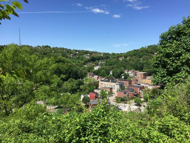
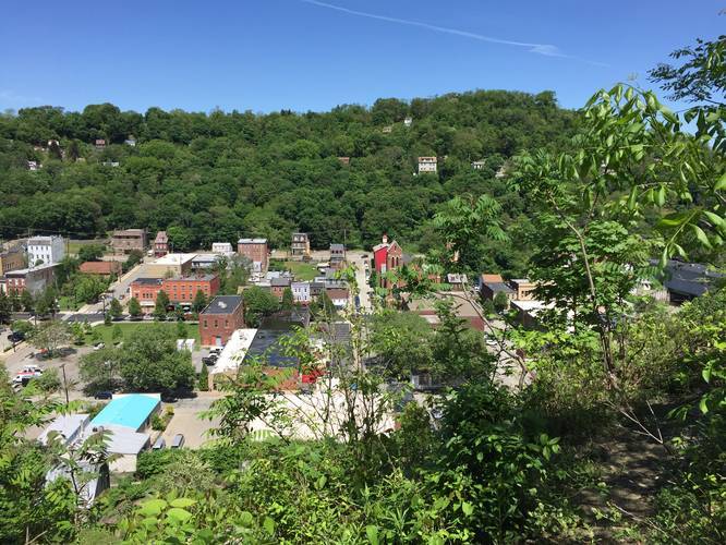
Continue onward along the flatter section of the trail with views to the west. Just before the trail continues back uphill, you'll get to yet another great lookout point high above the West End and Elliott. Follow the trail uphill back to Greenleaf Street - crossing Greenleaf and follow Horner Street up the hill. The trail ends at the end of Horner Street where the George and Guy Trail begins. Take the George and Guy Trail back up Mt Washington to the top where you'll find amazing views of downtown Pittsburgh.
Views: Just after the powerlines and brush, you'll pass a few lookout points with views of Elliott and the West End in Pittsburgh.
Parking: There's a decent-sized parking lot along Greenleaf Street at the parking coordinates provided. Plenty of room for about 10 cars or so.
Pets: Dogs are allowed on this trail if they're leashed.
Biking: Biking is allowed on this trail, but be mindful of the curves and slow day hikers.
This trail is technically part of the Emerald View Trail, but this section was added to the site as it's own trail due to the awesome views you get of the West End and Elliott in Pittsburgh. The trail starts off at the parking lot along Greenleaf St and takes the immediate right-hand turn at the trail sign.
The trail then heads downhill, which can be steep in sections; hence, the moderate difficulty regardless of which direction you're hiking this trail. Shortly after the trail reaches the bottom of the hill, you'll have to cross through a section of overgrown brush under the powerlines, which lasts about 20 to 30-feet. During the summer, this section may be totally overgrown since during mid-May, this section was almost not visible if it were not for the day hikers pushing through to make a path.
Continue onward along the flatter section of the trail with views to the west. Just before the trail continues back uphill, you'll get to yet another great lookout point high above the West End and Elliott. Follow the trail uphill back to Greenleaf Street - crossing Greenleaf and follow Horner Street up the hill. The trail ends at the end of Horner Street where the George and Guy Trail begins. Take the George and Guy Trail back up Mt Washington to the top where you'll find amazing views of downtown Pittsburgh.
Views: Just after the powerlines and brush, you'll pass a few lookout points with views of Elliott and the West End in Pittsburgh.
Parking: There's a decent-sized parking lot along Greenleaf Street at the parking coordinates provided. Plenty of room for about 10 cars or so.
Pets: Dogs are allowed on this trail if they're leashed.
Biking: Biking is allowed on this trail, but be mindful of the curves and slow day hikers.