The Deadman Trail at Tioga State Forest in Shippen Township is an easy 2.7-mile out-and-back trail that runs adjacent to the Deadman Hollow Run Trail and along the mountainside. This trail does not have much to see, but during the colder months when no leaves are on the trees, hikers will get glimpses of the surrounding mountain ranges.
The trail begins at the yellow and black service gate and follows the wide trail, mostly heading downhill the whole time, through the forest and along the mountainside. The trail has several sections of overgrowth that have not yet been chopped down - these are mostly smaller coniferous trees that often make it look like the trail ends. Hikers can push past these small trees to continue on the trail.
Several sections of the hike include large areas of evergreens, but most of the trail follows a mixed forest of deciduous trees and conifers.
Hikers will essentially reach the "end" of this trail when they reach the larger clear-cut area, located about 1.2 to 1.3-miles from the parking lot. The trail technically continues on from here, as does this GPS track, but it's not clear where the trail truly ends or if it connects with any of the neighboring trails.
The hike back to parking is more difficult than the hike to the clear-cut area, but it's still an easy hike because of the gradual elevation grade.
Parking
Parking can be found at the coordinates provided. The turnout is large enough for a few cars. Do not block the yellow access gate. Hikers will also find that the Deadman Hollow Run Trail leads up to this parking lot; however, that trail (blue blazes) is not easy to follow from this parking lot because of the lack of blazes.
Pets
Dogs are allowed if leashed.
Vistas
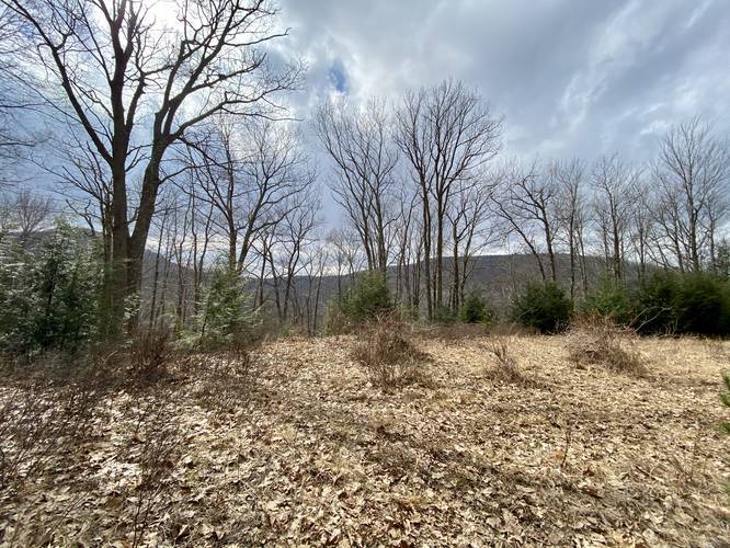
There's really no true vista point here because of the trees; however, hikers will find some obstructed views of the surrounding mountain ranges during colder months.
Winter Road Conditions
Tioga State Forest does not maintain this road during the winter. Do not attempt driving on this road without proper equipment including snow tires and/or chains unless the road is clear. High wind storms may also cause trees to fall across the road, making the road impassible. If you plan to visit during the winter, plan accordingly.
The trail begins at the yellow and black service gate and follows the wide trail, mostly heading downhill the whole time, through the forest and along the mountainside. The trail has several sections of overgrowth that have not yet been chopped down - these are mostly smaller coniferous trees that often make it look like the trail ends. Hikers can push past these small trees to continue on the trail.
Several sections of the hike include large areas of evergreens, but most of the trail follows a mixed forest of deciduous trees and conifers.
Hikers will essentially reach the "end" of this trail when they reach the larger clear-cut area, located about 1.2 to 1.3-miles from the parking lot. The trail technically continues on from here, as does this GPS track, but it's not clear where the trail truly ends or if it connects with any of the neighboring trails.
The hike back to parking is more difficult than the hike to the clear-cut area, but it's still an easy hike because of the gradual elevation grade.
Parking
Parking can be found at the coordinates provided. The turnout is large enough for a few cars. Do not block the yellow access gate. Hikers will also find that the Deadman Hollow Run Trail leads up to this parking lot; however, that trail (blue blazes) is not easy to follow from this parking lot because of the lack of blazes.
Pets
Dogs are allowed if leashed.
Vistas
There's really no true vista point here because of the trees; however, hikers will find some obstructed views of the surrounding mountain ranges during colder months.
Winter Road Conditions
Tioga State Forest does not maintain this road during the winter. Do not attempt driving on this road without proper equipment including snow tires and/or chains unless the road is clear. High wind storms may also cause trees to fall across the road, making the road impassible. If you plan to visit during the winter, plan accordingly.