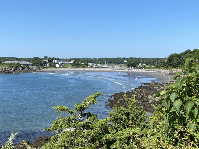
The Cliff Walk Trail is a short 1.2-mile out-and-back trail that leads from the York Harbor Beach, along the cliff side, over to Milbury Lane and features beautiful views of Maine's southern coastline.
This is a great day hike for anyone visiting the area. You can also extend your hike by checking out a couple of other trails close by. One of the trails is the Fisherman's Walk and is located just a few hundred feet from this trailhead. You can use the Fisherman's Walk Trail to connect to yet another great trail, the Wiggly Bridge.
Parking
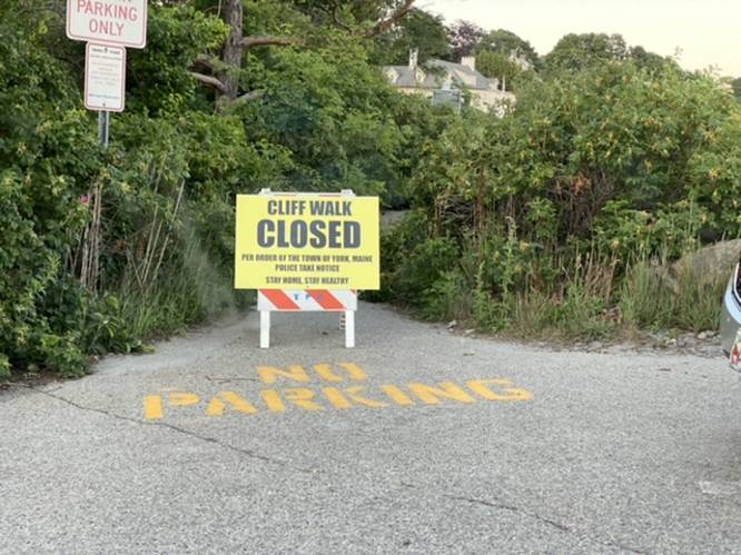
Parking here can be tricky. If you're a resident with a permit, you can park along Harbor Beach Rd (next to the trailhead). If you do not have a permit, you can park on York Street (Route 1A) and walk down to the trailhead. The parking directions for this trail will lead you to the entrance to Harbor Beach Rd along York Street (Route 1A). Be respectful of the locals and do not park on Harbor Beach Rd if you do not have a permit. Also note that this is a very popular destination during the Summer, so parking along Route 1A can be a nightmare. Plan on walking an additional 1 mile just to get to and from the trailhead during peak season, unless you arrive early in the day.
Pets
Dogs are not permitted on this trail.
Biking
Biking is not permitted on this trail.
Warnings
Poison Ivy: Hikers will notice plenty of poison ivy along this trail, mostly located around the 0.3-mile mark and onward, heading northeast.
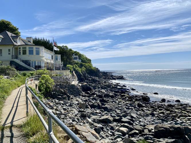
Steep cliffs: There are some steep sections of cliff side along this trail in addition to a narrow rocky path. Hikers should come prepared and watch their step.
Hiking the Cliff Walk in York, Maine
This trail provides hikers with amazing views of York Harbor and the beach below along with massive mansions along the coastline. The trail starts out paved but quickly switches to an uneven rocky terrain that follows a narrow path. Eventually the trail ends along a small Town right-of-way at the end of Milbury Lane in York. At the end of the trail, hikers can choose to take the trail back for a 1.2-mile out-and-back hike or walk the public roads back to parking in a loop, for a similar distance.This is a great day hike for anyone visiting the area. You can also extend your hike by checking out a couple of other trails close by. One of the trails is the Fisherman's Walk and is located just a few hundred feet from this trailhead. You can use the Fisherman's Walk Trail to connect to yet another great trail, the Wiggly Bridge.
Parking
Parking here can be tricky. If you're a resident with a permit, you can park along Harbor Beach Rd (next to the trailhead). If you do not have a permit, you can park on York Street (Route 1A) and walk down to the trailhead. The parking directions for this trail will lead you to the entrance to Harbor Beach Rd along York Street (Route 1A). Be respectful of the locals and do not park on Harbor Beach Rd if you do not have a permit. Also note that this is a very popular destination during the Summer, so parking along Route 1A can be a nightmare. Plan on walking an additional 1 mile just to get to and from the trailhead during peak season, unless you arrive early in the day.
Pets
Dogs are not permitted on this trail.
Biking
Biking is not permitted on this trail.
Warnings
Poison Ivy: Hikers will notice plenty of poison ivy along this trail, mostly located around the 0.3-mile mark and onward, heading northeast.
Steep cliffs: There are some steep sections of cliff side along this trail in addition to a narrow rocky path. Hikers should come prepared and watch their step.