The Centralia Cemetery Loop in Centralia, Pennsylvania is an easy 0.8-mile walk that features two cemeteries within the ghost town of Centralia.
Walk
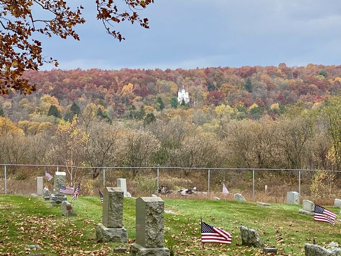
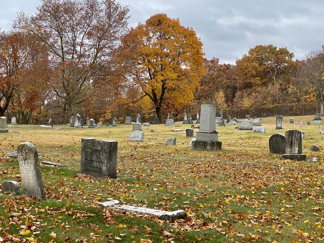
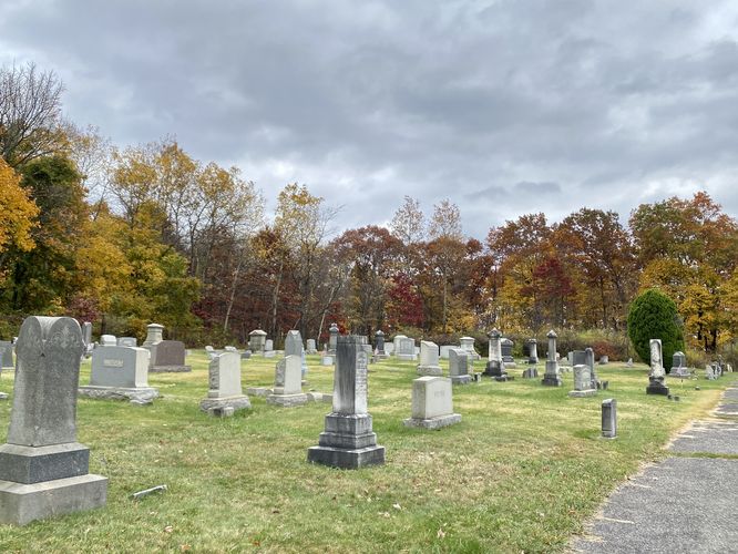
This short walk begins near the Abandoned PA-61 entrance and first heads into the St. Ignatius Cemetery. Note that the cemetery is only open during certain times of the year -- during Halloween, the gates are apparently open. The St. Ignatius Cemetery doesn't have a whole lot to see -- most of the graves are well-maintained; however, the hill provides a nice view into Centralia. The last-standing church, called the Assumption of the Blessed Virgin Mary church, sits on a hill opposite the cemetery so walkers can get a nice view of that unique structure. Note that the church is still used as of 2023 on a regular basis.
The walk then takes visitors down Peach Street, South Street, and Apple Alley before reaching 2nd Street to enter the Odd Fellow Cemetery. The walk over to the Odd Fellow Cemetery is a bit spooky -- all of the houses have been raised, leaving nothing but empty grass plots where houses once stood. All of the lots are generally overgrown with grass, weeds, and bushes -- a clear sign that people are long-gone in this abandoned town. The Odd Fellow Cemetery is tucked away, further back from Centralia's "main drag" and is much smaller than the St. Ignatius Cemetery. Not a whole lot to see at this one either, but it's a fun walk during or around Halloween.
Parking
Visitors will find parking along PA-61 at the coordinates provided. Visitors can park on the side of the road -- there's enough space for a dozen vehicles or so.
Pets
Dogs are allowed only if leashed and must be cleaned up after. Note that the ghost town of Centralia can often have broken glass covered abandoned streets -- so just be careful with your pets.
Walk
This short walk begins near the Abandoned PA-61 entrance and first heads into the St. Ignatius Cemetery. Note that the cemetery is only open during certain times of the year -- during Halloween, the gates are apparently open. The St. Ignatius Cemetery doesn't have a whole lot to see -- most of the graves are well-maintained; however, the hill provides a nice view into Centralia. The last-standing church, called the Assumption of the Blessed Virgin Mary church, sits on a hill opposite the cemetery so walkers can get a nice view of that unique structure. Note that the church is still used as of 2023 on a regular basis.
The walk then takes visitors down Peach Street, South Street, and Apple Alley before reaching 2nd Street to enter the Odd Fellow Cemetery. The walk over to the Odd Fellow Cemetery is a bit spooky -- all of the houses have been raised, leaving nothing but empty grass plots where houses once stood. All of the lots are generally overgrown with grass, weeds, and bushes -- a clear sign that people are long-gone in this abandoned town. The Odd Fellow Cemetery is tucked away, further back from Centralia's "main drag" and is much smaller than the St. Ignatius Cemetery. Not a whole lot to see at this one either, but it's a fun walk during or around Halloween.
Parking
Visitors will find parking along PA-61 at the coordinates provided. Visitors can park on the side of the road -- there's enough space for a dozen vehicles or so.
Pets
Dogs are allowed only if leashed and must be cleaned up after. Note that the ghost town of Centralia can often have broken glass covered abandoned streets -- so just be careful with your pets.