Abandoned PA-61 in Centralia, Pennsylvania is an easy 0.2-mile out-and-back walk that leads down the abandoned highway in the ghost town of Centralia and features scarce amounts of interesting graffiti.
Walk
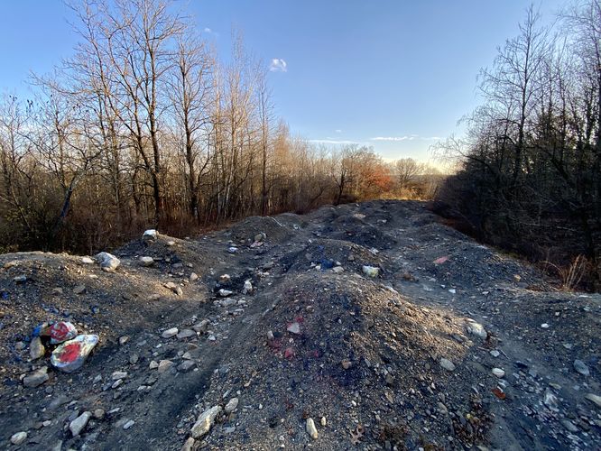
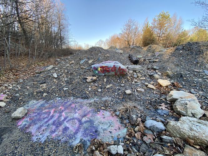
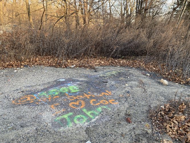
This short walk begins along the main route for PA-61, in the "center" of the abandoned ghost town of Centralia. This GPS track heads-in adjacent to the St. Ignatius Cemetery and skirts around the old highway, following a muddy path. There's some colorful graffiti along the way in, but the old abundance of graffiti is long-gone -- visitors will walk onto the Old PA-61 highway to find it's covered in dirt mounds. In 2020, a new private land owner acquired the land -- due to the influx of visitors who were either unemployed or had more free time during the COVID pandemic, found their way to Centralia and the Old PA-61 highway to explore. Due to this, the new land owner decided to cover the entire highway in 4-foot dirt mounds that now line the old route. It's funny -- these dirt mounds, and the large rocks and gravel, pose a much higher level of risk to visitors now than the old, flat, highway did years ago; however, the interest in this abandoned highway has certainly died-down because of the lack of interesting graffiti and the fact that you can't really walk the highway anymore. It's still interesting to show up and poke around -- to see what other people have done with the area and knowing cars used to drive down this route. You may find graffiti here and there, with some spots of dirt that have been removed to expose some of the colorful drawings on the abandoned road.
Parking
Visitors will find parking along the side of the road on PA-61 near the coordinates provided. The turnouts are large enough to fit a dozen vehicles or so.
Pets
Dogs are allowed only if leashed and must be cleaned up after.
Walk
This short walk begins along the main route for PA-61, in the "center" of the abandoned ghost town of Centralia. This GPS track heads-in adjacent to the St. Ignatius Cemetery and skirts around the old highway, following a muddy path. There's some colorful graffiti along the way in, but the old abundance of graffiti is long-gone -- visitors will walk onto the Old PA-61 highway to find it's covered in dirt mounds. In 2020, a new private land owner acquired the land -- due to the influx of visitors who were either unemployed or had more free time during the COVID pandemic, found their way to Centralia and the Old PA-61 highway to explore. Due to this, the new land owner decided to cover the entire highway in 4-foot dirt mounds that now line the old route. It's funny -- these dirt mounds, and the large rocks and gravel, pose a much higher level of risk to visitors now than the old, flat, highway did years ago; however, the interest in this abandoned highway has certainly died-down because of the lack of interesting graffiti and the fact that you can't really walk the highway anymore. It's still interesting to show up and poke around -- to see what other people have done with the area and knowing cars used to drive down this route. You may find graffiti here and there, with some spots of dirt that have been removed to expose some of the colorful drawings on the abandoned road.
Parking
Visitors will find parking along the side of the road on PA-61 near the coordinates provided. The turnouts are large enough to fit a dozen vehicles or so.
Pets
Dogs are allowed only if leashed and must be cleaned up after.