The Canyon Nature Trail at Timpanogos Cave National Monument near American Fork, Utah is an easy 0.4-mile out-and-back walk that features views of the rugged cliffs and terrain of the American Fork Canyon along with views of the Timpanogos Cave entrances from the valley below.
Hike
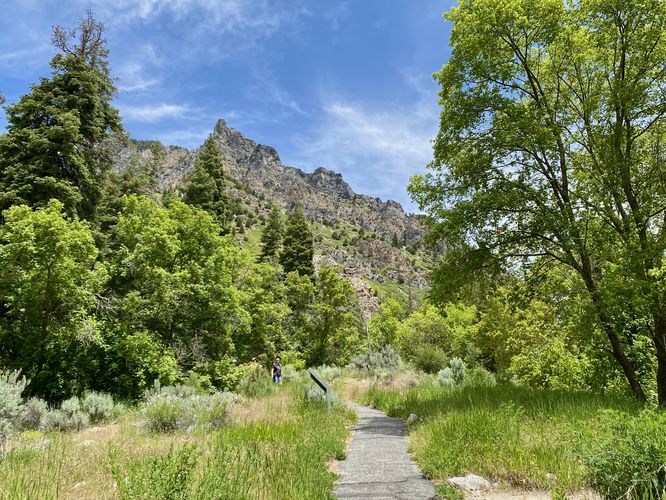
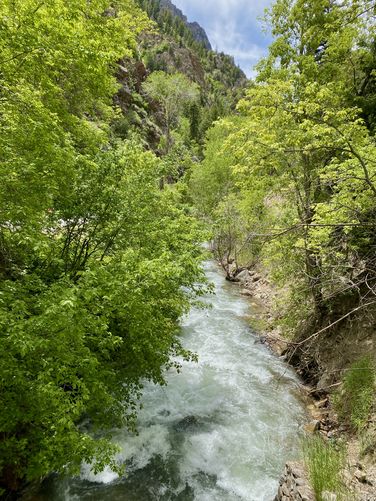
This very short hike, more or less considered a walk, starts along the Alpine Scenic Highway, just west of the main parking lot for Timpanogos Cave. The trailhead can be found at the western end of a small parking turnout where a footbridge crosses the American Fork River to reach a paved trail. The Canyon Nature Trail winds its way westward through the American Fork Canyon valley, passing rock fields and seldom views of the towering cliffs of Mt. Timpanogos overhead.
Timpanogos Cave Entrance View - Mile 0.12
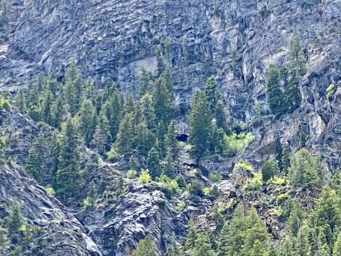
Down the paved pathway sits an interpretive sign where you can read about the American Fork Canyon. Adjacent are two metal pipes, which are viewports -- one for adults and one for children. They both point to the same thing -- a massive hole in the side of Mt. Timpanogos. This is the Timpanogos Cave entrance. During my visit here, the cave was closed to tours so I instead checked out this short nature loop. It's surprising how far up the mountainside the cave entrance is, as getting to it appears to be quite the hike in itself.
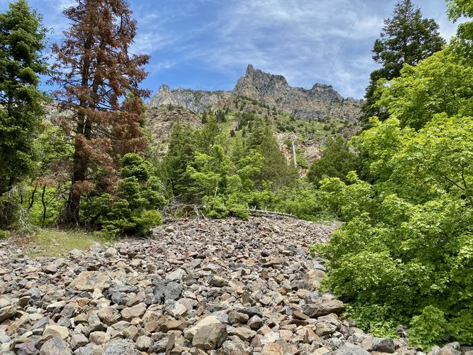
Just behind the viewport to the Timpanogos Cave sits a large rock field just downhill from towering cliffs within the canyon. The nature trail then leads over to the Swinging Bridge Picnic Area within the park before it heads back to parking for a short 0.4-mile out-and-back walk.
Parking
Hikers will find a small parking turnout located at the coordinates provided, along Alpine Scenic Highway just west of the main Timpanogos Cave parking lot. The turnout is large enough to fit a half-dozen vehicles as of May 2024.
Pets
Dogs are allowed only if leashed and must be cleaned up after.
Hike
This very short hike, more or less considered a walk, starts along the Alpine Scenic Highway, just west of the main parking lot for Timpanogos Cave. The trailhead can be found at the western end of a small parking turnout where a footbridge crosses the American Fork River to reach a paved trail. The Canyon Nature Trail winds its way westward through the American Fork Canyon valley, passing rock fields and seldom views of the towering cliffs of Mt. Timpanogos overhead.
Timpanogos Cave Entrance View - Mile 0.12
Down the paved pathway sits an interpretive sign where you can read about the American Fork Canyon. Adjacent are two metal pipes, which are viewports -- one for adults and one for children. They both point to the same thing -- a massive hole in the side of Mt. Timpanogos. This is the Timpanogos Cave entrance. During my visit here, the cave was closed to tours so I instead checked out this short nature loop. It's surprising how far up the mountainside the cave entrance is, as getting to it appears to be quite the hike in itself.
Just behind the viewport to the Timpanogos Cave sits a large rock field just downhill from towering cliffs within the canyon. The nature trail then leads over to the Swinging Bridge Picnic Area within the park before it heads back to parking for a short 0.4-mile out-and-back walk.
Parking
Hikers will find a small parking turnout located at the coordinates provided, along Alpine Scenic Highway just west of the main Timpanogos Cave parking lot. The turnout is large enough to fit a half-dozen vehicles as of May 2024.
Pets
Dogs are allowed only if leashed and must be cleaned up after.