This section of the Buckeye Trail at Skyline Wilderness Park in Napa, California is an easy to moderate 1.4-mile one-way trail that features vistas of Napa Valley.
Please note that this GPS recording is about half of the full Buckeye Trail. This section of the Buckeye Trail was used as a loop while hiking the Skyline Trail.
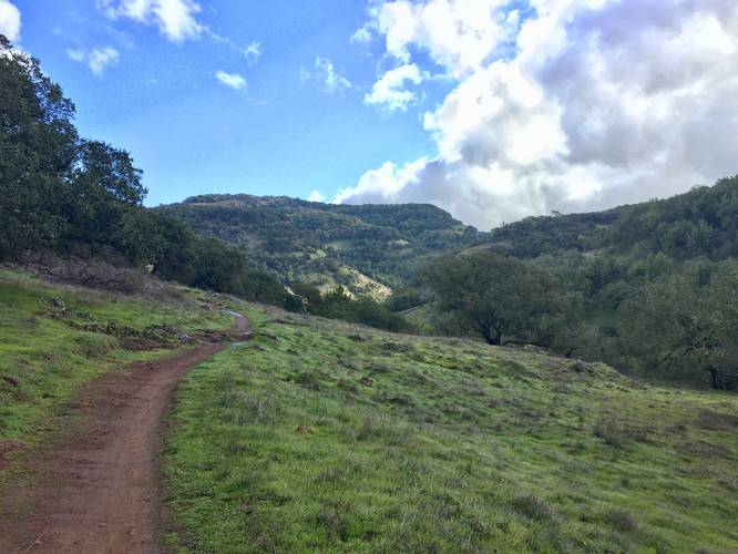
Hikers heading in from the north, hiking south, will find this trail moderate heading uphill. For hikers following this trail back to parking, the trail is very easy. Regardless of difficulty, the trail can be muddy and slippery after recent rainfalls.
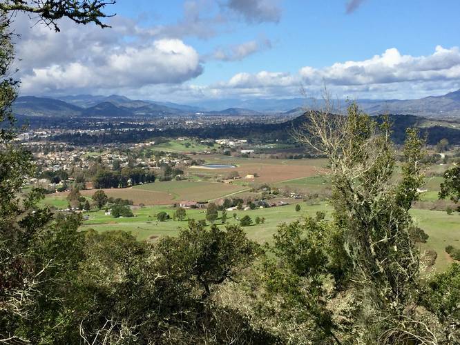
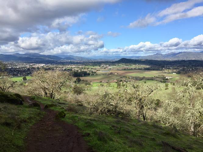
Along the hike are vistas of Napa Valley which include vineyards that sit near the base of Skyline Wilderness Park. Other sights along the trail are the neighboring hills that outline the eastern side of Napa Valley.
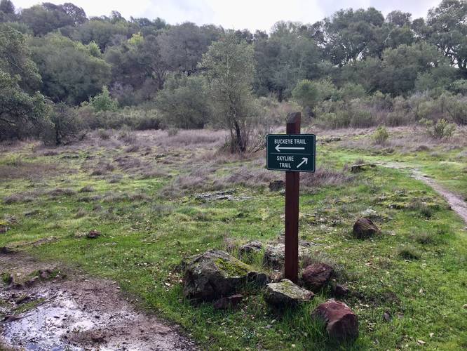
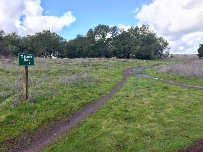
This trail also passes a few junctions along the way - two of which are junctions to the Skyline Trail and one is a junction with the Bayleaf Trail.
Reaching the Trailhead
This trail can be found not too far in from the Lake Marie Road trail. Hikers can take the Parking to Skyline Trail to reach this trailhead if starting from the main parking lot.
Warning
Beware of Rattlesnakes, Wild pigs, poison oak, ticks, and mountain lions. Mountain lions, in particular, are seldom seen but are known to attack without warning. Keep children close as mountain lions seem to be especially drawn to them. Avoid hiking alone. Make plenty of noise while hiking to reduce the chances of surprising a lion.
History
In the late 1970's the Napa State Hospital made land available and interested citizens rallied to save the valuable oak woodland which became Skyline Wilderness Park.
Fees
There is an entry fee for Skyline Wilderness Park. As of January 2020, the fee was $5 for a two axle vehicle. Check the Skyline Wilderness Park website for more accurate and up-to-date details.
Parking
Hikers will find parking at the coordinates provided. The lot is large enough to fit a few dozen vehicles, but the lot fills up quickly.
Pets
Dogs are not allowed on the trails at Skyline Wilderness Park.
Hours
Gates open at 7AM and close at 5PM. The gate to the park's trails also closes so if hikers get stuck, they will need to call the local police for help (stated on signs hiking in).
Biking
Mountain biking is allowed on this trail.
Please note that this GPS recording is about half of the full Buckeye Trail. This section of the Buckeye Trail was used as a loop while hiking the Skyline Trail.
Hikers heading in from the north, hiking south, will find this trail moderate heading uphill. For hikers following this trail back to parking, the trail is very easy. Regardless of difficulty, the trail can be muddy and slippery after recent rainfalls.
Along the hike are vistas of Napa Valley which include vineyards that sit near the base of Skyline Wilderness Park. Other sights along the trail are the neighboring hills that outline the eastern side of Napa Valley.
This trail also passes a few junctions along the way - two of which are junctions to the Skyline Trail and one is a junction with the Bayleaf Trail.
Reaching the Trailhead
This trail can be found not too far in from the Lake Marie Road trail. Hikers can take the Parking to Skyline Trail to reach this trailhead if starting from the main parking lot.
Warning
Beware of Rattlesnakes, Wild pigs, poison oak, ticks, and mountain lions. Mountain lions, in particular, are seldom seen but are known to attack without warning. Keep children close as mountain lions seem to be especially drawn to them. Avoid hiking alone. Make plenty of noise while hiking to reduce the chances of surprising a lion.
History
In the late 1970's the Napa State Hospital made land available and interested citizens rallied to save the valuable oak woodland which became Skyline Wilderness Park.
Fees
There is an entry fee for Skyline Wilderness Park. As of January 2020, the fee was $5 for a two axle vehicle. Check the Skyline Wilderness Park website for more accurate and up-to-date details.
Parking
Hikers will find parking at the coordinates provided. The lot is large enough to fit a few dozen vehicles, but the lot fills up quickly.
Pets
Dogs are not allowed on the trails at Skyline Wilderness Park.
Hours
Gates open at 7AM and close at 5PM. The gate to the park's trails also closes so if hikers get stuck, they will need to call the local police for help (stated on signs hiking in).
Biking
Mountain biking is allowed on this trail.