This section of the Skyline Trail at Skyline Wilderness Park in Napa, California is an easy to moderate 1.2-mile one-way trail that connects the northern trailhead to the Buckeye Trail and features beautiful views of Napa Valley and the Napa-Sonoma Marshes Wildlife Area.
This trail was hiked in January, 2020 when there was plenty of water running down the hillside, which made the trail slick and difficult to hike on. Regardless of the season, the elevation gain is approximately 600-feet in just over a half-mile to reach the top of the hill. Hikers heading south may find this trail moderate or difficult, but hikers heading north will find this section of the Skyline Trail to be easy.
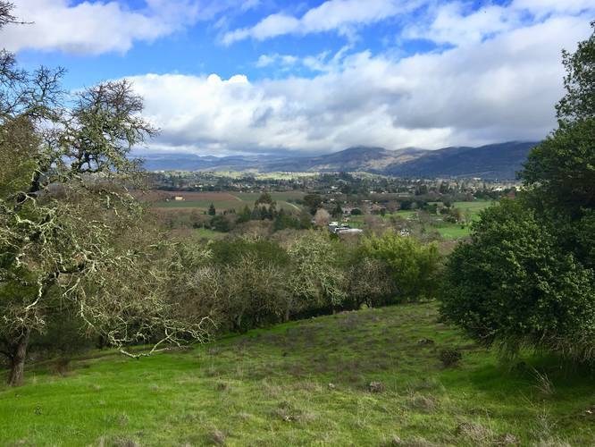
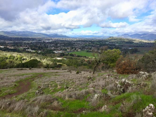
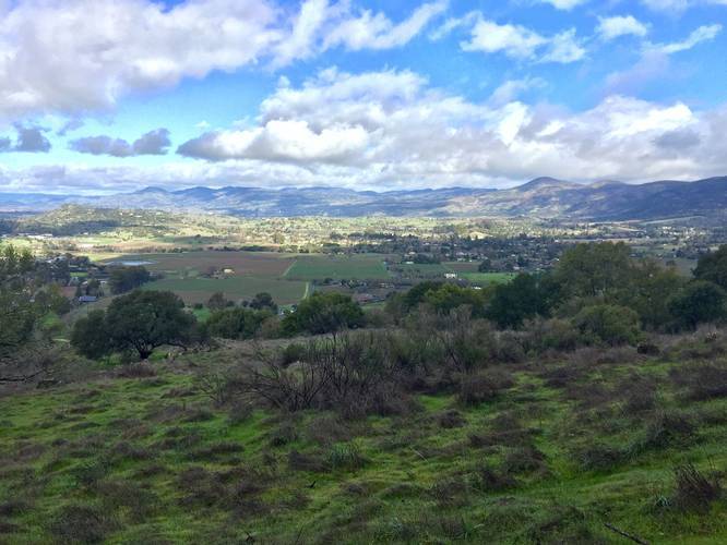
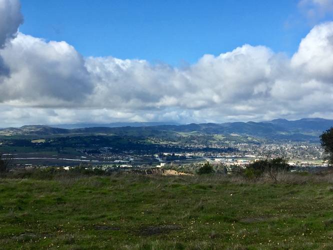
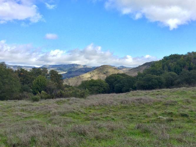
On the way up the trail, hikers get stunning vistas of Napa Valley including vineyards near the park. Hikers do not need to put in too much effort to get views either, which makes this an ideal day hike for visitors who want a different view of the Napa region.
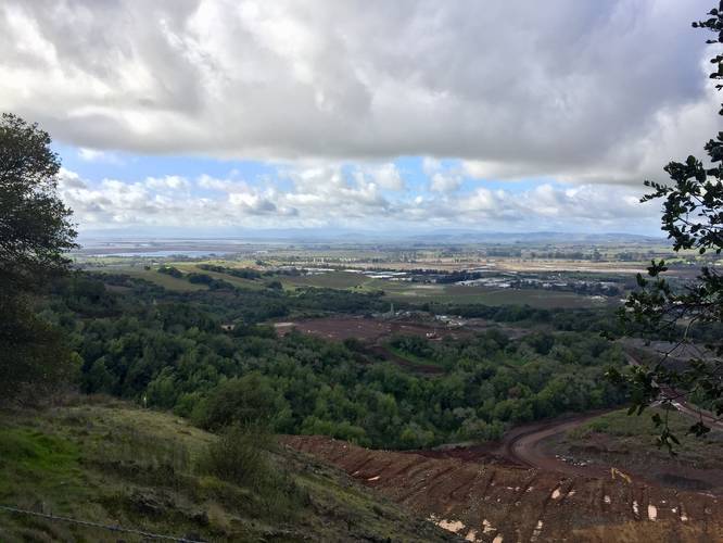
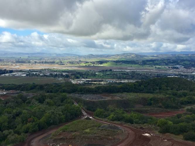
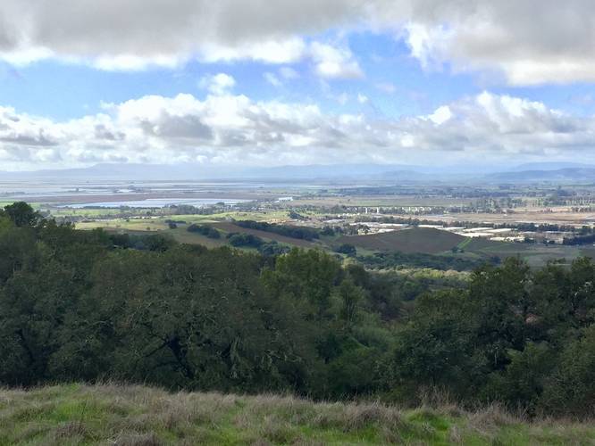
Once at the top of the hill, the landscape opens up to fields that run adjacent to the trail, giving hikers vistas of the Napa-Sonoma Marsh Wildlife Area and San Pablo Bay. On clearer days, hikers can see Mt. Tamalpais in the distance, but the peak is often covered by clouds.
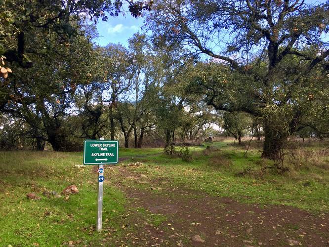
On this hike, we ended up using the Buckeye Trail to head back to parking, so this recording ends at the second trail junction with the Buckeye Trail. Hikers can, however, continue a bit further (about 0.5-miles) to reach yet another junction with the Buckeye Trail - or continue for many miles further along the Skyline Trail.
Reaching the Trailhead
This trail can be found not too far in from the Lake Marie Road trail. Hikers can take the Parking to Skyline Trail to reach this trailhead if starting from the main parking lot.
Bay Area Ridge Trail
The Skyline Trail, and hence this section of it, is also part of the much longer Bay Area Ridge Trail.
Warning
Beware of Rattlesnakes, Wild pigs, poison oak, ticks, and mountain lions. Mountain lions, in particular, are seldom seen but are known to attack without warning. Keep children close as mountain lions seem to be especially drawn to them. Avoid hiking alone. Make plenty of noise while hiking to reduce the chances of surprising a lion.
History
In the late 1970's the Napa State Hospital made land available and interested citizens rallied to save the valuable oak woodland which became Skyline Wilderness Park.
Fees
There is an entry fee for Skyline Wilderness Park. As of January 2020, the fee was $5 for a two axle vehicle. Check the Skyline Wilderness Park website for more accurate and up-to-date details.
Parking
Hikers will find parking at the coordinates provided. The lot is large enough to fit a few dozen vehicles, but the lot fills up quickly.
Pets
Dogs are not allowed on the trails at Skyline Wilderness Park.
Hours
Gates open at 7AM and close at 5PM. The gate to the park's trails also closes so if hikers get stuck, they will need to call the local police for help (stated on signs hiking in).
Biking
Mountain biking is allowed on this trail.
This trail was hiked in January, 2020 when there was plenty of water running down the hillside, which made the trail slick and difficult to hike on. Regardless of the season, the elevation gain is approximately 600-feet in just over a half-mile to reach the top of the hill. Hikers heading south may find this trail moderate or difficult, but hikers heading north will find this section of the Skyline Trail to be easy.
On the way up the trail, hikers get stunning vistas of Napa Valley including vineyards near the park. Hikers do not need to put in too much effort to get views either, which makes this an ideal day hike for visitors who want a different view of the Napa region.
Once at the top of the hill, the landscape opens up to fields that run adjacent to the trail, giving hikers vistas of the Napa-Sonoma Marsh Wildlife Area and San Pablo Bay. On clearer days, hikers can see Mt. Tamalpais in the distance, but the peak is often covered by clouds.
On this hike, we ended up using the Buckeye Trail to head back to parking, so this recording ends at the second trail junction with the Buckeye Trail. Hikers can, however, continue a bit further (about 0.5-miles) to reach yet another junction with the Buckeye Trail - or continue for many miles further along the Skyline Trail.
Reaching the Trailhead
This trail can be found not too far in from the Lake Marie Road trail. Hikers can take the Parking to Skyline Trail to reach this trailhead if starting from the main parking lot.
Bay Area Ridge Trail
The Skyline Trail, and hence this section of it, is also part of the much longer Bay Area Ridge Trail.
Warning
Beware of Rattlesnakes, Wild pigs, poison oak, ticks, and mountain lions. Mountain lions, in particular, are seldom seen but are known to attack without warning. Keep children close as mountain lions seem to be especially drawn to them. Avoid hiking alone. Make plenty of noise while hiking to reduce the chances of surprising a lion.
History
In the late 1970's the Napa State Hospital made land available and interested citizens rallied to save the valuable oak woodland which became Skyline Wilderness Park.
Fees
There is an entry fee for Skyline Wilderness Park. As of January 2020, the fee was $5 for a two axle vehicle. Check the Skyline Wilderness Park website for more accurate and up-to-date details.
Parking
Hikers will find parking at the coordinates provided. The lot is large enough to fit a few dozen vehicles, but the lot fills up quickly.
Pets
Dogs are not allowed on the trails at Skyline Wilderness Park.
Hours
Gates open at 7AM and close at 5PM. The gate to the park's trails also closes so if hikers get stuck, they will need to call the local police for help (stated on signs hiking in).
Biking
Mountain biking is allowed on this trail.