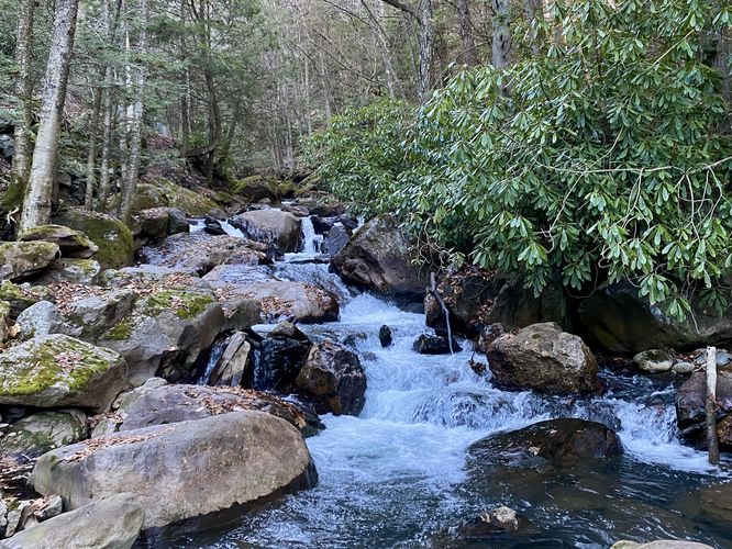
Buck Mountain Falls at Lehigh Gorge State Park in Weatherly, Pennsylvania is an easy 0.1-mile out-and-back walk that leads to the 7-foot tall multi-tiered waterfall, Buck Mountain Falls.
This very short walk leads from the parking lot, heading due-West, along Buck Mountain Creek to reach the multi-tiered waterfall that sits within the creek. Buck Mountain Falls total height is not much more than 7-feet and is comprised of a few small tiers of cascades; however, this scenic waterfall is worth the stop if you're visiting the Rockport Access area of Lehigh Gorge State Park. There's also a bench so visitors can relax and enjoy the water as it tumbles down the creek below your feet.
While in the area, you might want to consider checking out Luke's Falls, Buttermilk Falls, or even the Rockport Mine Tunnel as they're only a short walking distance to each.
Parking
Hikers will find a large parking lot at the coordinates provided, located at the end of Rockport Road in Weatherly. The lot is large enough to fit a couple dozen vehicles.
Pets
Dogs are allowed only if leashed and must be cleaned up after.