Loading...

Distance:
0.8 Miles / 1.3 km
Type:
Out-and-Back
Difficulty:
Easy
Time to Hike:
~24 minutes
Features:
Surface Type:
Dirt
Town:
Wailuku, Hawaii
Directions:
21.028177, -156.594353
Added:
August 16, 2018
Updated:
February 06, 2019
Please consider making a donation to the Maui Strong Fund to help the victims of Hawaii's recent wildfires.

This section of the Acid War Zone Trail in Wailuku, Maui starts at the northern most trailhead and passed through eroded coastal fields before reaching a lighthouse atop a cliff edge. This is an easy 0.8 mile out-and-back hike to the lighthouse, but you can extend the hike by an additional 1 mile or more by following the trail down towards the water and south towards the Nakalele Blowhole.

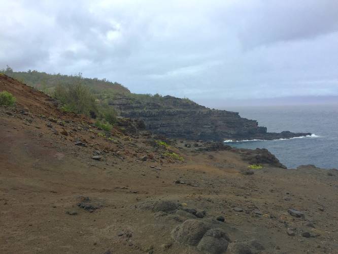
From the lighthouse, you can look down upon Maui's battered cliffsides and to the north you get views of Kahakuloa Head - the two massive rocks jutting up from the northern shore.

Wildflowers can be found along the trail due to the frequent rain that hits Maui's northern coast. Don't be surprised if it rains on you a couple of times during the hike.

Respecting the Land
Hawaiian land is considered sacred to native Hawaiians and many locals, so please stay on-trail, take nothing but photos, and leave nothing but footprints. Respect the locals - don't stay for long and have a backup hike planned in case the parking lot is full.

Explore 43 trails near Wailuku, HI
  1. Parking

    21.028177, -156.594353
  2. Main Trailhead

    21.028285, -156.594141
  3. Rock circle

    21.028642, -156.592772
    Rock circle
  4. View / Overlook / Vista

    21.029067, -156.590544
    View / Overlook / Vista
Explore other trail routes for this hike, added by the MyHikes Community via Trip Reports.
No community routes found. To add your own route as a Community Route for this Trail guide, please leave a Trip Report with a GPX file on this Trail.

Seasons

All
Loading...
Loading...
63 '

Total Change
75 '

Ascent
75 '

Descent

Photo Albums

2 Trip Reports

No Star-Ratings
Write-up by:
Admin user profile picture
0.8 miles / 1.3 km
Trail added
August 16, 2018
Hiked on
August 15, 2018
Updated on
February 06, 2019
0.8 miles / 1.3 km
August 15, 2018
Hiking

Weather Forecast

In Wailuku, HI

Explore Hiking Trails

New Hikes

Congaree Boardwalk Loop
2.5 Miles
4 km
Easy
Loop
Coquina Loop (Old Levi Mill Waterfall)
1.7 Miles
2.7 km
Moderate
Loop
Double Run to Canyon Vista Loop
3.7 Miles
6 km
Moderate
Loop
Spencer Pond Loop
0.3 Miles
0.5 km
Easy
Loop

Before you leave...

MyHikes is an indie web platform aimed to make exploring public trails easier for everyone. The site has no investors and is owned and operated by one person, Dave Miller (Founder & Admin). As the Founder, main contributor, and doer-of-all-things for MyHikes, I share my trips with over-detailed write-ups for fun on a volunteer basis and I believe that public trail information should be available to everyone.

It takes a lot of time 🕦, money 💰, and effort (including espresso shots ☕) to run MyHikes, including hiking , mapping , writing , and publishing new trails with high-quality content... along with building new features, moderating, site maintainance, and app development for iOS and Android . I simply ask that if you find MyHikes' trail guides helpful to please consider becoming a Supporter to help keep the site, iOS, and Android apps available to everyone.

Supporters unlock website and in-app perks with a one-time payment of $25 (you renew) 😎👍. Or you can simply make a Donation of your choice without a MyHikes user account. Otherwise, telling your friends about MyHikes is the next-best thing - both quick and free 🎉

Thanks for visiting MyHikes and have a great hike!️

Admin user profile picture

Dave Miller
MyHikes Founder & Admin