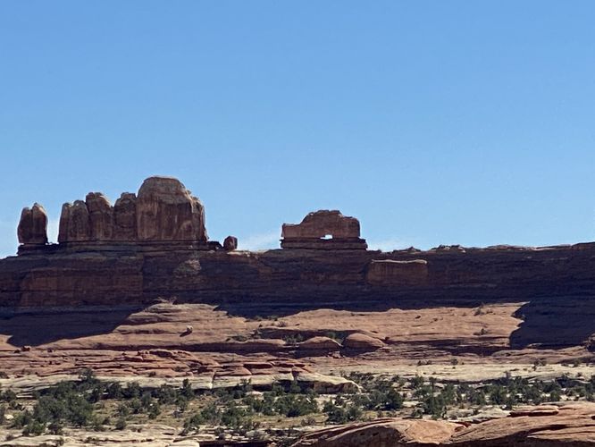
The Wooden Shoe Arch Overlook at Canyonlands National Park near Moab, Utah is a short roadside stop that features views of the natural rock arch that looks like a wooden shoe.
This is not a hike but rather a short stop that requires little-to-no walking to view the Wooden Shoe Arch in Canyonlands. The Wooden Shoe Arch sits atop a long rock ridge that sits approximately 0.75-miles from the overlook. Note that if you wish to stay in your vehicle, you can certainly do so as this short walk simply leads to a different viewing area located a couple dozen feet from the parking lot along a non-accessible dirt path.
Universal Access
This overlook should be considered universally-accessible as visitors can view the Wooden Shoe Arch directly from the paved parking lot -- no walking or hiking is required.
Parking
Visitors will find parking at the coordinates provided along Needles Main Park Rd. The lot is large enough to fit just under a dozen vehicles or so, as of September 2023.
Pets
Dogs are allowed ONLY in the parking lot. Please keep your dog on-leash at all times and do not allow them outside the parking lot or on any trails. You can read more about Canyonlands National Parks pet rules here.
Fees
Vehicle entry fees to Canyonlands National Park is $30 as of September 2023.