Loading...

Distance:
1.4 Miles / 2.3 km
Type:
Out-and-Back
Difficulty:
Easy
Time to Hike:
~42 minutes
Features:
Surface Type:
Dirt
Park:
Cumberland Gap National Historical Park
Town:
Ewing, Virginia
Directions:
36.60072, -83.659406
Added:
September 06, 2017
Updated:
October 25, 2018
Loading...
Loading...
82 '

Total Change
172 '

Ascent
170 '

Descent

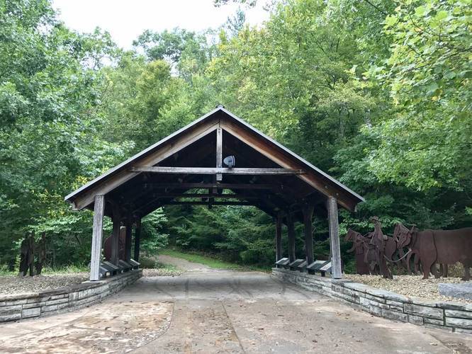
The Wilderness Road Trail at Cumberland Gap National Historical Park near Cumberland Gap, Virginia is an easy 1.4 mile out-and-back hike that leads from the Daniel Boone visitor center west toward the Gap Cave Trail and the Tennessee Road Trail to the Iron Furnace.

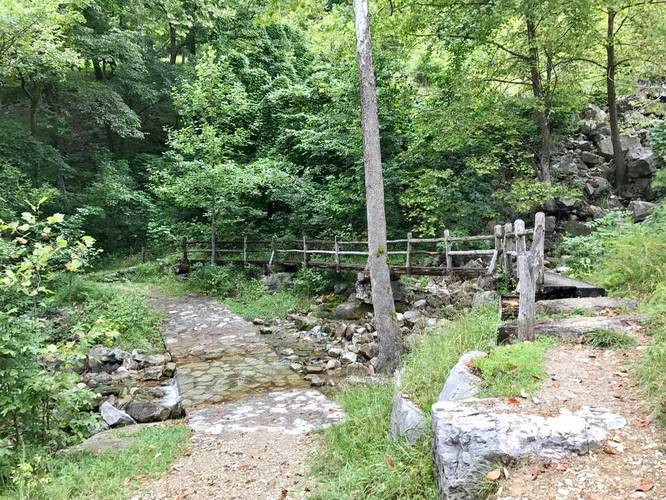
This trail is flat and easy with not much elevation change, but there are a couple of waterfalls along the way. You'll pass a creek that spills over the trail - there's a bridge you can use to cross it and waterfalls to each side; however, during the summer the waterfalls are hard to see without hiking down the hill to get a closer view. The waterfalls looked to be about 10 feet in height or more, but it was difficult to tell at the time.

Biking and dogs are allowed here.

Explore 4 trails near Ewing, VA
  1. Parking

    36.60072, -83.659406
  2. Main Trailhead

    36.601961, -83.659971
  3. Entrance to the trail

    36.601853, -83.660003
    Entrance to the trail
  4. Creek crossing with a footbridge

    36.602208, -83.667503
    Creek crossing with a footbridge
No community routes found. To add your own hike as a Community Route for this Trail guide, leave a Trip Report with an attached GPX file.

Hazards

Ticks - Lyme Disease More Info (CDC)

Season

Summer

Photo Albums

2 Trip Reports

No Star-Ratings
Trail Guide By:
Admin user profile picture
1.4 miles / 2.3 km
Trail added
September 06, 2017
Hiked on
September 02, 2017
Updated on
October 25, 2018
1.4 miles / 2.3 km
September 02, 2017
Hiking

Weather Forecast

In Ewing, VA

Explore Hiking Trails

New Hikes

Catawba Falls Trail
2.9 Miles
4.7 km
Moderate
Out-and-Back
Lake Estes Trail
0.9 Miles
1.4 km
Easy
Out-and-Back
Alluvial Fan (East) Waterfall
0.4 Miles
0.6 km
Easy
Out-and-Back
Hidden Valley Nature Trail
0.7 Miles
1.1 km
Easy
Loop

Before you boogie...

Find our trail guides useful? Consider becoming a Supporter to unlock perks!

MyHikes is an indie platform that makes exploring public trails easier for everyone. The platform has no investors, runs no ads, and is owned and operated by one person, Dave Miller. Dave has personally mapped and written over 1,600 trail guides on MyHikes for the public to explore. As of 2024, MyHikes has helped over 1,300,000 outdoor enthusiasts plan their next adventure.

But it takes a lot of time 🕦, money 💰, and work, and espresso shots ☕ to run MyHikes, including hiking , mapping , writing , and publishing new trails with high-quality (accurate) information... along with software engineering (coding) the platform like building new features, site and mobile app development for iOS and Android, site maintainance . and much much more.

Supporters unlock website and mobile app perks with an annual one-time payment of $25 (you renew) 😎👍. Or you can simply make a Donation of your choice. Otherwise, you can support us by telling your friends about MyHikes - both quick and free 🎉

Admin user profile picture

Dave Miller
MyHikes Founder