Loading...

Distance:
0.2 Miles / 0.3 km
Type:
Out-and-Back
Difficulty:
Easy
Time to Hike:
~6 minutes
Features:
Surface Type:
Dirt
Park:
Cumberland Gap National Historical Park
Town:
Ewing, Virginia
Directions:
36.600719, -83.659405
Added:
September 06, 2017
Updated:
November 27, 2017
Loading...
Loading...
67 '

Total Change
65 '

Ascent
56 '

Descent

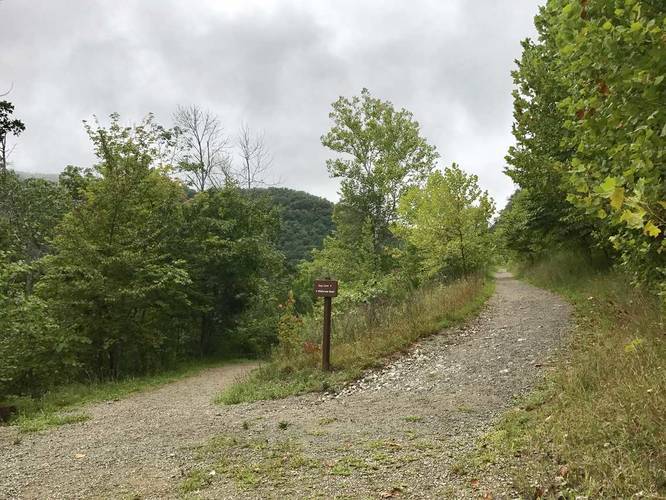
The Gap Cave Trail at the Cumberland Gap National Historical Park in Virginia, near Cumberland Gap, is a short 0.2 mile out-and-back hike from the Wilderness Road Trail to the Gap Cave and back.

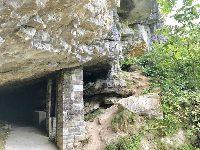
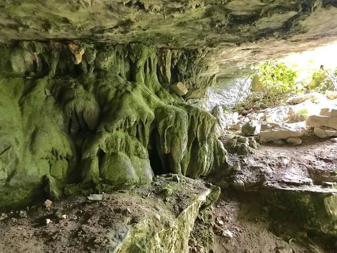
Gap Cave is formerly known as Cudjo's Cave and lies right on the Virginia and Tennessee border and lies just below the Pinnacle Overlook Trail.

You can pay for tours through the cave and people are still discovering new section of the cave all the time. As of 2015, 18.5 miles has been mapped of the cave.

In order to reach the cave, take the Wilderness Road Trail west until you find signs for Gap Cave.

Explore 4 trails near Ewing, VA
  1. Parking

    36.600719, -83.659405
  2. Main Trailhead

    36.601621, -83.665424
  3. Stay right and head uphill

    36.601628, -83.665292
    Stay right and head uphill
  4. View of neighboring mountains

    36.602833, -83.666943
    View of neighboring mountains
  5. Entrance of Gap Cave

    36.602833, -83.666943
    Entrance of Gap Cave
  6. Next to Gap Cave entrance

    36.602833, -83.666943
    Next to Gap Cave entrance
No community routes found. To add your own hike as a Community Route for this Trail guide, leave a Trip Report with an attached GPX file.

Hazards

Ticks - Lyme Disease More Info (CDC)

Season

Spring

Photo Albums

2 Trip Reports

No Star-Ratings
Trail Guide By:
Admin user profile picture
0.2 miles / 0.3 km
Trail added
September 06, 2017
Hiked on
September 02, 2017
Updated on
November 27, 2017
0.2 miles / 0.3 km
September 02, 2017
Hiking

Weather Forecast

In Ewing, VA

Explore Hiking Trails

New Hikes

Boulder Falls Trail
0.2 Miles
0.3 km
Moderate
Out-and-Back
Conklin's Gully Loop
2.4 Miles
3.9 km
Hard
Loop
Mary's Lake Trail
0.6 Miles
1 km
Easy
Out-and-Back
West Rim Trail (Stony Brook)
0.7 Miles
1.1 km
Moderate
One-Way

Before you boogie...

Find our trail guides useful? Consider becoming a Supporter to unlock perks!

MyHikes is an indie platform that makes exploring public trails easier for everyone. The platform has no investors, runs no ads, and is owned and operated by one person, Dave Miller. Dave has personally mapped and written over 1,600 trail guides on MyHikes for the public to explore. As of 2024, MyHikes has helped over 1,300,000 outdoor enthusiasts plan their next adventure.

But it takes a lot of time 🕦, money 💰, and work, and espresso shots ☕ to run MyHikes, including hiking , mapping , writing , and publishing new trails with high-quality (accurate) information... along with software engineering (coding) the platform like building new features, site and mobile app development for iOS and Android, site maintainance . and much much more.

Supporters unlock website and mobile app perks with an annual one-time payment of $25 (you renew) 😎👍. Or you can simply make a Donation of your choice. Otherwise, you can support us by telling your friends about MyHikes - both quick and free 🎉

Admin user profile picture

Dave Miller
MyHikes Founder