The West Rim Trail at Stony Brook State Park in Dansville, New York is a moderate 0.7-mile one-way trail that features views into the Stony Brook Gorge and makes for a great loop hike with the Gorge Trail.
Trails
This hike follows one named trail: West Rim Trail (red blazes).
Hike
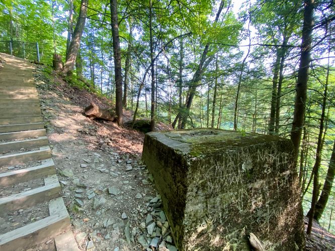
The West Rim Trail at the park can be started at either parking lot; however, this route begins at the very-end of the Gorge Trail which skips a short amount of mileage from the southern parking lot at the park. The main purpose of this is due to a planned loop hike where we started at the norther parking lot and hiked up the Gorge Trail first. Hikers will find a similar experience despite the missing data. The route, beginning in the south, first leads up a steep series of stairs with a metal fence that lines the gorge. Hikers will pass some old concrete footings located on-trail before reaching a taller concrete structure -- all abandoned structures that were likely once used for shipping goods across the gorge via a train bridge.
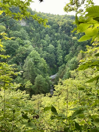
Gorge Views - Mile 0.1 and 0.16
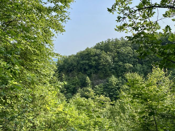
After the stairs end, hikers will find a couple of views into the Stony Brook gorge below. These two viewing areas, located near mile 0.1 and 0.16 peer into the gorge where you'll find sloping hills or steep rocky cliffs in the gorge. Albeit the views are not spectacular, they're a nice addition to the forest hiking.
View of Stony Brook Falls - Mile 0.4
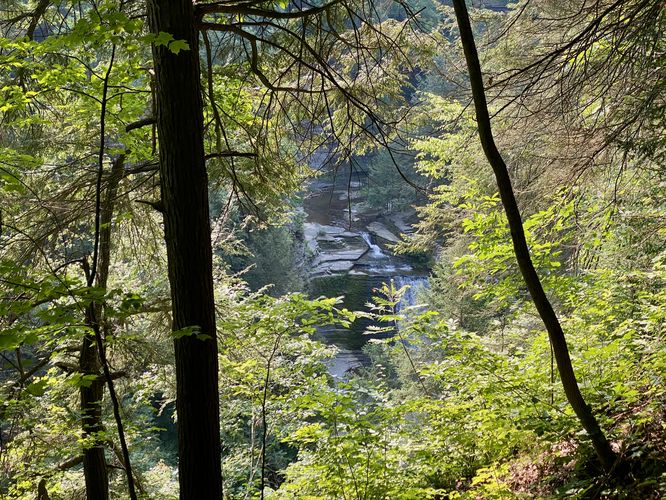
At mile 0.4, hikers will reach a viewing area with a staircase that leads down to a fenced platform. Here, you'll find a view of Stony Brook Falls as it cascades down the gorge below. Note that the view during warm months is obstructed by the nearby trees.
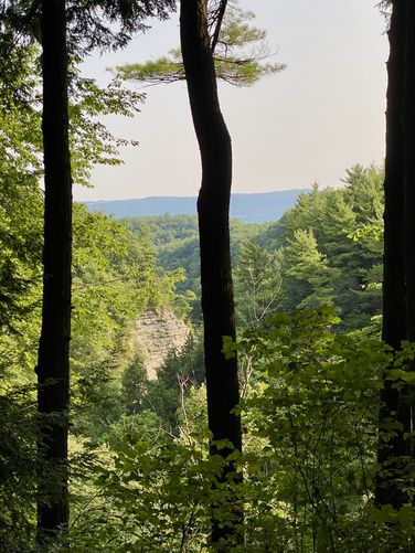
Gorge View - Mile 0.6
Around mile 0.6, just before the trail descends to parking, hikers will pass one last view into the Stony Brook Gorge. This view is obstructed like the one at Stony Brook Falls, but worth checking out before hiking down.
The trail then descends a steep dirt trail with some loose rocks before reaching the parking lot for a short 0.7-mile one-way hike.
Parking & Fees
As of July 2024, there's a $9/vehicle entrance fee. Hikers will find a large parking lot at the coordinates provided, located at the end of the northern entrance of the park. The lot is large enough to fit several dozen vehicles as of July 2024.
Pets
Dogs are allowed only if leashed and must be cleaned up after.
Restrooms
There are restroom facilities located at the trailhead / parking lot.
Warning
Steep cliffs: This trail passes areas with sheer cliffs that drop hundreds of feet into the gorge below. It's best to stay on-trail at all times and to stay away from steep drop-offs. Note that most of these areas are fenced-in.
Trails
This hike follows one named trail: West Rim Trail (red blazes).
Hike
The West Rim Trail at the park can be started at either parking lot; however, this route begins at the very-end of the Gorge Trail which skips a short amount of mileage from the southern parking lot at the park. The main purpose of this is due to a planned loop hike where we started at the norther parking lot and hiked up the Gorge Trail first. Hikers will find a similar experience despite the missing data. The route, beginning in the south, first leads up a steep series of stairs with a metal fence that lines the gorge. Hikers will pass some old concrete footings located on-trail before reaching a taller concrete structure -- all abandoned structures that were likely once used for shipping goods across the gorge via a train bridge.
Gorge Views - Mile 0.1 and 0.16
After the stairs end, hikers will find a couple of views into the Stony Brook gorge below. These two viewing areas, located near mile 0.1 and 0.16 peer into the gorge where you'll find sloping hills or steep rocky cliffs in the gorge. Albeit the views are not spectacular, they're a nice addition to the forest hiking.
View of Stony Brook Falls - Mile 0.4
At mile 0.4, hikers will reach a viewing area with a staircase that leads down to a fenced platform. Here, you'll find a view of Stony Brook Falls as it cascades down the gorge below. Note that the view during warm months is obstructed by the nearby trees.
Gorge View - Mile 0.6
Around mile 0.6, just before the trail descends to parking, hikers will pass one last view into the Stony Brook Gorge. This view is obstructed like the one at Stony Brook Falls, but worth checking out before hiking down.
The trail then descends a steep dirt trail with some loose rocks before reaching the parking lot for a short 0.7-mile one-way hike.
Parking & Fees
As of July 2024, there's a $9/vehicle entrance fee. Hikers will find a large parking lot at the coordinates provided, located at the end of the northern entrance of the park. The lot is large enough to fit several dozen vehicles as of July 2024.
Pets
Dogs are allowed only if leashed and must be cleaned up after.
Restrooms
There are restroom facilities located at the trailhead / parking lot.
Warning
Steep cliffs: This trail passes areas with sheer cliffs that drop hundreds of feet into the gorge below. It's best to stay on-trail at all times and to stay away from steep drop-offs. Note that most of these areas are fenced-in.