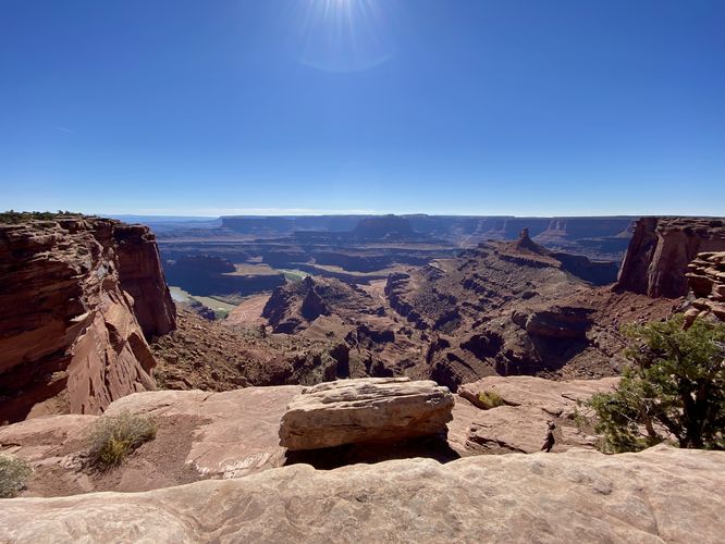
The West Rim Overlook at Dead Horse Point State Park near Moab, Utah is an easy 0.1-mile out-and-back walk that leads to a stunning view of the Colorado River.
This very short walk provides visitors will a stunning view of the lush green Colorado River as it passes through the brownish-redish landscape of Utah's vast desert.
Parking & Fees
As of September 2023, there's a $20 entry fee to get into Dead Horse Point State Park. Visitors will find parking turnouts at the coordinates provided, located on both sides of the road. The turnouts are large enough for a few vehicles on each side.
Pets
Dogs are allowed only if leashed and cleaned up after.
Warnings
Sun exposure: This trail has very little shade and no water sources. Pack-in all water and wear sun screen and a hat to protect against sun exposure. It's smart to hike either in the early morning or late afternoon to avoid the intense desert sun.
No water: This trail has no water sources so you must pack-in all water. A general rule of thumb in the desert is 1 gallon of water per person per day.
Rattlesnakes: This is rattlesnake territory, so be on the lookout and give any rattlers you find plenty of space.
Cliffs: This hike follows sheer cliff sides that drop hundreds of feet.