Loading...

Distance:
1.8 Miles / 2.9 km
Type:
Out-and-Back
Difficulty:
Easy
Time to Hike:
~54 minutes
Features:
Surface Type:
Semi-Paved
Park:
White Tank Mountain Regional Park
Town:
Waddell, Arizona
Directions:
33.589785, -112.507215
Added:
January 11, 2019
Updated:
January 23, 2020
Loading...
Loading...
194 '

Total Change
200 '

Ascent
199 '

Descent

The Waterfall Trail at White Tank Mountain Regional Park in Waddell, Arizona is a very popular and easy 1.8 mile out-and-back hike up to one of the only waterfalls near Phoenix. This waterfall only runs during the rainy season and after heavy rainfalls. Be sure to get out quickly after it rains as the waterfall dries up quickly.

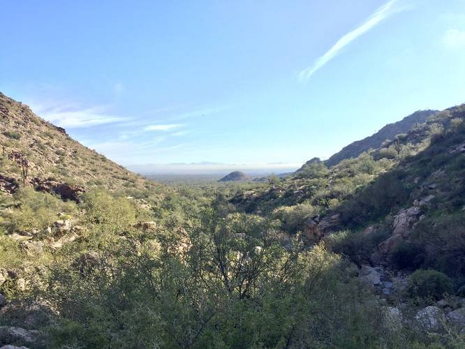
The trail starts out paved and runs between two large foothills of White Tank Mountain while heading gradually uphill towards the waterfall. Eventually the paved section ends, but the trail itself is easy to walk on until you reach the rock steps up to the waterfall.

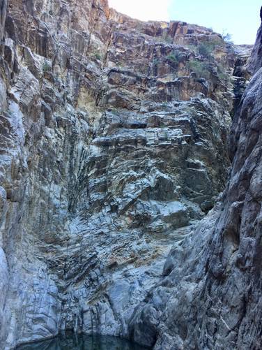
Just before the waterfall, you'll start to see larger boulders and steps that head into a canyon. Not much further up the trail lies the waterfall - depending on the season.

Admission Fee: There's a $7 fee to enter the park with a vehicle. You can read more about the fees here.

Explore 4 trails near Waddell, AZ
  1. Parking

    33.589785, -112.507215
  2. Main Trailhead

    33.589484, -112.507712
  3. Waterfall - dried up

    33.584057, -112.519443
    Waterfall - dried up
  4. Vista point

    33.584744, -112.519119
    Vista point
No community routes found. To add your own hike as a Community Route for this Trail guide, leave a Trip Report with an attached GPX file.

Hazards

Snakes

Seasons

All

Photo Albums

1 Trip Report

No Star-Ratings
Write-up by:
Admin user profile picture
1.8 miles / 2.9 km
Trail added
January 11, 2019
Hiked on
January 07, 2019
Updated on
January 23, 2020

Weather Forecast

In Waddell, AZ

Explore Hiking Trails

New Hikes

Weston Lake Loop
3.2 Miles
5.1 km
Easy
Loop
Almond Lake Overlook
0.1 Miles
0.2 km
Easy
Out-and-Back
Almond-Hornell Overlook
0 Miles
0 km
Easy
Out-and-Back
Angel Falls Loop
2.8 Miles
4.5 km
Moderate
Loop

Before you leave...

MyHikes is an indie web platform aimed to make exploring public trails easier for everyone. The site has no investors and is owned and operated by one person, Dave Miller (Founder & Admin). As the Founder, main contributor, and doer-of-all-things for MyHikes, I share my trips with over-detailed write-ups for fun on a volunteer basis and I believe that public trail information should be available to everyone.

It takes a lot of time 🕦, money 💰, and effort (including espresso shots ☕) to run MyHikes, including hiking , mapping , writing , and publishing new trails with high-quality content... along with building new features, moderating, site maintainance, and app development for iOS and Android . I simply ask that if you find MyHikes' trail guides helpful to please consider becoming a Supporter to help keep the site, iOS, and Android apps available to everyone.

Supporters unlock website and in-app perks with a one-time payment of $25 (you renew) 😎👍. Or you can simply make a Donation of your choice without a MyHikes user account. Otherwise, telling your friends about MyHikes is the next-best thing - both quick and free 🎉

Thanks for visiting MyHikes and have a great hike!️

Admin user profile picture

Dave Miller
MyHikes Founder & Admin