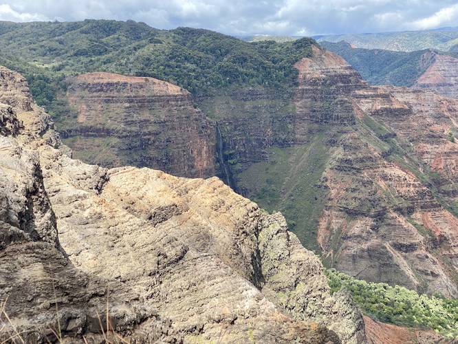
The Waipo'o Falls Lookout at Waimea Canyon State Park in Waimea, Hawaii (Kauai) is an easy loop or out-and-back walk that leads to a roadside vista of Waipo'o Falls cascading several thousand feet into Waimea Canyon.
This is not really a hike or a walk, but rather a nice quick roadside stop along a self-guided tour of Kauai. Hikers can actually reach the top of the 800-foot cascade of Waipo'o Falls by hiking the Canyon Trail to Waipo'o Falls at Waimea Canyon State Park for a moderate to difficult 3.3-mile out-and-back trek. Note that the view from this lookout is far better than the on-trail view, since it's impossible to see the 800-foot cascade from the top of the waterfall.
Parking
Visitors will find a parking turnout by the vista. The turnout is large enough for a few vehicles. Across the street is a picnic area with more parking.
Respecting the Land
Hawaiian land is considered sacred to native Hawaiians and many locals, so please stay on-trail, take nothing but photos, and leave nothing but footprints. Respect the locals - don't stay for long and have a backup hike planned in case the parking lot is full.