Loading...

🎉 Enjoy a Free 7-Day Supporter Trial and Unlock Exclusive Perks — No Credit Card Required. Learn more.

Virginia Highlands Horse Trail

Directions
Map
Pictures
Send to App
Distance:
2.8 Miles / 4.5 km
Type:
One-Way
Difficulty:
Moderate
Time to Hike:
1 hour, ~24 minutes
Features:
Surface Type:
Dirt
Park:
Jefferson National Forest
Town:
Whitetop, Virginia
Directions:
36.646244, -81.582882
Added:
September 06, 2017
Updated:
November 27, 2017
Copy Trail Link Hiking this trail? Send a friend or family member a link to this trail guide for your own safety. Hike at your own risk (disclaimer)
Loading...
Loading...
783'

Total Change
41'

Ascent
795'

Descent

Download the Trail Route for Offline Use

Supporters get exclusive access to download trail routes to the MyHikes app for offline use. Stay prepared on your adventure, even without an internet connection! Become a Supporter today to unlock this feature and hike with confidence.

Send to App

Virginia Highlands Horse Trail

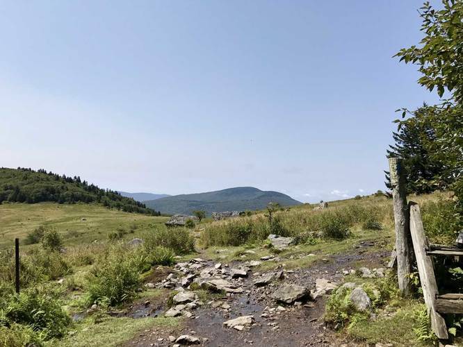
The Virginia Highlands Horse Trail at Jefferson National Forest near Wilson Creek and Whitetop, Virginia is a moderate 2.8 mile one-way hike to/from the Elk Garden Trailhead to the intersection with the Appalachian Trail to Mount Rogers.

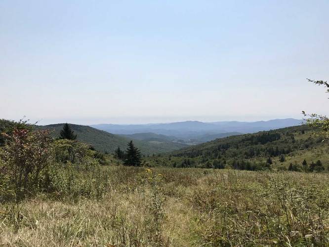
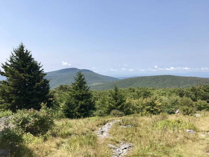
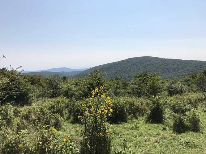
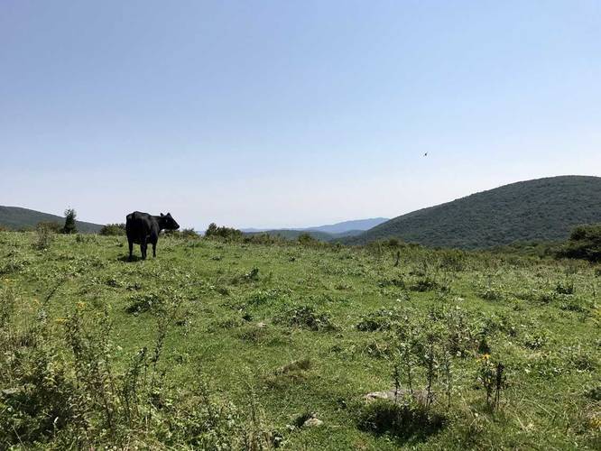
This GPS data starts at the AT to Mount Rogers Trail with scenic mountain top views and heads into the Lewis Fork Wilderness at Jefferson National Forest. The trail ends up in a scenic cow pasture with mountain top views before getting back to the Elk Garden Trailhead parking lot.

The trail itself is much longer than 2.8 miles one-way, but this section is a great shortcut back from Mount Rogers to make the hike 8.5 miles instead of 9 on the AT.

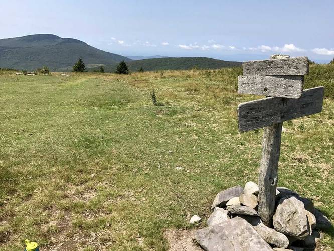
Follow the orange blazes; however, some of them look dark orange/redish at times. When you make it to the connector trail between this one and the AT, the blazes will be blue on the large boulders along the trail.
Explore 17 trails near Whitetop, VA
  1. Parking

    36.646244, -81.582882
  2. Main Trailhead

    36.651205, -81.547566
  3. Vista at the trailhead

    36.651128, -81.547508
    Vista at the trailhead
  4. Beautiful vista along the trail

    36.651086, -81.547914
    Beautiful vista along the trail
  5. Beautiful vista along the trail

    36.650831, -81.548522
    Beautiful vista along the trail
  6. Beautiful vista along the trail

    36.650322, -81.550094
    Beautiful vista along the trail
  7. Beautiful vista along the trail

    36.650489, -81.551078
    Beautiful vista along the trail
  8. Beautiful vista along the trail

    36.647811, -81.577539
    Beautiful vista along the trail
  9. Cow amongst a beautiful vista

    36.646064, -81.581856
    Cow amongst a beautiful vista
No community routes found. To add your own hike as a Community Route for this Trail guide, leave a Trip Report with an attached GPX file.

Hazards

Ticks - Lyme Disease More Info (CDC)

Season

Summer

Blaze Color

Orange

Trip Reports

Trail Guide By:
Admin user profile picture
2.8 miles / 4.5 km
2.8 miles / 4.5 km
September 03, 2017
Hiking

Weather Forecast

In Whitetop, VA

Explore Hiking Trails

You May Also Like

New York's Best Waterfalls - Whether you're planning a day hike, roadside stop, or a leisurely short walk, this guide provides hikers, travelers, and locals alike with 63 different locations to over 100 scenic waterfalls to help plan your next adventure!
Explore

New York's Best Waterfalls

Whether you're planning a day hike, roadside stop, or a leisurely short walk, this guide provides hikers, travelers, and locals alike with 63 different locations to over 100 scenic waterfalls to help plan your next adventure!

Read
25 Best Day Hikes in North Carolina - Discover the top 25 best day hikes in North Carolina, from breathtaking waterfalls to mountain peaks. Explore hidden gems, scenic views, and trails suitable for all skill levels, perfect for your next outdoor adventure.
Explore

25 Best Day Hikes in North Carolina

Discover the top 25 best day hikes in North Carolina, from breathtaking waterfalls to mountain peaks. Explore hidden gems, scenic views, and trails suitable for all skill levels, perfect for your next outdoor adventure.

Read

Before you boogie...

Find our trail guides useful? Consider becoming a Supporter to unlock perks!

MyHikes is an indie platform that makes exploring public trails easier for everyone. The platform has no investors, no ads, and is owned and operated by one person, Dave Miller. Dave has personally mapped and written over 1,800 trail guides on MyHikes for the public to explore. MyHikes has helped millions outdoor enthusiasts plan their next adventure.

But it takes a lot of time 🕦, money 💰, work, and espresso shots ☕ to run MyHikes, including hiking , mapping , writing , and publishing new trails with high-quality (accurate) information... along with software engineering (coding) the platform like building new features, website and mobile app development (iOS and Android), site maintainance . and much much more.

Supporters unlock website and mobile app perks with an annual one-time payment of $25 (you renew) 😎👍. Or you can simply make a Donation of your choice. Otherwise, you can support us by telling your friends about MyHikes - both quick and free 🎉

Admin user profile picture

Dave Miller
MyHikes Founder