The Appalachian Trail to Mount Rogers at Jefferson National Forest in Virginia is a moderately-trafficked 9 mile out-and-back hike from the Elk Garden Trailhead / Appalachian Trailhead to Mount Rogers and back.
Mount Rogers is the highest peak in Virginia sitting at 5,728 feet; however, there are no views from the top. The hike out to Mt Rogers is a bit of a challenge due to the elevation change and length, but the hike isn't much more difficult than moderate.
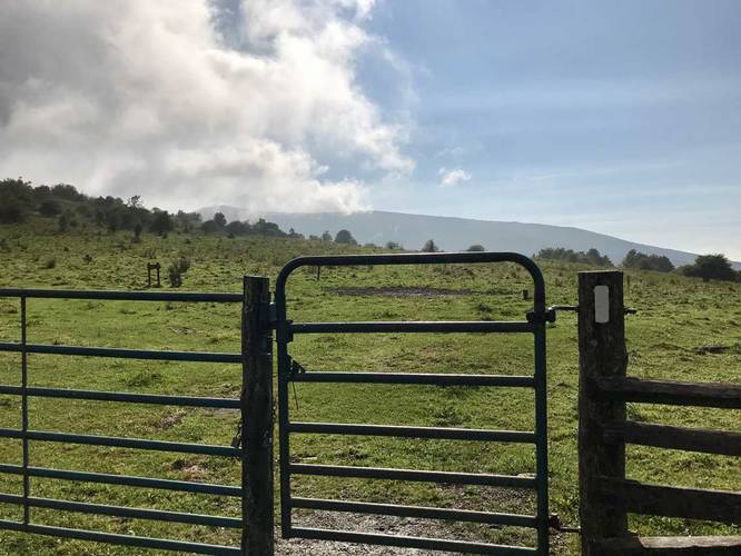
The trail first starts off in a cow pasture where you hike up and down scenic hills before heading into the woods after about a half mile in.
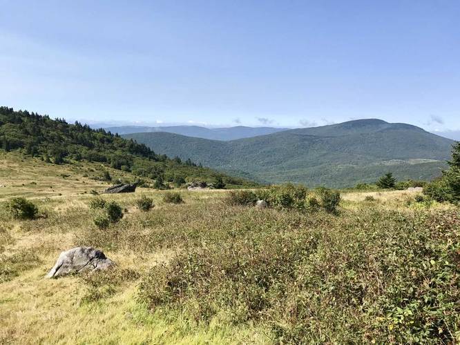
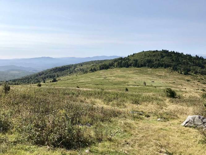
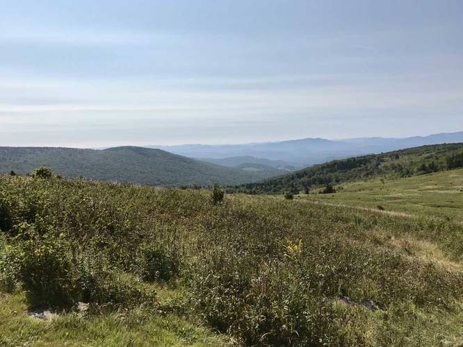
There honestly isn't anything to see from mile 0.5 to about mile 3 where there's an intersection with a spur trail that leads down to the Virginia Highlands Horse Trail. I highly recommend heading down this short 0.1 mile out-and-back spur trail to get an amazing view of the surrounding mountains - some in Grayson Highlands State Park.
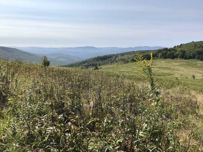
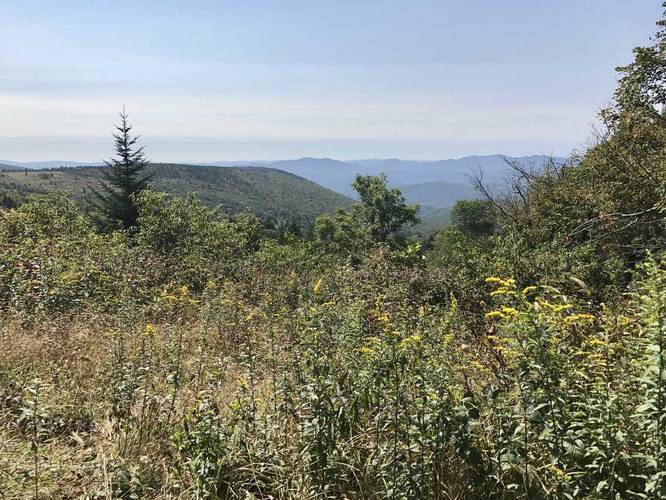
After this intersection, you're only 1.5 miles from the summit of Mt Rogers. About 0.75 miles from the Virginia Highlands Horse Trail intersection, you'll find another set of amazing mountain views - the views don't get much better than this spot, so soak them in while you can before heading up to the summit.
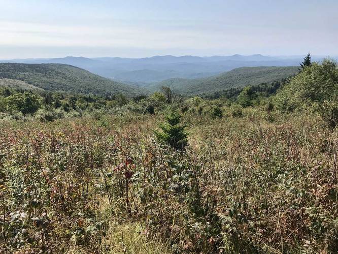
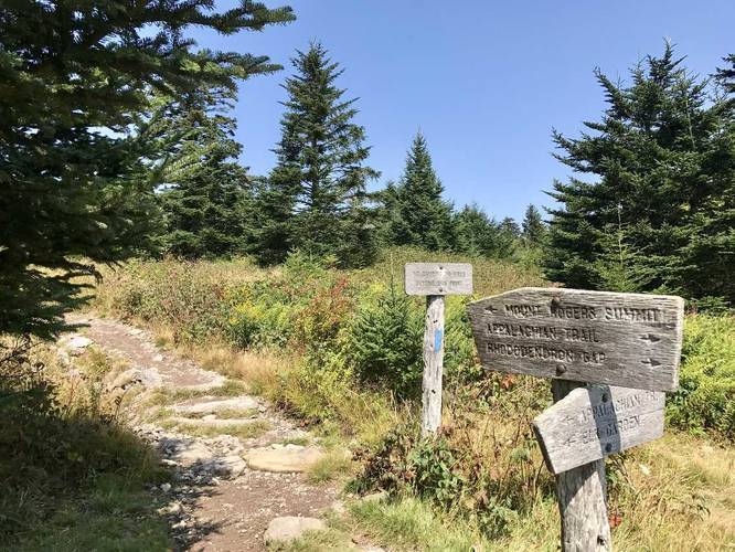
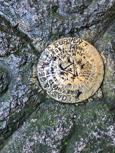
Once you reach the intersection below the summit, you have 0.5 miles left to climb. You'll hike through evergreen forests before reaching the summit with a small marker at the highest point. Start your journey back to parking, but enjoy the views along the way.
On the way back, you can alternatively take the Virginia Highlands Horse Trail which is only 2.8 miles one-way, to shorten the trip to about 8.5 miles total.
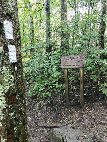
The Appalachian Trail has white blazes - you can follow these all the way until you reach the intersection just below the summit (0.5 miles from summit) where the blazes turn to only blue.
Mount Rogers is the highest peak in Virginia sitting at 5,728 feet; however, there are no views from the top. The hike out to Mt Rogers is a bit of a challenge due to the elevation change and length, but the hike isn't much more difficult than moderate.
The trail first starts off in a cow pasture where you hike up and down scenic hills before heading into the woods after about a half mile in.
There honestly isn't anything to see from mile 0.5 to about mile 3 where there's an intersection with a spur trail that leads down to the Virginia Highlands Horse Trail. I highly recommend heading down this short 0.1 mile out-and-back spur trail to get an amazing view of the surrounding mountains - some in Grayson Highlands State Park.
After this intersection, you're only 1.5 miles from the summit of Mt Rogers. About 0.75 miles from the Virginia Highlands Horse Trail intersection, you'll find another set of amazing mountain views - the views don't get much better than this spot, so soak them in while you can before heading up to the summit.
Once you reach the intersection below the summit, you have 0.5 miles left to climb. You'll hike through evergreen forests before reaching the summit with a small marker at the highest point. Start your journey back to parking, but enjoy the views along the way.
On the way back, you can alternatively take the Virginia Highlands Horse Trail which is only 2.8 miles one-way, to shorten the trip to about 8.5 miles total.
The Appalachian Trail has white blazes - you can follow these all the way until you reach the intersection just below the summit (0.5 miles from summit) where the blazes turn to only blue.