The Upper Cascadilla Gorge Trail in Ithaca, New York is an easy 0.5-mile loop hike that features waterfalls and a gorge footbridge.
Hike Description
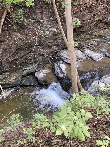
This hike begins at the end of the Cascadilla Gorge Trail along Oak Ave and College Ave in Ithaca and follows the dirt trail leading around the upper portion of the gorge in a counter-clockwise direction. Along the way hikers will hear sounds of small waterfalls cascading down the creek in the gorge below your feet like around mile 0.15; however, most of them are difficult to see and photograph. Eventually, the trail will bend with the gorge and there will be a view of a wooden footbridge and waterfalls.
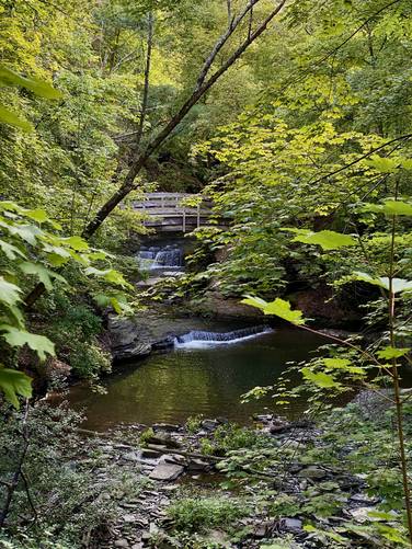
Footbridge and Waterfall View - Mile 0.22 to 0.25
Between miles 0.22 and 0.25 are a couple of scenic overlooks of the footbridge and waterfalls cascading down below and behind the bridge.
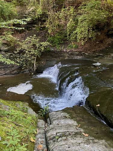
Top of 7-foot Waterfall - Mile 0.26
The trail will follow a bend in the gorge but hikers can take an off-shoot walk to reach the top of the 7-foot waterfall, located around mile 0.26.
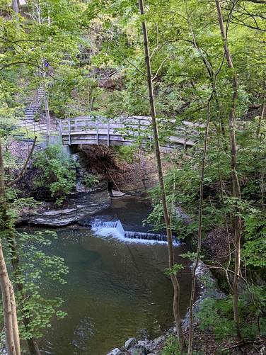
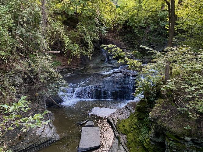
Waterfall View from Bridge - Mile 0.27
The best view of the 7-foot waterfall can be seen from the wooden footbridge. This cascade flows down Upper Cascadilla Gorge as it sends water on its way to reach the large waterfalls downstream.
The trail then heads uphill, passing several Cornell-owned buildings, before it heads back toward the trailhead.
Trolley Bridge - Mile 0.46 to 0.5
From miles 0.46 to 0.5, hikers will cross an old Trolley Bridge which is now a footbridge that crosses Cascadilla Gorge. After crossing the bridge, the hike ends at the trailhead where you started.
Parking
Hikers will find paid parking along Oak Ave during weekdays from 9-5. Weekends appear to be free.
Pets
Dogs are allowed only if leashed and their waste should be carried out by the hiker.
Hike Description
This hike begins at the end of the Cascadilla Gorge Trail along Oak Ave and College Ave in Ithaca and follows the dirt trail leading around the upper portion of the gorge in a counter-clockwise direction. Along the way hikers will hear sounds of small waterfalls cascading down the creek in the gorge below your feet like around mile 0.15; however, most of them are difficult to see and photograph. Eventually, the trail will bend with the gorge and there will be a view of a wooden footbridge and waterfalls.
Footbridge and Waterfall View - Mile 0.22 to 0.25
Between miles 0.22 and 0.25 are a couple of scenic overlooks of the footbridge and waterfalls cascading down below and behind the bridge.
Top of 7-foot Waterfall - Mile 0.26
The trail will follow a bend in the gorge but hikers can take an off-shoot walk to reach the top of the 7-foot waterfall, located around mile 0.26.
Waterfall View from Bridge - Mile 0.27
The best view of the 7-foot waterfall can be seen from the wooden footbridge. This cascade flows down Upper Cascadilla Gorge as it sends water on its way to reach the large waterfalls downstream.
The trail then heads uphill, passing several Cornell-owned buildings, before it heads back toward the trailhead.
Trolley Bridge - Mile 0.46 to 0.5
From miles 0.46 to 0.5, hikers will cross an old Trolley Bridge which is now a footbridge that crosses Cascadilla Gorge. After crossing the bridge, the hike ends at the trailhead where you started.
Parking
Hikers will find paid parking along Oak Ave during weekdays from 9-5. Weekends appear to be free.
Pets
Dogs are allowed only if leashed and their waste should be carried out by the hiker.