The Tully Trail to Spirit Falls hike in Royalston, Massachusetts is a moderate 3.4 mile trail that leads from Doane Hill Rd up to Spirit Falls while following the East Branch of the Tully River.
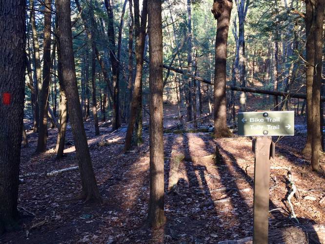
This hike follows the Tully Trail, but the blaze colors can be confusing. You'll start out at the parking lot along the Orange and Yellow blazes - located on the northeast corner of Tully Lake. Follow the Orange and Yellow blazes for about 1.5 miles to a trail junction with the creek for Spirit Falls where the Tully Trail begins to follow Red Blazes uphill alongside Spirit Falls.
Creek Crossing
When you reach the Red Blazes, you'll need to cross the creek, which can be difficult depending on the time of year. There should be small foot bridges, but the water can often be high enough to cover one of the bridges so you may need to creek hop. Waterproof boots can be helpful on this hike.
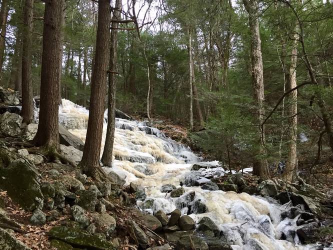
Spirit Falls
Spirit Falls is about 150 feet tall and cascades down the mountain side, south of Jacobs Hill. The red blaze trail follows the entirety of Spirit Falls where views can be found along the way; however, this recording only heads half-way up the mountain side before heading back. The remaining trail data has been included in the Jacobs Hill & Spirit Falls hike.
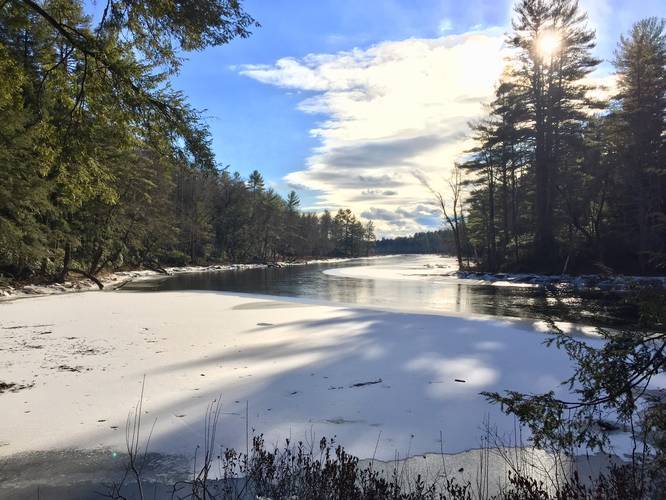
Tully River
The trail skirts the side of the East Branch of the Tully River until you reach the junction for Spirit Falls.
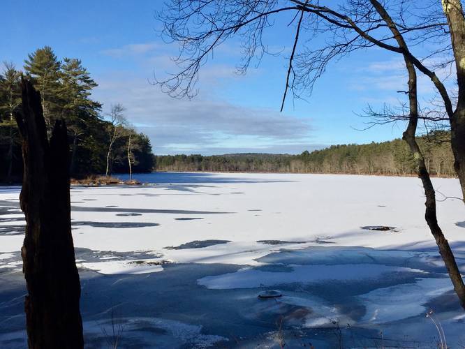
Views
Just before the trail turns east to head towards the Spirit Falls junction, you'll get views of Long Pond, which sits just below Jacobs Hill.
Camping
Camping/backpacking is allowed along the Tully Trail; however, there are plenty of signs in key areas along the trail that restrict camping and fires. Please leave no trace and camp only where permitted.
Biking
Biking is allowed on this trail.
Pets
Dogs are allowed, but must be leashed.
This hike follows the Tully Trail, but the blaze colors can be confusing. You'll start out at the parking lot along the Orange and Yellow blazes - located on the northeast corner of Tully Lake. Follow the Orange and Yellow blazes for about 1.5 miles to a trail junction with the creek for Spirit Falls where the Tully Trail begins to follow Red Blazes uphill alongside Spirit Falls.
Creek Crossing
When you reach the Red Blazes, you'll need to cross the creek, which can be difficult depending on the time of year. There should be small foot bridges, but the water can often be high enough to cover one of the bridges so you may need to creek hop. Waterproof boots can be helpful on this hike.
Spirit Falls
Spirit Falls is about 150 feet tall and cascades down the mountain side, south of Jacobs Hill. The red blaze trail follows the entirety of Spirit Falls where views can be found along the way; however, this recording only heads half-way up the mountain side before heading back. The remaining trail data has been included in the Jacobs Hill & Spirit Falls hike.
Tully River
The trail skirts the side of the East Branch of the Tully River until you reach the junction for Spirit Falls.
Views
Just before the trail turns east to head towards the Spirit Falls junction, you'll get views of Long Pond, which sits just below Jacobs Hill.
Camping
Camping/backpacking is allowed along the Tully Trail; however, there are plenty of signs in key areas along the trail that restrict camping and fires. Please leave no trace and camp only where permitted.
Biking
Biking is allowed on this trail.
Pets
Dogs are allowed, but must be leashed.