Tioga River Walk via Bear Run Road at Tioga State Forest in Blossburg, Pennsylvania is an easy 1.8-mile out-and-back hike that features beautiful views of the Tioga River.
Trails
This hike follows one named trail: Bear Run Road.
Hike Description
This hike begins at the main parking lot along Bear Run Road, located down the forest road that connects to Ogdensburg Road. The GPS track provided first heads over to the Tioga River to check out the river views from the south bank. This is a nice spot to checkout the river or to try your hand at some backcountry fishing. The track then heads to the bright yellow gate that blocks vehicles along Bear Run Road -- this is the technical trailhead for the hike.
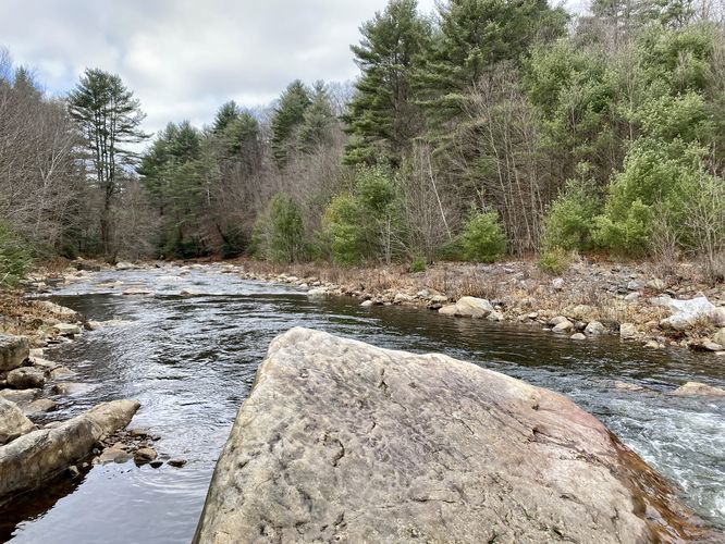
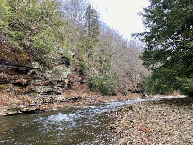
Tioga River View at Boulder - Mile 0.15
Around mile 0.15, hikers will reach a cut-out in the forest between the trail and the river -- here you'll find a very large boulder sitting in the river. This is a great spot to take a photo, facing downstream which includes small rapids and evergreens.
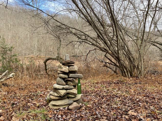
River Access / Fisherman's Cairn - Mile 0.33
Around mile 0.33 is a very skinny path that leads off-trail to reach the shores of the Tioga River. This is most-likely a fisherman's path. Along the path is a 2-foot tall rock cairn that's propped up with an old green beer bottle -- likely built by a bored fisherman at some point in time.
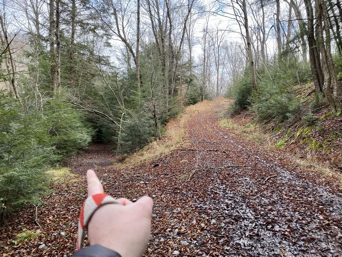
Back on the trail, Bear Run Road continues on headed northeast along a flat easy-to-follow forest road.
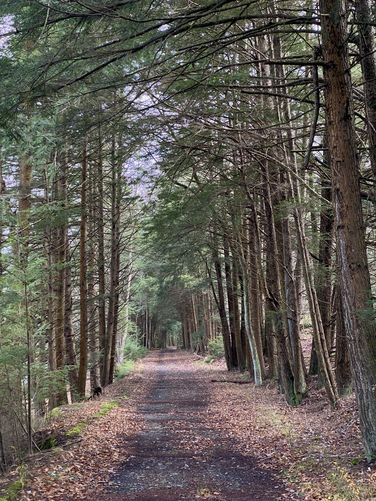
Hemlock Forest - Mile 0.5
Around mile 0.5, hikers will enter a beautiful hemlock forest where the trees wrap around the trail and extend for the better part of half a mile ahead. This creates a natural "tree tunnel" of evergreens. Some parts of this grove have shorter trees which fill-in the forest floor while others have tall hemlocks that stretch toward the sky -- providing a darker look/feel to the trail. This section is very scenic.
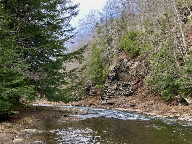
Tioga River View (Off-Trail) - Mile 0.7
Around mile 0.7, hikers will find another off-trail view of the Tioga River. This one is a bit tricky to reach since you have to walk along slick rocks to get there, but the view upstream of the small rapids and evergreens are really nice.
Left-Hand Turn - Mile 0.8
Around mile 0.8, hikers will reach a fork in the trail. This GPS data heads left at the fork to continue along the Tioga River. Heading this way technically dead-ends shortly after. Bear Run Road likely heads up to the right to head over the hill here, but we wanted to see the river on this Thanksgiving Day hike.
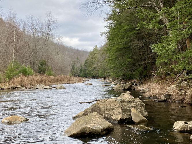
Dead End / Tioga River Views - Mile 0.9 to 0.95
At mile 0.9, hikers will reach the dead-end of this path. You'll know you're at the end when you find a couple of stone campfire rings under some old, tall hemlock trees. The Tioga River in this section is once again very scenic -- if you walk out to the bank, you'll find tall rock ledges across the way, small rapids, and evergreens that surround this bend in the river. Here the trail ends and the hike back begins.
Hike Back - Mile 0.95 to 1.8
The hike back to parking is 0.85-miles along the flat Bear Run Road.
Fishing
This is a great spot for fishing, especially during early Spring. This trail provides a plethora of access points to the Tioga River without having to walk very far.
Camping Prohibited
This area and Bear Run Road are one of the only few places in Tioga State Forest where camping is not allowed at any time. This is likely due to overzealous fisherman or maybe to protect the wild habitat of the upper reaches of the Tioga River. In any case, you may find stone fire pits -- you can use these for day-use only. Please do not camp here per state forest rules and regulations.
How to get to Parking
The parking lot for Bear Run Road is located 0.3-miles from Ogdensburg Road, so drive to the parking coordinates provided first (41.652285, -77.036685). If the forest road gates are open adjacent to Ogdensburg Road and if the road is passable (i.e. no deep snow) you can drive down the road to reach a large parking lot. You'll notice another gate blocking the road -- this bright yellow gate is the trailhead for the hike along Bear Run Road.
Pets
Dogs are allowed if leashed and must be cleaned up after.
Warning
Muddy trail: Bear Run Road can often be very muddy in many different sections.
Trails
This hike follows one named trail: Bear Run Road.
Hike Description
This hike begins at the main parking lot along Bear Run Road, located down the forest road that connects to Ogdensburg Road. The GPS track provided first heads over to the Tioga River to check out the river views from the south bank. This is a nice spot to checkout the river or to try your hand at some backcountry fishing. The track then heads to the bright yellow gate that blocks vehicles along Bear Run Road -- this is the technical trailhead for the hike.
Tioga River View at Boulder - Mile 0.15
Around mile 0.15, hikers will reach a cut-out in the forest between the trail and the river -- here you'll find a very large boulder sitting in the river. This is a great spot to take a photo, facing downstream which includes small rapids and evergreens.
River Access / Fisherman's Cairn - Mile 0.33
Around mile 0.33 is a very skinny path that leads off-trail to reach the shores of the Tioga River. This is most-likely a fisherman's path. Along the path is a 2-foot tall rock cairn that's propped up with an old green beer bottle -- likely built by a bored fisherman at some point in time.
Back on the trail, Bear Run Road continues on headed northeast along a flat easy-to-follow forest road.
Hemlock Forest - Mile 0.5
Around mile 0.5, hikers will enter a beautiful hemlock forest where the trees wrap around the trail and extend for the better part of half a mile ahead. This creates a natural "tree tunnel" of evergreens. Some parts of this grove have shorter trees which fill-in the forest floor while others have tall hemlocks that stretch toward the sky -- providing a darker look/feel to the trail. This section is very scenic.
Tioga River View (Off-Trail) - Mile 0.7
Around mile 0.7, hikers will find another off-trail view of the Tioga River. This one is a bit tricky to reach since you have to walk along slick rocks to get there, but the view upstream of the small rapids and evergreens are really nice.
Left-Hand Turn - Mile 0.8
Around mile 0.8, hikers will reach a fork in the trail. This GPS data heads left at the fork to continue along the Tioga River. Heading this way technically dead-ends shortly after. Bear Run Road likely heads up to the right to head over the hill here, but we wanted to see the river on this Thanksgiving Day hike.
Dead End / Tioga River Views - Mile 0.9 to 0.95
At mile 0.9, hikers will reach the dead-end of this path. You'll know you're at the end when you find a couple of stone campfire rings under some old, tall hemlock trees. The Tioga River in this section is once again very scenic -- if you walk out to the bank, you'll find tall rock ledges across the way, small rapids, and evergreens that surround this bend in the river. Here the trail ends and the hike back begins.
Hike Back - Mile 0.95 to 1.8
The hike back to parking is 0.85-miles along the flat Bear Run Road.
Fishing
This is a great spot for fishing, especially during early Spring. This trail provides a plethora of access points to the Tioga River without having to walk very far.
Camping Prohibited
This area and Bear Run Road are one of the only few places in Tioga State Forest where camping is not allowed at any time. This is likely due to overzealous fisherman or maybe to protect the wild habitat of the upper reaches of the Tioga River. In any case, you may find stone fire pits -- you can use these for day-use only. Please do not camp here per state forest rules and regulations.
How to get to Parking
The parking lot for Bear Run Road is located 0.3-miles from Ogdensburg Road, so drive to the parking coordinates provided first (41.652285, -77.036685). If the forest road gates are open adjacent to Ogdensburg Road and if the road is passable (i.e. no deep snow) you can drive down the road to reach a large parking lot. You'll notice another gate blocking the road -- this bright yellow gate is the trailhead for the hike along Bear Run Road.
Pets
Dogs are allowed if leashed and must be cleaned up after.
Warning
Muddy trail: Bear Run Road can often be very muddy in many different sections.