This section of the Timber Point Trail at the Rachel Carson Wildlife Refuge in Biddeford, Maine is an easy 2.6-mile out-and-back trail that includes beautiful views of Curtis Cove, leads to Timber Point, and features a walk to Timber Island during low tide.
Note that during low tide only, hikers can reach Timber Island, but must be warned that if not timed properly, you can get stuck on Timber Island until the next low tide approaches (~12 hours). You must time the walk to Timber Island according to the annual, local tide calendar.
Hike Description
Please note that this trail is significantly longer than the track provided here, which was recorded in mid-July 2021. We ended up turning back due to an abundance of mosquitos.
The trail begins at the end of Granite Point Rd in Biddeford, Maine where a small paved parking lot can be found, in addition to a larger dirt parking lot located river-side.
The trail itself follows what appears to be a private road that passes Curtis Cove - featuring scenic views of the cove before keeping to the right at a junction near the southern end of the cove.
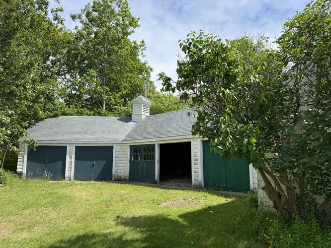
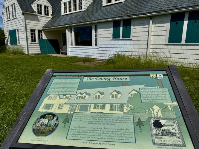
The trail then heads south headed for Timber Point and Timber Island. From the southern end of the trail, at Timber Point, hikers will find beautiful ocean views with Timber Island straight ahead. To the east sit the historic buildings of the Ewing House that hikers can explore the exterior of.
Parking
Hikers will find parking at the coordinates provided. The paved lot is large enough to fit about 5 cars, while the dirt lot is large enough to fit about 10 cars.
Pets
Dogs are not allowed on this trail as of July 2021.
Biking
Biking is not allowed on this trail as of July 2021.
Note that during low tide only, hikers can reach Timber Island, but must be warned that if not timed properly, you can get stuck on Timber Island until the next low tide approaches (~12 hours). You must time the walk to Timber Island according to the annual, local tide calendar.
Hike Description
Please note that this trail is significantly longer than the track provided here, which was recorded in mid-July 2021. We ended up turning back due to an abundance of mosquitos.
The trail begins at the end of Granite Point Rd in Biddeford, Maine where a small paved parking lot can be found, in addition to a larger dirt parking lot located river-side.
The trail itself follows what appears to be a private road that passes Curtis Cove - featuring scenic views of the cove before keeping to the right at a junction near the southern end of the cove.
The trail then heads south headed for Timber Point and Timber Island. From the southern end of the trail, at Timber Point, hikers will find beautiful ocean views with Timber Island straight ahead. To the east sit the historic buildings of the Ewing House that hikers can explore the exterior of.
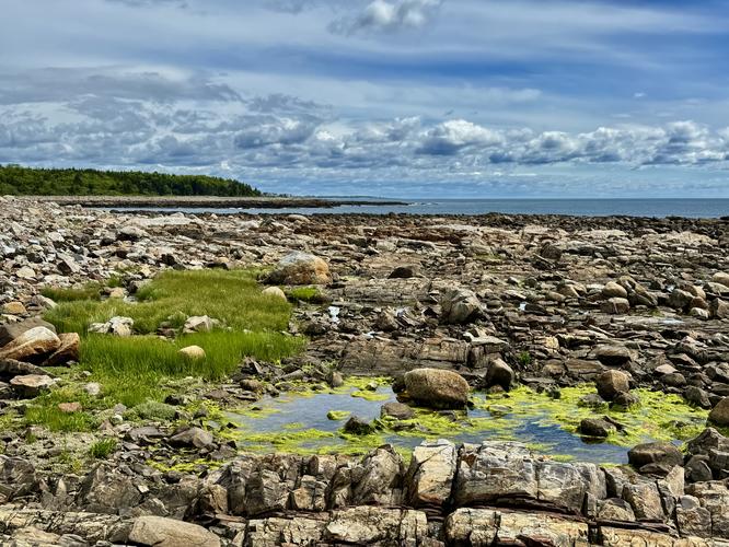
Exploring Timber Island
The hike out to Timber Island is relatively easy if you enjoy hiking on loose ocean rocks. During low tide only, follow the natural land bridge as it stretches out to Timber Island. The hike along the island follows no defined path, but rather an outer loop of the rocky Maine coastline. One of the best features of Timber Island, aside from the views, are the tide pools that sit near the dark bedrock close to the ocean's edge. Spend time searching for critters like crabs, urchins, or even sea stars in the tide pools as you cruise around the island's edge.Parking
Hikers will find parking at the coordinates provided. The paved lot is large enough to fit about 5 cars, while the dirt lot is large enough to fit about 10 cars.
Pets
Dogs are not allowed on this trail as of July 2021.
Biking
Biking is not allowed on this trail as of July 2021.