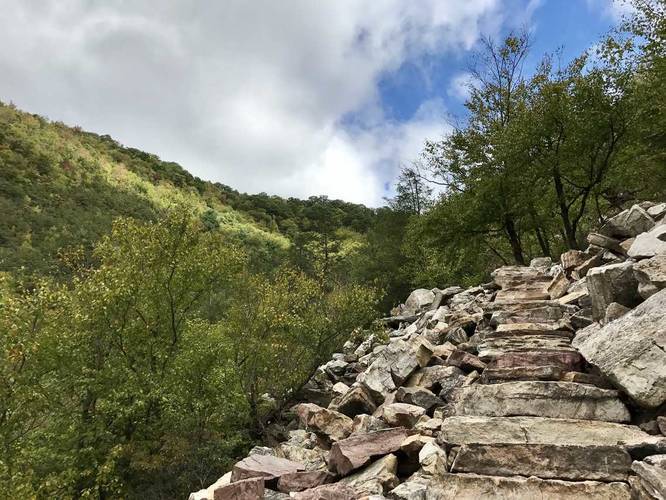
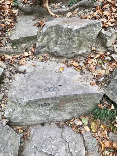
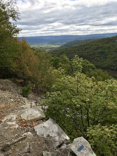
The Standing Stone Trail, also known as the Thousand (1000) Steps Trail, near Mapleton Depot and Mount Union Pennsylvania is a strenuous 2.7 mile out-and-back hike that leads straight up Jacks Mountain to the site of an old quarry with amazing views of the valley below. There are technically more than 1000 steps to the top, 1037 to be precise. If you head to the western overlook you'll likely climb closer to 1150 steps or so.
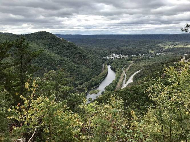
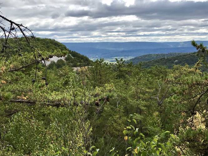
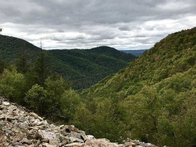
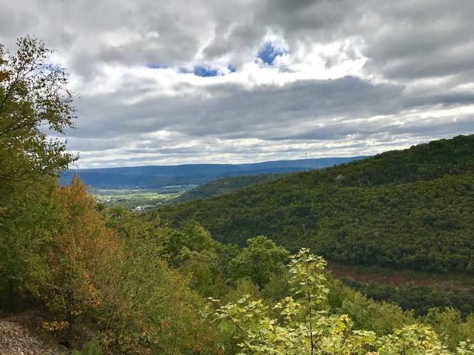
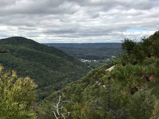
The quarry used to mine silica from Jacks Mountain and had railroad cars bring the silica down the mountainside. The 1000 steps is the old trail quarry workers used to take to get to work each day. At the top of the 1000 steps is an old railroad bed that's now part of the Standing Stone Trail, so once you make it to the top hiking is much easier. The trail is now moderately trafficked, especially on weekends, but has some amazing views of the Juniata River and the surrounding towns. Since this hike is strenuous, plan to take breaks while heading up and down the 1000 steps. Once you make it to the top, the hiking is extremely easy to the lookout points in comparison.
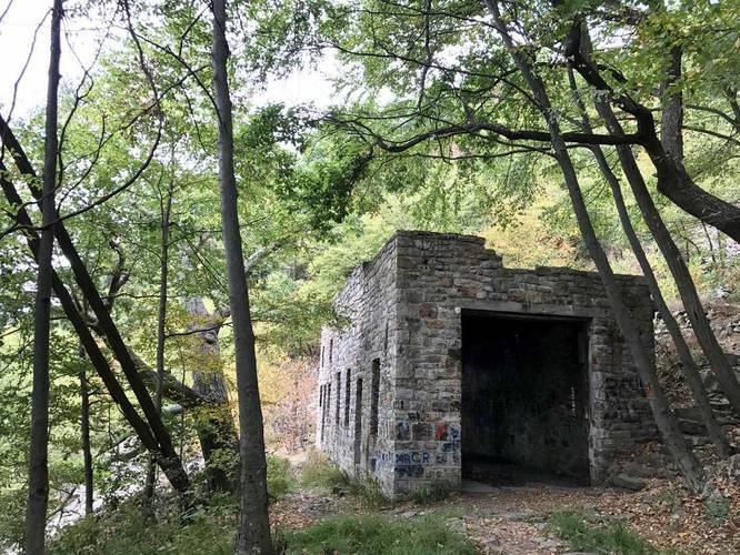
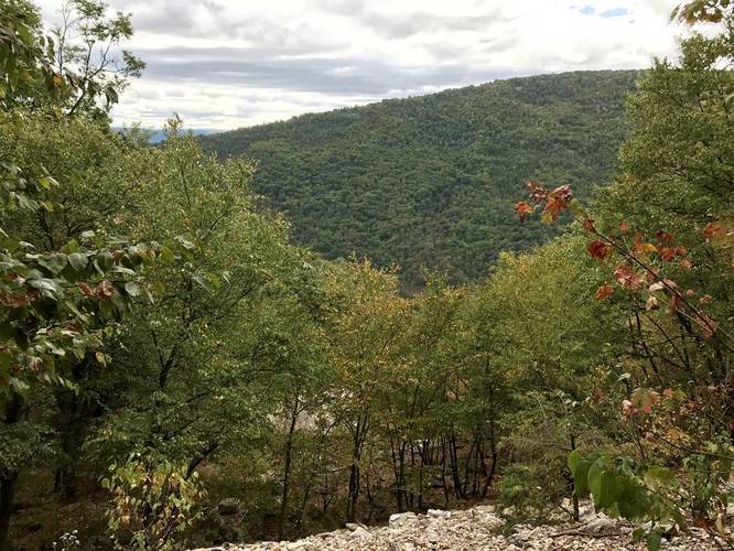
Lookout points: At the top of the 1000 steps, the trail heads left and right with lookout points in both directions. Heading right is the shorter of the two ways to take which is about 0.6 miles out-and-back to the lookout and back to the top of the steps. Heading left will first bring you to an old train car shed before heading uphill toward the 2nd, and better lookout point (Ledge Quarry Lookout).
Blaze colors: the trail starts at the road along the blue blazed trail. Follow this until you reach the small structure with historical information on it. From here, follow the orange blazes until you reach the top of the 1000 steps. If you take a right at the top, the blazes turn to blue - follow these to the eastern lookout. If you head left at the top of the stairs, continue following the orange blazes until you reach a sign that says "Ledge Quarry" - you'll know you're at the overlook when you get there.
Note: the 1000 steps is located in Pennsylvania State Game Lands, so it's smart to wear orange when hiking through this park.
The quarry used to mine silica from Jacks Mountain and had railroad cars bring the silica down the mountainside. The 1000 steps is the old trail quarry workers used to take to get to work each day. At the top of the 1000 steps is an old railroad bed that's now part of the Standing Stone Trail, so once you make it to the top hiking is much easier. The trail is now moderately trafficked, especially on weekends, but has some amazing views of the Juniata River and the surrounding towns. Since this hike is strenuous, plan to take breaks while heading up and down the 1000 steps. Once you make it to the top, the hiking is extremely easy to the lookout points in comparison.
Lookout points: At the top of the 1000 steps, the trail heads left and right with lookout points in both directions. Heading right is the shorter of the two ways to take which is about 0.6 miles out-and-back to the lookout and back to the top of the steps. Heading left will first bring you to an old train car shed before heading uphill toward the 2nd, and better lookout point (Ledge Quarry Lookout).
Blaze colors: the trail starts at the road along the blue blazed trail. Follow this until you reach the small structure with historical information on it. From here, follow the orange blazes until you reach the top of the 1000 steps. If you take a right at the top, the blazes turn to blue - follow these to the eastern lookout. If you head left at the top of the stairs, continue following the orange blazes until you reach a sign that says "Ledge Quarry" - you'll know you're at the overlook when you get there.
Note: the 1000 steps is located in Pennsylvania State Game Lands, so it's smart to wear orange when hiking through this park.