The Temple of Sinawava (Riverside Walk) at Zion National Park near Springdale, Utah is an easy and universally-accessible 1.9-mile out-and-back hike that features views of the Virgin River, hanging gardens, an emerald pool, and leads to the trailhead for Zion's Narrows.
Trails
This hike follows one named trail: Riverside Walk in Zion's Temple of Sinawava.
Universal Access
Note that this trail follows a paved and universally-accessible pathway.
Parking
Important note: Trailhead parking is only available during off-season months. For most seasons of the year, hikers must park outside of the Zion Canyon Scenic Drive, located along the road at a limited-number of parking spots located near (37.217472, -112.973270) and then you can hike to the trailhead or hop on a shuttle bus. Or hikers must park at the visitors center on the south side of the park, located (37.197994, -112.986847) and hop on a shuttle bus. Please refer to the Zion National Park website for all up-to-date information on when the shuttle service is running.
Hike Description
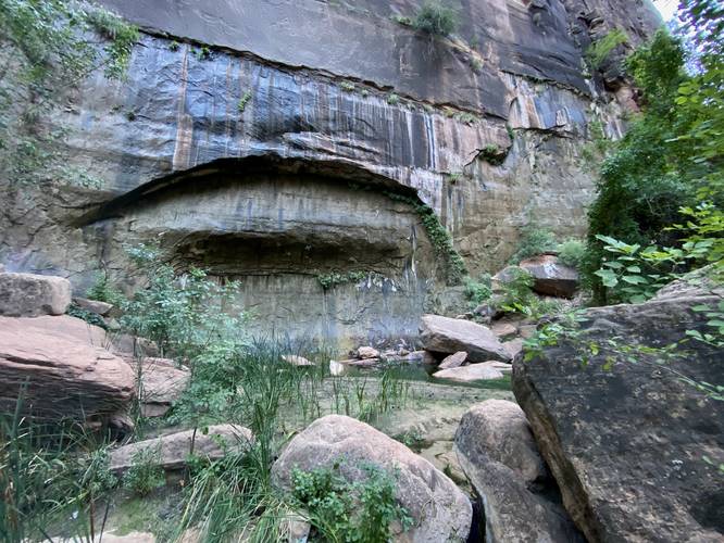
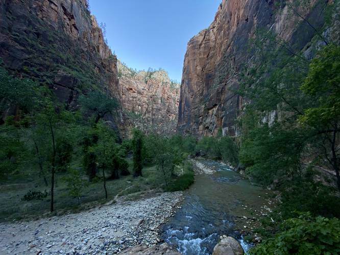
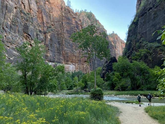
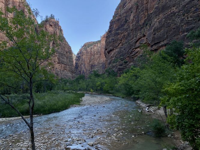
This short hike begins at the last shuttle stop at Zion National Park and follows the Riverside Walk trail. The Riverside Walk trail leads northward, through Zion's Temple of Sinawava, as it meanders its way through the super steep rock cliff gorge. Along the way, hikers will pass numerous views of the Virgin River in addition to lush hanging gardens that cling to the cliffs. Around mile 0.5, hikers will pass a dark green emerald pool that sits below the rocky cliffs on the eastern side of the trail. This emerald pool is quite the unique find along this hike. Finally, the trail will end around mile 0.95 where the trail leads down a staircase to reach The Narrows section of the Virgin River. Here, at The Narrows trailhead, is where hikers will begin their trek up the Virgin River to reach more hiking challenges and natural beauty, like more emerald pools of water. On this hike, we only planned for a short morning coffee walk - so we stopped at The Narrows and turned around. On the hike out, be sure to hop off-trail for a bit to take in more and different views of the Temple of Sinawava's gorge including small cascades within the Virgin River.
Pets
Dogs are not allowed on this trail.
Popularity
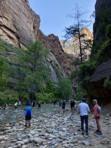
This is one of the most-popular and highly-trafficked trails at Zion National Park, especially due to the popularity of The Narrows which is only reachable via this trail.
Warnings
Rockfalls: This trail passes under massive cliffs that sometimes have rockfalls.
Rattlesnakes: This trail passes through areas known to inhabit rattlesnakes. If encountered, give them plenty of space.
Trails
This hike follows one named trail: Riverside Walk in Zion's Temple of Sinawava.
Universal Access
Note that this trail follows a paved and universally-accessible pathway.
Parking
Important note: Trailhead parking is only available during off-season months. For most seasons of the year, hikers must park outside of the Zion Canyon Scenic Drive, located along the road at a limited-number of parking spots located near (37.217472, -112.973270) and then you can hike to the trailhead or hop on a shuttle bus. Or hikers must park at the visitors center on the south side of the park, located (37.197994, -112.986847) and hop on a shuttle bus. Please refer to the Zion National Park website for all up-to-date information on when the shuttle service is running.
Hike Description
This short hike begins at the last shuttle stop at Zion National Park and follows the Riverside Walk trail. The Riverside Walk trail leads northward, through Zion's Temple of Sinawava, as it meanders its way through the super steep rock cliff gorge. Along the way, hikers will pass numerous views of the Virgin River in addition to lush hanging gardens that cling to the cliffs. Around mile 0.5, hikers will pass a dark green emerald pool that sits below the rocky cliffs on the eastern side of the trail. This emerald pool is quite the unique find along this hike. Finally, the trail will end around mile 0.95 where the trail leads down a staircase to reach The Narrows section of the Virgin River. Here, at The Narrows trailhead, is where hikers will begin their trek up the Virgin River to reach more hiking challenges and natural beauty, like more emerald pools of water. On this hike, we only planned for a short morning coffee walk - so we stopped at The Narrows and turned around. On the hike out, be sure to hop off-trail for a bit to take in more and different views of the Temple of Sinawava's gorge including small cascades within the Virgin River.
Pets
Dogs are not allowed on this trail.
Popularity
This is one of the most-popular and highly-trafficked trails at Zion National Park, especially due to the popularity of The Narrows which is only reachable via this trail.
Warnings
Rockfalls: This trail passes under massive cliffs that sometimes have rockfalls.
Rattlesnakes: This trail passes through areas known to inhabit rattlesnakes. If encountered, give them plenty of space.