The Sunrise Viewpoint Hike at Olympic National Park near Port Angeles, Washington is a moderate 0.9-mile loop that leads to Sunrise Point and features panoramic views of the Olympic Mountains and Port Angeles area.
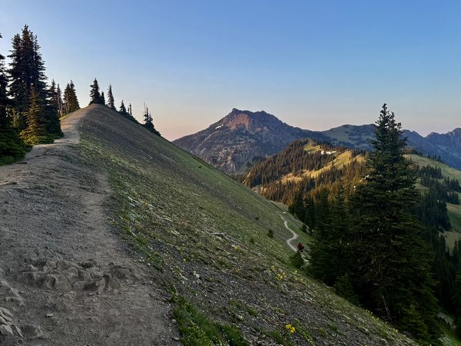
This route takes you along the Sunrise Point loop counter-clockwise, which arguably is the more-difficult route as the eastern side of the loop follows a moderate trail that ascends at a steeper elevation grade, but also provides better views along the way. On the left-hand side of the loop, hikers will find several short switchbacks that makes ascending easier. You choose how you ascend, but we took the harder route up to take in views of the sun setting atop the Olympic Mountains with easterly views.
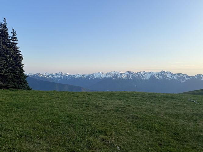
No matter what time of day you hike up to the Sunrise Viewpoint, you'll find stunning panoramic views without having to push in a lot of time to reach them.
Cougars: This area is habitat for the cougar / mountain lion. While rare, they can pass through from time to time. It's best to hike in a group of 2 or more and keep small children close at all times. Be aware of your surroundings and make noise while hiking to alert cougars of your presence.
Sunrise Point on Hurricane Ridge
The hike to Sunrise Point begins along the eastern side of the main parking lot near the Hurricane Ridge Visitor Center and ski area where the trailhead can be found on the north side of the lot. The trail initially leads through an open meadow along an easy path, but quickly ascends the nearby hill.This route takes you along the Sunrise Point loop counter-clockwise, which arguably is the more-difficult route as the eastern side of the loop follows a moderate trail that ascends at a steeper elevation grade, but also provides better views along the way. On the left-hand side of the loop, hikers will find several short switchbacks that makes ascending easier. You choose how you ascend, but we took the harder route up to take in views of the sun setting atop the Olympic Mountains with easterly views.
No matter what time of day you hike up to the Sunrise Viewpoint, you'll find stunning panoramic views without having to push in a lot of time to reach them.
Sunrise Point - Mile 0.21
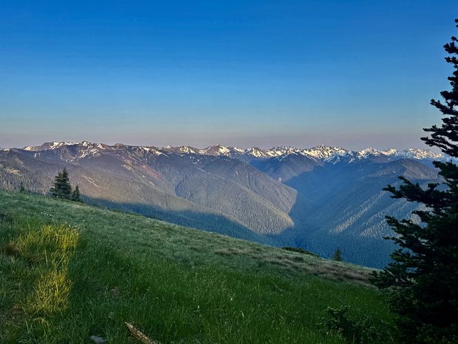
Just 0.21 miles from the trailhead sits the official Sunrise Point with exposed mountain slopes that provide hikers with breathtaking panoramic views into the eastern and southeastern Olympic Mountains. This easterly view is obviously best for sunrise, hence the name, as you can watch the sun slowly ascend from below the distant mountains if you show up early enough. From here, you can enjoy the snow and glacier-capped peaks that make up this seemingly-endless mountain range. As of June 2025, there's a bench at the viewpoint that can be used to take a break.Hill Top Viewpoint - Mile 0.3
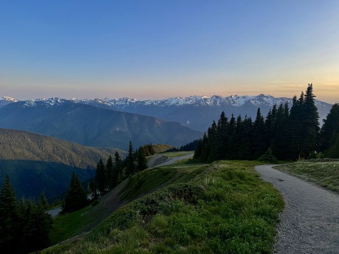
After taking in the sunrise, sunset, or simply the breathtaking views from Sunrise Point, the trail continues uphill as it leads to more viewpoints. As promised, the trail continues along a moderate elevation grade to reach a viewpoint around mile 0.3. When we reached this viewpoint, we found a group of hikers hanging out and enjoying the south-facing view between an opening in the evergreen trees; however, the top of this hill was once used for a ski resort and appears to be a defunct ski lift tower of sorts. The old ski lift tower used to connect to pullies and cables that ran down the southern slopes of the hill and thus the exposed opening provides hikers with another view.Sunset Point - Mile 0.47
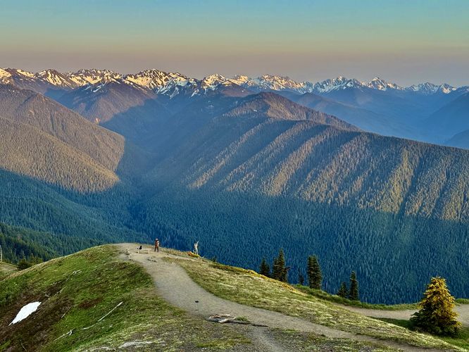
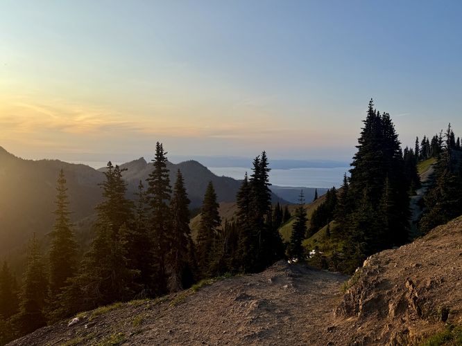
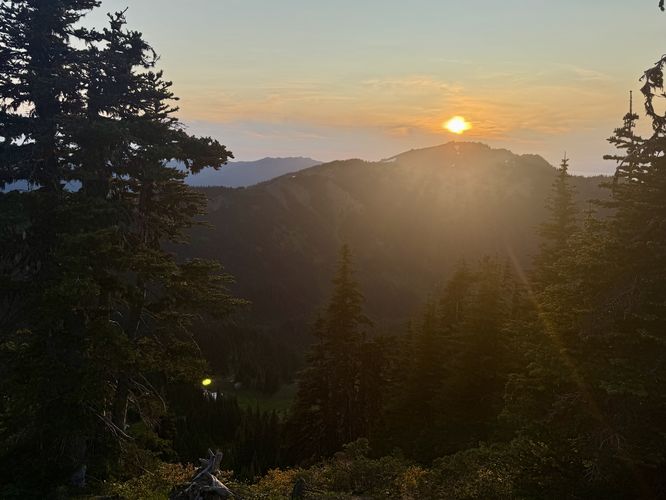
While the map provided labels "Sunrise Viewpoint" at mile 0.47, the national park's official location for Sunrise Point is way back at mile 0.21 on the eastern slopes. Regardless of the technicalities, the route then leads hikers north from a trail junction at mile 0.33 along a steep-sloped ridge out to what I'm calling "Sunset Point" at mile 0.47, located at the dead-end of this spur trail. At Sunset Point, you'll find beautiful views to the west and southwest of the Olympic Mountains in addition to the Port Angeles area with Unicorn Peak and Unicorn Horn below your feet to the northwest. You'll even find views of Vancouver Island on the horizon. From Sunrise Point, you probably guessed that you'll find a stunning sunset here, just like we did. Show up at the right time and you too can watch the sun make its way behind the western peaks in Olympic National Park like Hurricane Hill.Hiking Out - Mile 0.47 to 0.9
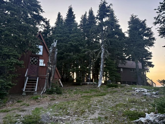
The last leg of this short loop hike leads from Sunset Point back to the trailhead by following the western side of the loop trail. Hike the ridge back to the trail junction and keep right at the junction. Follow the switchbacks down toward the old ski lift area where you'll find ski patrol buildings that appear to no longer be in use. Then keep left at the old ski lift pully tower which will lead you directly back to the open meadow you hiked past on your way in. Wrap up the hike at the parking lot at 0.9-miles.Other Hikes on Hurricane Ridge
If you're looking for another hike to tackle while exploring Hurricane Ridge, consider hiking the Hurricane Hill Trail. The Hurricane Hill Trail is one of the most popular hikes at Olympic National Park and for good reason. Throughout virtually the entire hike, Hurricane Hill provides breathtaking panoramic views of the Olympic Mountains. Take a short stroll for a 1-mile out-and-back walk or complete the entire, hard hike at 3.4-mile which includes a summit with old structural footings.Parking
Hikers will find a massive parking lot at the coordinates provided, located on Hurricane Ridge Road south of Port Angeles, Washington. The lot is large enough to fit many dozens of vehicles as of June 2025.Warning
Steep terrain: This hike follows exposed mountain slopes with very steep terrain. Stay on-trail for your own safety and hike at your own risk.Cougars: This area is habitat for the cougar / mountain lion. While rare, they can pass through from time to time. It's best to hike in a group of 2 or more and keep small children close at all times. Be aware of your surroundings and make noise while hiking to alert cougars of your presence.