The Stinger-Plantation Loop at Tioga State Forest near Middlebury, Pennsylvania is a moderate 2.2-mile loop hike that features some very-obstructed views amongst a peaceful young forest.
Trails
This hike follows two unnamed service / logging roads, two named trails, and a named forest road in order: logging road (no blazes), Stinger Trail (yellow blazes), Plantation Trail (red blazes), service road (no blazes), Spoor Hollow Road (no blazes).
Hike Description
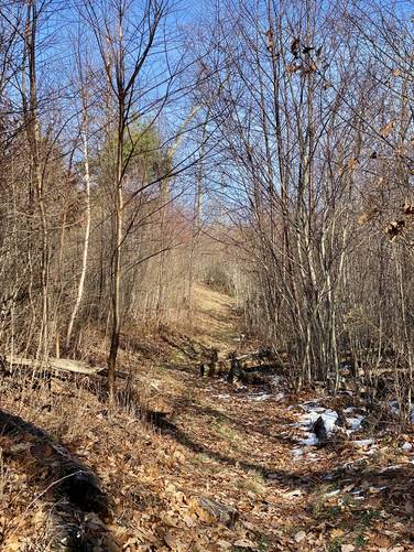
This hike begins at the yellow service road gate at the parking coordinates provided and follows the old logging road (now service road) into the woods as it meanders its way up the mountainside. Along the way, hikers will find plenty of white pine and hemlock trees that scatter alongside the trail. Eventually, around mile 0.6, the wide service road trail will somewhat end and become more closed-in as the young forest envelopes most of the trail - leaving the hiker following a true trail and not a service road.
Stinger Trail, Left-Hand Turn - Mile 0.7
At mile 0.7, hikers will take a left-hand turn onto the yellow blazes of the Stinger Trail. Once on the Stinger Trail, hikers will pass mountain laurel as they make their way north to a junction with the Plantation Trail.
Plantation Trail, Left-Hand Turn - Mile 0.84
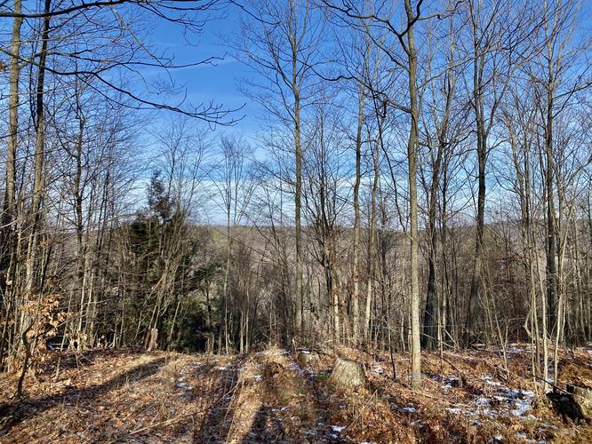
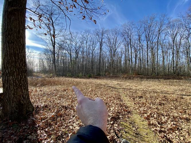
At mile 0.84, hikers will reach a left-hand turn that leads onto the Plantation Trail. Here, during the colder months when no leaves are on the trees, is a very-obstructed view of the surrounding mountains.
Plantation Trail's Mossy Substrate / Obstructed View - Mile 0.95
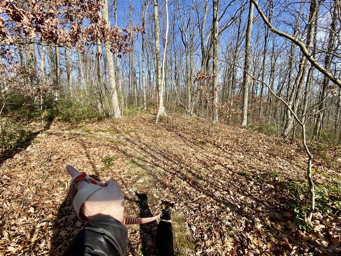
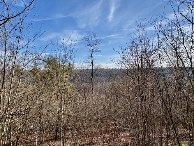
Once on the Plantation Trail, hiking becomes fairly pleasant as a good portion of this trail is covered in moss - which makes for a softer landing of each footstep. At mile 0.95, when the leaves are off of the trees, is another very-obstructed view of the surrounding mountains.
Service Road, Left-Hand Turn - Mile 1.2
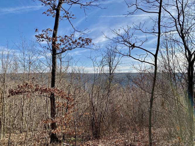
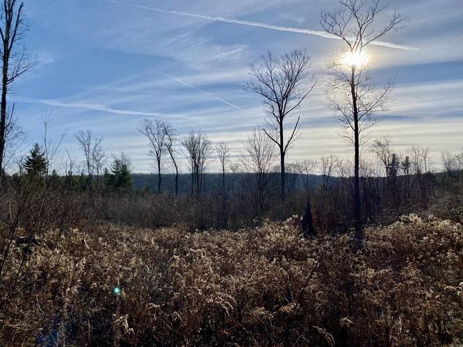
At mile 1.2, hikers will find another service road on their left-hand side. Take this left-hand turn to head down the mountain to reach Spoor Hollow Road. Once on the second service road, hikers will find some obstructed views around miles 1.3 and mile 1.55.
Spoor Hollow Road, Left-Hand Turn - Mile 1.95
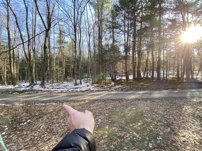
At mile 1.95, hikers will reach the left-hand turn that leads hikers onto Spoor Hollow Road and back to their vehicle. Hike the road downhill for 0.3 miles to reach the parking lot for a ~2.2-mile loop.
Parking
Hikers will find a small parking lot at the coordinates provided. Do not block the service road gate.
Pets
Dogs are allowed if leashed and their waste should be carried out by the hiker.
Views
Despite this are being clear-cut and logged ~10-15 years ago, this young forest has grown up and has begun to block the views, as of November 2022 (and much earlier). The views you'll get along this hike are very obstructed at best.
Biking
Note that biking is only allowed along the service roads and the Plantation Trail, but not the Stinger Trail.
Camping & Backpacking
Camping and backpacking are allowed here per state forest rules; however, there were no campsites noted along this hike as of November 2022. There are some places where one could setup a tent or hammock campsite. Please follow all state forest rules and regulations when backcountry / primitive / dispersed camping.
Trails
This hike follows two unnamed service / logging roads, two named trails, and a named forest road in order: logging road (no blazes), Stinger Trail (yellow blazes), Plantation Trail (red blazes), service road (no blazes), Spoor Hollow Road (no blazes).
Hike Description
This hike begins at the yellow service road gate at the parking coordinates provided and follows the old logging road (now service road) into the woods as it meanders its way up the mountainside. Along the way, hikers will find plenty of white pine and hemlock trees that scatter alongside the trail. Eventually, around mile 0.6, the wide service road trail will somewhat end and become more closed-in as the young forest envelopes most of the trail - leaving the hiker following a true trail and not a service road.
Stinger Trail, Left-Hand Turn - Mile 0.7
At mile 0.7, hikers will take a left-hand turn onto the yellow blazes of the Stinger Trail. Once on the Stinger Trail, hikers will pass mountain laurel as they make their way north to a junction with the Plantation Trail.
Plantation Trail, Left-Hand Turn - Mile 0.84
At mile 0.84, hikers will reach a left-hand turn that leads onto the Plantation Trail. Here, during the colder months when no leaves are on the trees, is a very-obstructed view of the surrounding mountains.
Plantation Trail's Mossy Substrate / Obstructed View - Mile 0.95
Once on the Plantation Trail, hiking becomes fairly pleasant as a good portion of this trail is covered in moss - which makes for a softer landing of each footstep. At mile 0.95, when the leaves are off of the trees, is another very-obstructed view of the surrounding mountains.
Service Road, Left-Hand Turn - Mile 1.2
At mile 1.2, hikers will find another service road on their left-hand side. Take this left-hand turn to head down the mountain to reach Spoor Hollow Road. Once on the second service road, hikers will find some obstructed views around miles 1.3 and mile 1.55.
Spoor Hollow Road, Left-Hand Turn - Mile 1.95
At mile 1.95, hikers will reach the left-hand turn that leads hikers onto Spoor Hollow Road and back to their vehicle. Hike the road downhill for 0.3 miles to reach the parking lot for a ~2.2-mile loop.
Parking
Hikers will find a small parking lot at the coordinates provided. Do not block the service road gate.
Pets
Dogs are allowed if leashed and their waste should be carried out by the hiker.
Views
Despite this are being clear-cut and logged ~10-15 years ago, this young forest has grown up and has begun to block the views, as of November 2022 (and much earlier). The views you'll get along this hike are very obstructed at best.
Biking
Note that biking is only allowed along the service roads and the Plantation Trail, but not the Stinger Trail.
Camping & Backpacking
Camping and backpacking are allowed here per state forest rules; however, there were no campsites noted along this hike as of November 2022. There are some places where one could setup a tent or hammock campsite. Please follow all state forest rules and regulations when backcountry / primitive / dispersed camping.