This trail starts along the train tracks next to where the Round Island Run trail ends and is a 3.2 mile alternative route back up to the campsite in Sproul State Forest, PA.
This is partially a defined trail and partially a bushwhacking trail.
The climb back to Jerry Ridge Rd from where the data leaves the train track area is straight bushwhacking up about 1000 feet of steep mountain side. Prepare for the worst and keep on pushing...
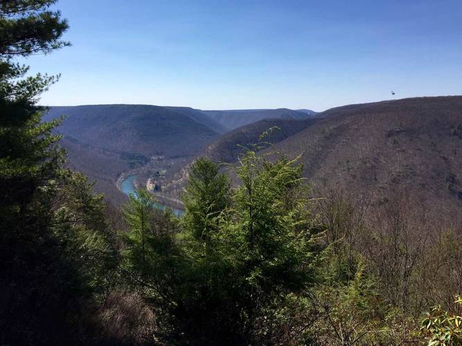
Camping: At the end of this recording is a small spur trail that leads from Jerry Ridge Rd over to an amazing campsite with views of Sinnemahoning Creek and the surrounding mountains. You can park at the road and walk a couple hundred feet to the campsite.
Road Conditions: Jerry Ridge Rd and the roads leading to it are all dirt. These roads can often be extremely muddy during the rainy seasons and if you're not careful, your car could get stuck. There's also no cell service for dozens of miles. If you plan to drive in, it's often an 11-mile one-way drive to get to the trailhead, so come prepared with a vehicle that can handle these conditions.
This is partially a defined trail and partially a bushwhacking trail.
The climb back to Jerry Ridge Rd from where the data leaves the train track area is straight bushwhacking up about 1000 feet of steep mountain side. Prepare for the worst and keep on pushing...
Camping: At the end of this recording is a small spur trail that leads from Jerry Ridge Rd over to an amazing campsite with views of Sinnemahoning Creek and the surrounding mountains. You can park at the road and walk a couple hundred feet to the campsite.
Road Conditions: Jerry Ridge Rd and the roads leading to it are all dirt. These roads can often be extremely muddy during the rainy seasons and if you're not careful, your car could get stuck. There's also no cell service for dozens of miles. If you plan to drive in, it's often an 11-mile one-way drive to get to the trailhead, so come prepared with a vehicle that can handle these conditions.