The Sperr Loop Trail at Sperr Memorial Park in Big Flats, New York is an easy 0.7-mile universal access loop trail that features views of Lowe Pond and the Chemung Feeder Canal.
Trail Description
This trail begins at the main parking lot for Sperr Memorial Park and follows the loop trail in a clockwise direction by first following a small portion of the Big Flats Rail Trail before taking a right-hand turn to continue on the loop.
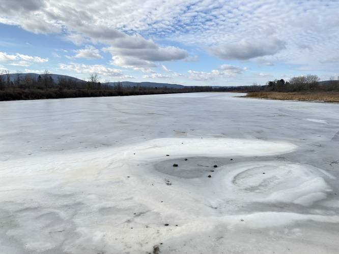
Views - Mile 0.23
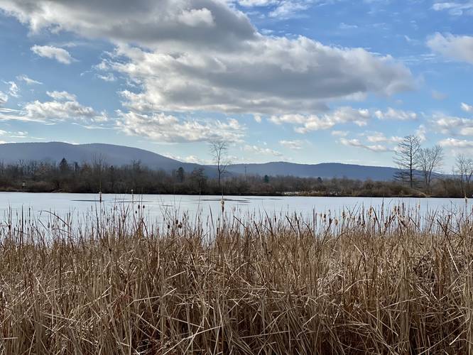
Around mile 0.23, hikers will find a viewing platform of Lowe Pond, facing west with the surrounding mountains in the distance.
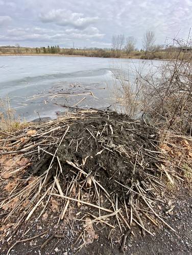
Beaver Hut - Mile 0.24
Around mile 0.24, as of January 2023, is a beaver hut that literally sits on the trail. Please do not disturb their home, but you can stand quietly and potentially watch beavers swimming to and from their house. Note the floating sticks near the entrance to their hut - this is their food. Nearby you'll also notice dirt slides that lead down from the trail to Lowe Pond - these are beaver slides.
After passing the beaver hut, the trail meanders around the north side of Lowe Pond before passing a memorial plaque for Lowe Farm and Pond. After passing the Lowe family plaque, hikers will pass the plaque in honor of Andrew Sperr who was a New York State Trooper who passed away on March 1, 2006. The park is named in his honor.
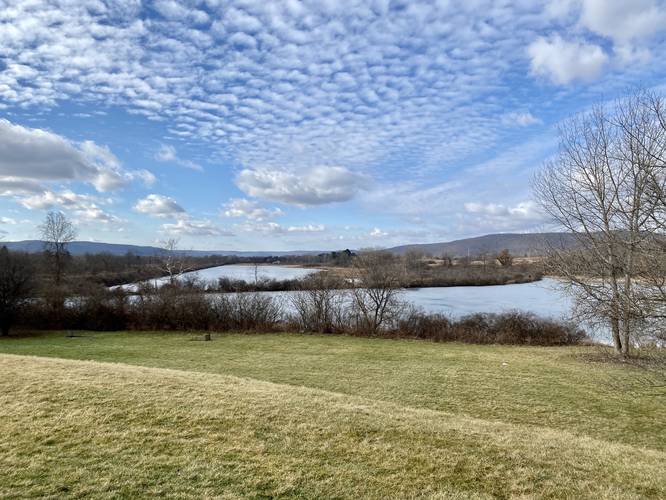
Finally, hikers will reach a beautiful overlook of Lowe Pond near the parking lot next to a row of benches to finish the short hike.
History
According to the plaque, Cornelius W. Lowe, trapper and farmer, came to this land in 1794. He and his descendants farmed here until 1958.
Universal Access
This trail is universally accessible along the crushed stone path the begins on the south end of the parking lot. As of January 2023, there's no crushed stone between Lowe Rd and the parking lot, thus this trail is not fully accessible at the time of this write-up.
Parking
Hikers and walkers will find a large parking lot at the coordinates provided. It's large enough to fit a dozen or more vehicles. The lot fills up fairly quickly by noon on warm days, especially on weekends.
Pets
Dogs are allowed if leashed and their waste must be carried out by the hiker.
Trail Description
This trail begins at the main parking lot for Sperr Memorial Park and follows the loop trail in a clockwise direction by first following a small portion of the Big Flats Rail Trail before taking a right-hand turn to continue on the loop.
Views - Mile 0.23
Around mile 0.23, hikers will find a viewing platform of Lowe Pond, facing west with the surrounding mountains in the distance.
Beaver Hut - Mile 0.24
Around mile 0.24, as of January 2023, is a beaver hut that literally sits on the trail. Please do not disturb their home, but you can stand quietly and potentially watch beavers swimming to and from their house. Note the floating sticks near the entrance to their hut - this is their food. Nearby you'll also notice dirt slides that lead down from the trail to Lowe Pond - these are beaver slides.
After passing the beaver hut, the trail meanders around the north side of Lowe Pond before passing a memorial plaque for Lowe Farm and Pond. After passing the Lowe family plaque, hikers will pass the plaque in honor of Andrew Sperr who was a New York State Trooper who passed away on March 1, 2006. The park is named in his honor.
Finally, hikers will reach a beautiful overlook of Lowe Pond near the parking lot next to a row of benches to finish the short hike.
History
According to the plaque, Cornelius W. Lowe, trapper and farmer, came to this land in 1794. He and his descendants farmed here until 1958.
Universal Access
This trail is universally accessible along the crushed stone path the begins on the south end of the parking lot. As of January 2023, there's no crushed stone between Lowe Rd and the parking lot, thus this trail is not fully accessible at the time of this write-up.
Parking
Hikers and walkers will find a large parking lot at the coordinates provided. It's large enough to fit a dozen or more vehicles. The lot fills up fairly quickly by noon on warm days, especially on weekends.
Pets
Dogs are allowed if leashed and their waste must be carried out by the hiker.