Big Flats Rail Trail at Sperr Memorial Park in Big Flats, New York is an easy and popular 2.5-mile out-and-back trail that features views of Lowe Pond and the surrounding mountains.
Trail Description
This hike and track begins at the Sperr Memorial Park entrance to the trail and first heads west to reach South Hibbard Rd; however, hikers can start at the western parking lot located at 42.14122, -76.92724 on South Hibbard Rd in Big Flats. No matter which parking lot you start from, this will be an out-and-back hike.
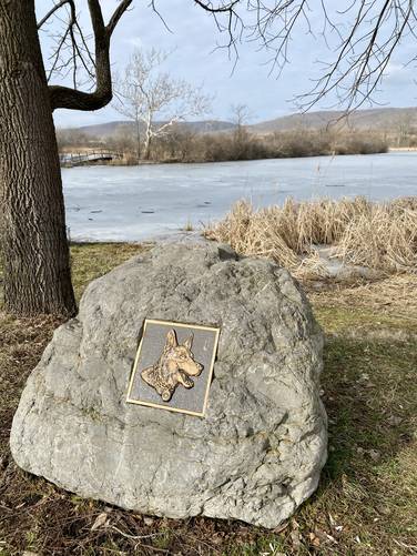
Before heading west and out of Sperr Memorial Park, hikers may notice the small spur trail that leads to the water's edge of Lowe Pond. Here is a plaque dedicated to the New York K-9 Police Force and provides a nice view of Lowe Pond.
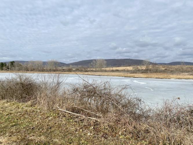
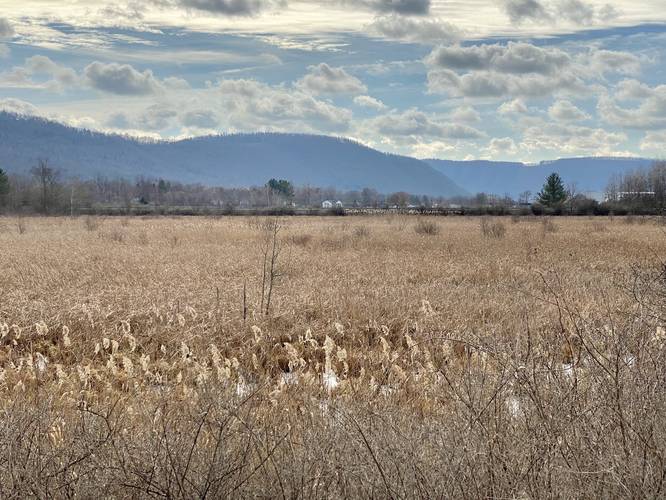
The trail itself is pretty much flat except for near the parking lots which have a small ~15-foot gradual elevation grade that follows crushed stone. Along the way, hikers will get nice views of Lowe Pond and the surrounding mountains like Steege Hill and Harris Hill to the south. Eventually the hiker will reach the western end of the trail - their turnaround point. Head back the same way you came in and when you reach Sperr Memorial Park you have the option to cross Kahler Rd S to continue heading East on the trail. We followed the Big Flats Rail Trail east from Kahler Rd S for a short while as the trail dip back downhill and runs through lowlands along side two tall banks, which were likely built-up to provide flood protection from the old train tracks. Eventually, we turned around to reach the parking lot for a 2.5-mile out-and-back hike.
Pets
Dogs are allowed if leashed and their waste must be carried out by the hiker. Note that as of January 2023, there's a sign at the trailhead stating dogs without leashes and leftover animal waste is a big reason why dogs may not be allowed at all on this trail in the future - it's up to dog walkers to ensure they follow the rules so they can continue bringing their pets here. The dog rule may change in the future, please note and follow all rules and regulations in case they do change.
Universal Access
This is a universally-accessible trail that follows crushed stone. There is minimal elevation change except for near the parking lots. The Sperr Memorial Park has a more gradual elevation change that leads from the park to the trail for folks who need an easier access point. Note that there's another somewhat steep elevation change that leads up and over Kahler Rd S near Sperr Memorial Park.
Parking
Hikers and walkers will find a large parking lot at the coordinates provided at Sperr Memorial Park in Big Flats. It's large enough to fit a dozen or more vehicles. The lot fills up fairly quickly by noon on warm days, especially on weekends. Hikers can also park at the western parking lot located at 42.14122, -76.92724 on South Hibbard Rd in Big Flats, which appears to be slightly-less popular than the parking lot at Sperr Memorial Park as of January 2023.
Hours
This trail is open from dawn to dusk each day.
Biking
There were no signs stating biking is not permitted, so it seems as though biking is allowed. Note that this appears to be mostly a walking trail.
Trail Description
This hike and track begins at the Sperr Memorial Park entrance to the trail and first heads west to reach South Hibbard Rd; however, hikers can start at the western parking lot located at 42.14122, -76.92724 on South Hibbard Rd in Big Flats. No matter which parking lot you start from, this will be an out-and-back hike.
Before heading west and out of Sperr Memorial Park, hikers may notice the small spur trail that leads to the water's edge of Lowe Pond. Here is a plaque dedicated to the New York K-9 Police Force and provides a nice view of Lowe Pond.
The trail itself is pretty much flat except for near the parking lots which have a small ~15-foot gradual elevation grade that follows crushed stone. Along the way, hikers will get nice views of Lowe Pond and the surrounding mountains like Steege Hill and Harris Hill to the south. Eventually the hiker will reach the western end of the trail - their turnaround point. Head back the same way you came in and when you reach Sperr Memorial Park you have the option to cross Kahler Rd S to continue heading East on the trail. We followed the Big Flats Rail Trail east from Kahler Rd S for a short while as the trail dip back downhill and runs through lowlands along side two tall banks, which were likely built-up to provide flood protection from the old train tracks. Eventually, we turned around to reach the parking lot for a 2.5-mile out-and-back hike.
Pets
Dogs are allowed if leashed and their waste must be carried out by the hiker. Note that as of January 2023, there's a sign at the trailhead stating dogs without leashes and leftover animal waste is a big reason why dogs may not be allowed at all on this trail in the future - it's up to dog walkers to ensure they follow the rules so they can continue bringing their pets here. The dog rule may change in the future, please note and follow all rules and regulations in case they do change.
Universal Access
This is a universally-accessible trail that follows crushed stone. There is minimal elevation change except for near the parking lots. The Sperr Memorial Park has a more gradual elevation change that leads from the park to the trail for folks who need an easier access point. Note that there's another somewhat steep elevation change that leads up and over Kahler Rd S near Sperr Memorial Park.
Parking
Hikers and walkers will find a large parking lot at the coordinates provided at Sperr Memorial Park in Big Flats. It's large enough to fit a dozen or more vehicles. The lot fills up fairly quickly by noon on warm days, especially on weekends. Hikers can also park at the western parking lot located at 42.14122, -76.92724 on South Hibbard Rd in Big Flats, which appears to be slightly-less popular than the parking lot at Sperr Memorial Park as of January 2023.
Hours
This trail is open from dawn to dusk each day.
Biking
There were no signs stating biking is not permitted, so it seems as though biking is allowed. Note that this appears to be mostly a walking trail.