The Speckled Mountain via Spruce Hill Trail at the White Mountain National Forest near Bethel, Maine is a moderate 6.3-mile out-and-back trail that ascends Speckled Mountain and features spectacular near-360 views from the summit.
Trail Description
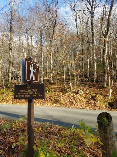
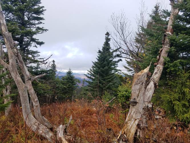
The trail begins across the road from the parking area with elevation gain starting immediately when the hiker gets on the trail. The trail's surface follows a rocky and rooty path with a few small stream crossings. During the Fall, the fallen leaves make it a little harder to find the trail, but you'll see yellow blazes which are easier to follow. Generally the trail is well worn, and once you hike into the the pines and evergreens, the leaves aren't an issue anymore.
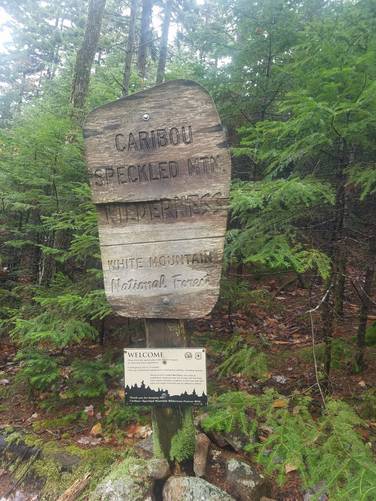
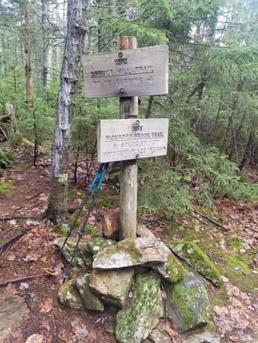
Around mile 0.7, hikers will reach the Caribou Speckled Mountain Wilderness which is part of the White Mountain National Forest. The next point of interest or marker along the trail is around mile 1.95 - the trail junction with the Bickford Brook Trail.
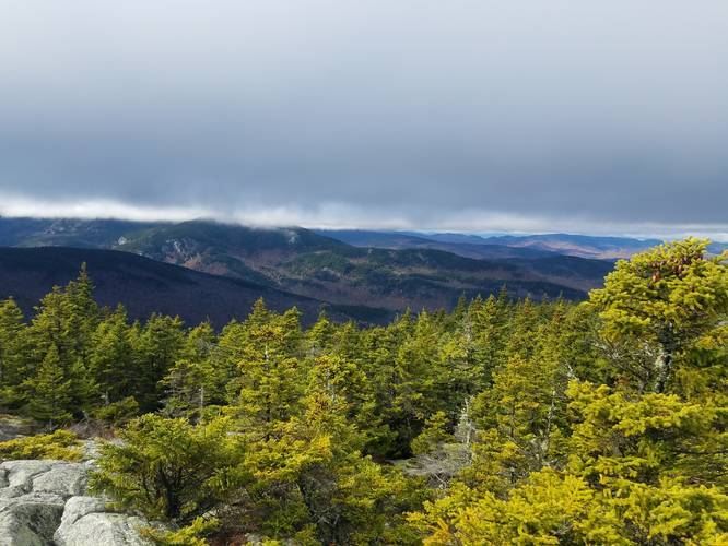
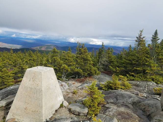
Finally hikers will reach the summit around mile 3.2. The summit features amazing, nearly 360 views. From the summit, hikers may notice Albany Mountain to the east, which is a shorter peak within the White Mountain National Forest. Absolutely worth the hike.
Parking
Parking for the Spruce Hill Trail trailhead is directly off Route 113, and shares a trailhead with Royce Mountain. There are no bathrooms or potable water stations at the trailhead, and this section of Route 113 is closed during winter.
Camping and Backpacking
Please note that the White Mountain National Forest allows primitive / dispersed / backcountry camping, but due to the steep elevation of the mountain, it's less likely backpackers will find a campsite along this trail.
Difficulty
Despite the 1,800-foot ascent and descent, the trail should be considered moderate for experienced hikers or "hard" for less experienced hikers. The trail is fine for dogs and experienced children as well.
Trail Description
The trail begins across the road from the parking area with elevation gain starting immediately when the hiker gets on the trail. The trail's surface follows a rocky and rooty path with a few small stream crossings. During the Fall, the fallen leaves make it a little harder to find the trail, but you'll see yellow blazes which are easier to follow. Generally the trail is well worn, and once you hike into the the pines and evergreens, the leaves aren't an issue anymore.
Around mile 0.7, hikers will reach the Caribou Speckled Mountain Wilderness which is part of the White Mountain National Forest. The next point of interest or marker along the trail is around mile 1.95 - the trail junction with the Bickford Brook Trail.
Finally hikers will reach the summit around mile 3.2. The summit features amazing, nearly 360 views. From the summit, hikers may notice Albany Mountain to the east, which is a shorter peak within the White Mountain National Forest. Absolutely worth the hike.
Parking
Parking for the Spruce Hill Trail trailhead is directly off Route 113, and shares a trailhead with Royce Mountain. There are no bathrooms or potable water stations at the trailhead, and this section of Route 113 is closed during winter.
Camping and Backpacking
Please note that the White Mountain National Forest allows primitive / dispersed / backcountry camping, but due to the steep elevation of the mountain, it's less likely backpackers will find a campsite along this trail.
Difficulty
Despite the 1,800-foot ascent and descent, the trail should be considered moderate for experienced hikers or "hard" for less experienced hikers. The trail is fine for dogs and experienced children as well.