Loading...

Distance:
0.8 Miles / 1.3 km
Type:
Out-and-Back
Difficulty:
Easy
Time to Hike:
~24 minutes
Features:
Surface Type:
Dirt
Park:
Iron Ore Heritage Trail
Town:
Marquette, Michigan
Directions:
46.528719, -87.391931
Added:
September 25, 2022
Updated:
September 30, 2022
Loading...
Loading...
7 '

Total Change
7 '

Ascent
7 '

Descent

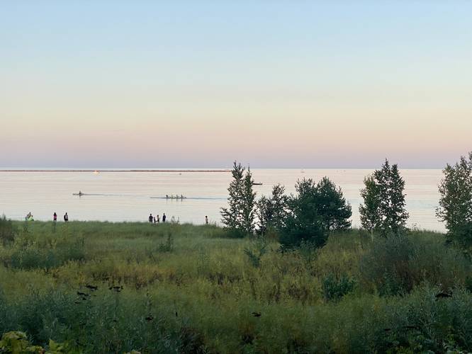
The South Beach Walk along the North Country Trail / Iron Ore Heritage Trail in Marquette, Michigan is an easy 0.9-mile out-and-back paved scenic walk that runs along the shores of Lake Superior and features views of the lake.

Trails
This walk follows one path with two names: North Country Trail (NST) / North Country Scenic Trail; Iron Ore Heritage Trail.

This is not a hike, but rather a short walk along a paved section of the North Country Trail (NST). During sunset, this is a great place to watch the colors change over the lake.

Parking
Walkers will find parking at the coordinates provided for South Beach in Marquette. The lot is large enough to fit several dozen vehicles.

Pets
Dogs are allowed if leashed and their waste must be carried out.

Biking
Note that biking is permitted. If not biking, stay to the side of the trail at all times, assuming bikers may pass on your left.

Explore 5 trails near Marquette, MI
  1. Parking

    46.528719, -87.391931
  2. Main Trailhead

    46.528458, -87.392313
  3. View of Lake Superior at sunet (rowers on the water)

    46.527217, -87.391769
    View of Lake Superior at sunet (rowers on the water)
No community routes found. To add your own hike as a Community Route for this Trail guide, leave a Trip Report with an attached GPX file.

Hazards

Ticks - Lyme Disease More Info (CDC)

Seasons

All

Photo Albums

2 Trip Reports

No Star-Ratings
Write-up by:
Admin user profile picture
0.8 miles / 1.3 km
Trail added
September 25, 2022
Hiked on
September 20, 2022
Updated on
September 30, 2022
0.8 miles / 1.3 km
September 20, 2022
Hiking

Weather Forecast

In Marquette, MI

Explore Hiking Trails

New Hikes

Diana's Baths Trail
1.2 Miles
1.9 km
Easy
Out-and-Back
Eternal Flame Falls via Eternal Flame Trail
1.2 Miles
1.9 km
Moderate
Out-and-Back
Raven Rocks via Appalachian Trail
5.1 Miles
8.2 km
Strenuous
Out-and-Back
Mt. Morris Dam Overlook
3.3 Miles
5.3 km
Easy
Out-and-Back

Before you leave...

MyHikes is an indie web platform aimed to make exploring public trails easier for everyone. The site has no investors and is owned and operated by one person, Dave Miller (Founder & Admin). As the Founder, main contributor, and doer-of-all-things for MyHikes, I share my trips with over-detailed write-ups for fun on a volunteer basis and I believe that public trail information should be available to everyone.

It takes a lot of time ๐Ÿ•ฆ, money ๐Ÿ’ฐ, and effort (including espresso shots โ˜•) to run MyHikes, including hiking , mapping , writing , and publishing new trails with high-quality content... along with building new features, moderating, site maintainance, and app development for iOS and Android . I simply ask that if you find MyHikes' trail guides helpful to please consider becoming a Supporter to help keep the site, iOS, and Android apps available to everyone.

Supporters unlock website and in-app perks with a one-time payment of $25 (you renew) ๐Ÿ˜Ž๐Ÿ‘. Or you can simply make a Donation of your choice without a MyHikes user account. Otherwise, telling your friends about MyHikes is the next-best thing - both quick and free ๐ŸŽ‰

Thanks for visiting MyHikes and have a great hike!๏ธ

Admin user profile picture

Dave Miller
MyHikes Founder & Admin