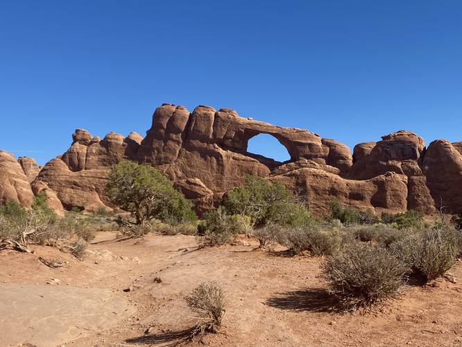
The Skyline Arch Trail at Arches National Park near Moab, Utah is an easy 0.4-mile out-and-back hike that leads to the less-visited natural rock formation known as the Skyline Arch.
Hike Description
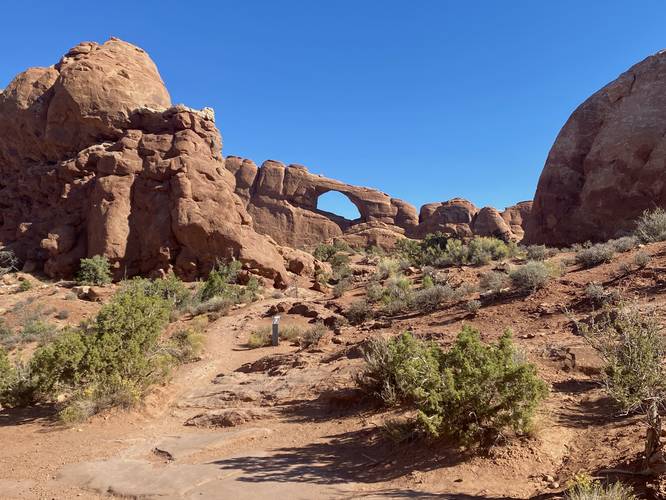
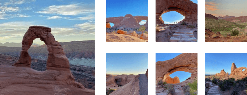
This hike begins at the main trailhead for the Skyline Arch Trail and follows the dirt path as it makes its way uphill toward the Skyline Arch. Hikers will be able to see the arch from the trailhead and will have a view of it for virtually the entire hike. The trail it mostly-flat after it ascends a gradual grade from the parking lot along a series of short stairs built into the trail.
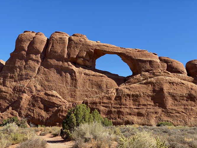
Skyline Arch - Mile 0.2
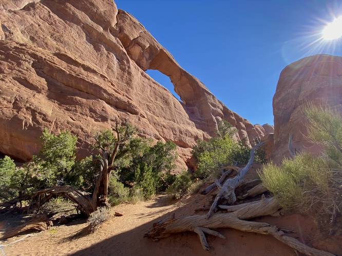
Around mile 0.2, hikers will reach the base of Skyline Arch where the trail ends. You may spot people up near the arch as there's another pathway that leads up the opposite side of the rock outcropping -- starting from the campground area instead. Note that the best view of Skyline Arch was from the trail, located around mile 0.1 just before reaching the base.
How to Get Into Arches National Park
Note that Arches National Park, as of September 2023 (and earlier) only allows vehicles to enter the park during scheduled time slots. You can read all about Arches' timed entry here and you can find reservation information here. Reservations are grabbed quickly, so be sure to log onto the reservation website when the date opens up to grab your timed entry ticket. Note that vehicles can enter the park outside of the timed entry slots (i.e. before 7AM or after 4PM each day, as of September 2023). If you do not have a timed entry ticket between 7AM and 4PM, do not wait in line to enter the park as you will be turned away and will slow everyone else down. The vehicle line to enter the park is very long and wait-times to enter can be a pain so show up prepared.
Parking
Hikers will find a small parking turnout at the coordinates provided along Main Park Road in Arches National Park. The lot is large enough to fit less than one dozen vehicles as of September 2023.
Seclusion
Visitors can see Skyline Arch from the road, so many people skip this trail and thus it's a lot less popular than most of the other trails at Arches National Park. When we hiked this, despite being on the trail for just a few minutes, we didn't see any other hikers -- and everyone who stopped at the trailhead quickly drove off once finding out they didn't need to hike the trail. If you're looking for seclusion in Arches NP, you'll likely find a bit of it here.
Pets
Dogs are not allowed on any trails at Arches National Park. Please do not bring your dog here.
Fees
As of September 2023, there's a $30 fee per vehicle to enter Arches National Park.
Warnings
Sun exposure: This trail has very little shade and no water sources. Pack-in all water and wear sun screen and a hat to protect against sun exposure. It's smart to hike either in the early morning or late afternoon to avoid the intense desert sun.
No water: This trail has no water sources so you must pack-in all water. A general rule of thumb in the desert is 1 gallon of water per person per day.
Rattlesnakes: This is rattlesnake territory, so be on the lookout and give any rattlers you find plenty of space.
Hike Description
This hike begins at the main trailhead for the Skyline Arch Trail and follows the dirt path as it makes its way uphill toward the Skyline Arch. Hikers will be able to see the arch from the trailhead and will have a view of it for virtually the entire hike. The trail it mostly-flat after it ascends a gradual grade from the parking lot along a series of short stairs built into the trail.
Skyline Arch - Mile 0.2
Around mile 0.2, hikers will reach the base of Skyline Arch where the trail ends. You may spot people up near the arch as there's another pathway that leads up the opposite side of the rock outcropping -- starting from the campground area instead. Note that the best view of Skyline Arch was from the trail, located around mile 0.1 just before reaching the base.
How to Get Into Arches National Park
Note that Arches National Park, as of September 2023 (and earlier) only allows vehicles to enter the park during scheduled time slots. You can read all about Arches' timed entry here and you can find reservation information here. Reservations are grabbed quickly, so be sure to log onto the reservation website when the date opens up to grab your timed entry ticket. Note that vehicles can enter the park outside of the timed entry slots (i.e. before 7AM or after 4PM each day, as of September 2023). If you do not have a timed entry ticket between 7AM and 4PM, do not wait in line to enter the park as you will be turned away and will slow everyone else down. The vehicle line to enter the park is very long and wait-times to enter can be a pain so show up prepared.
Parking
Hikers will find a small parking turnout at the coordinates provided along Main Park Road in Arches National Park. The lot is large enough to fit less than one dozen vehicles as of September 2023.
Seclusion
Visitors can see Skyline Arch from the road, so many people skip this trail and thus it's a lot less popular than most of the other trails at Arches National Park. When we hiked this, despite being on the trail for just a few minutes, we didn't see any other hikers -- and everyone who stopped at the trailhead quickly drove off once finding out they didn't need to hike the trail. If you're looking for seclusion in Arches NP, you'll likely find a bit of it here.
Pets
Dogs are not allowed on any trails at Arches National Park. Please do not bring your dog here.
Fees
As of September 2023, there's a $30 fee per vehicle to enter Arches National Park.
Warnings
Sun exposure: This trail has very little shade and no water sources. Pack-in all water and wear sun screen and a hat to protect against sun exposure. It's smart to hike either in the early morning or late afternoon to avoid the intense desert sun.
No water: This trail has no water sources so you must pack-in all water. A general rule of thumb in the desert is 1 gallon of water per person per day.
Rattlesnakes: This is rattlesnake territory, so be on the lookout and give any rattlers you find plenty of space.