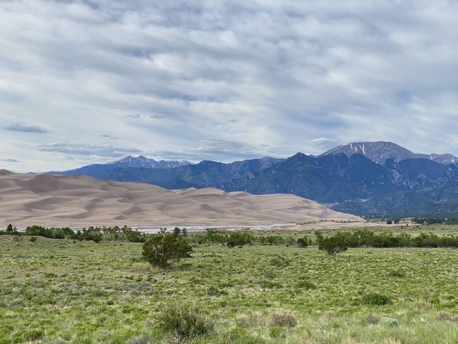
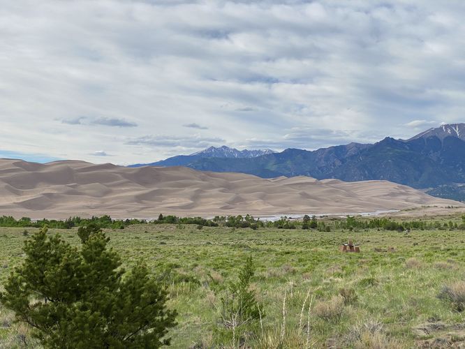
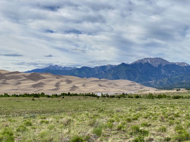
The Sand Sheet Interpretive Trail at Great Sand Dunes National Park in Mosca, Colorado is an easy 0.4-mile loop walk that features stunning views of the Great Sand Dunes, the Sangre de Cristo Mountains, and Medano Creek.
Walk
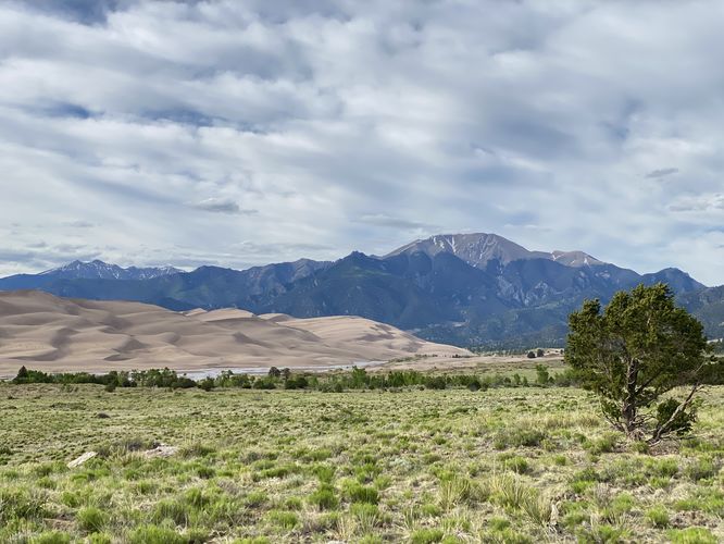
This is more of a short walk than an actual hike, but the trail is well-worth the time spent to view the Great Sand Dunes, especially if you don't have much time to spend while visiting the park. The trailhead is located at the visitors center and heads in along the western side of the building. The loop begins by heading downhill along a dirt pathway where you'll find different information kiosks about native plants, the mountains, and how the dunes formed. Hikers will get views all around them - if you follow this route by taking the southern half of the loop first, you'll get views of the distant San Luis Valley and Medano Creek. Once you swing around, heading back toward the trailhead, you'll get stunning views of the Great Sand Dunes and Sangre de Cristo Mountains. Granted, these views are there the entire time as the landscape is totally wide open with very few shrubs or trees blocking the views. The trail loops back to the trailhead at the visitors center for a short 0.4-mile walk.
Universal Access
This trail follows both a paved and dirt surface that should be considered universally accessible. The dirt is a firm hard surface with no tripping hazards, holes, or dips. Note that the connection between the dirt pathway and the paved surface may not be fully accessible - in that case, as of June 2024, there's a fully accessible paved pathway that encompasses the visitors center and provides similar views that the trail has to offer.
Other Hikes
While the park has many longer trails to explore, including the dunes themselves, if you don't have much time to spend at the park consider hiking the Great Sand Dunes View Trail (Mosca Pass) from the parking lot to reach the Montville Nature Loop Trail for a different perspective.
Pets
Dogs are allowed on this trail only if leashed and cleaned up after. Click here more information on where dogs are and are not allowed at Great Sand Dunes National Park.
Parking
Hikers will find a very large parking lot at the coordinates provided, located at the main visitors center for the park. The lot is large enough to fit many dozens of vehicles as of June 2024.
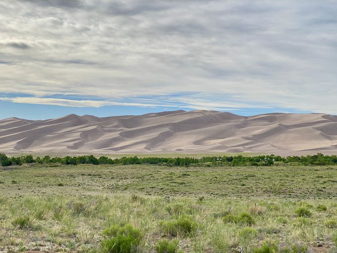
How were the Great Sand Dunes Formed?
Ten thousand years ago, this area was covered with lakes surrounded by wetlands. When the climate became drier, vegetation disappeared, leaving a sheet of sand and silt. Winds transported these deposits to form the dunes. The Great Sand Dunes are North America's tallest dunes, some of which reach heights of 750-feet tall.
Fees
There's a $25/vehicle entry fee as of June 2024 (subject to change). Entering the park is faster if you purchase an Annual National Parks pass ahead of time. You can learn more about Great Sand Dunes National Park entrance fees here.
Warning
Excessive heat: During the day, the heat can climb to unsafe temperatures, especially when hiking in exposed areas with little shade. Remember to bring plenty of water and to stay hydrated.
Walk
This is more of a short walk than an actual hike, but the trail is well-worth the time spent to view the Great Sand Dunes, especially if you don't have much time to spend while visiting the park. The trailhead is located at the visitors center and heads in along the western side of the building. The loop begins by heading downhill along a dirt pathway where you'll find different information kiosks about native plants, the mountains, and how the dunes formed. Hikers will get views all around them - if you follow this route by taking the southern half of the loop first, you'll get views of the distant San Luis Valley and Medano Creek. Once you swing around, heading back toward the trailhead, you'll get stunning views of the Great Sand Dunes and Sangre de Cristo Mountains. Granted, these views are there the entire time as the landscape is totally wide open with very few shrubs or trees blocking the views. The trail loops back to the trailhead at the visitors center for a short 0.4-mile walk.
Universal Access
This trail follows both a paved and dirt surface that should be considered universally accessible. The dirt is a firm hard surface with no tripping hazards, holes, or dips. Note that the connection between the dirt pathway and the paved surface may not be fully accessible - in that case, as of June 2024, there's a fully accessible paved pathway that encompasses the visitors center and provides similar views that the trail has to offer.
Other Hikes
While the park has many longer trails to explore, including the dunes themselves, if you don't have much time to spend at the park consider hiking the Great Sand Dunes View Trail (Mosca Pass) from the parking lot to reach the Montville Nature Loop Trail for a different perspective.
Pets
Dogs are allowed on this trail only if leashed and cleaned up after. Click here more information on where dogs are and are not allowed at Great Sand Dunes National Park.
Parking
Hikers will find a very large parking lot at the coordinates provided, located at the main visitors center for the park. The lot is large enough to fit many dozens of vehicles as of June 2024.
How were the Great Sand Dunes Formed?
Ten thousand years ago, this area was covered with lakes surrounded by wetlands. When the climate became drier, vegetation disappeared, leaving a sheet of sand and silt. Winds transported these deposits to form the dunes. The Great Sand Dunes are North America's tallest dunes, some of which reach heights of 750-feet tall.
Fees
There's a $25/vehicle entry fee as of June 2024 (subject to change). Entering the park is faster if you purchase an Annual National Parks pass ahead of time. You can learn more about Great Sand Dunes National Park entrance fees here.
Warning
Excessive heat: During the day, the heat can climb to unsafe temperatures, especially when hiking in exposed areas with little shade. Remember to bring plenty of water and to stay hydrated.