The Round Lake Loop at Green Lakes State Park in Fayetteville, New York is an easy and popular 1.4-mile one-way hike that encompasses a glacial kettle hole pond that reflects vibrant shades of green and turquoise.
Popularity
This is by far one of the most-popular hikes in the Syracuse, NY / Fayetteville, NY area - thus you will likely see people on this trail unless you show up right when the park opens on a weekday. Weekends are generally jam-packed at Green Lakes State Park, especially during the warm months.
Hike Description
This hike begins at a quiet parking lot at Green Lakes State Park, located in between both Round Lake and Green Lake. Hikers, if starting in this exact parking lot, will find a trailhead located on the southwestern corner of the lot - the trailhead has no signage. Follow this trail as it leads to a small park store (that sell drinks, snacks, etc.). At the park store, keep left to hike downhill toward the lakes. Around mile 0.35, hikers will keep-right to head toward Round Lake.
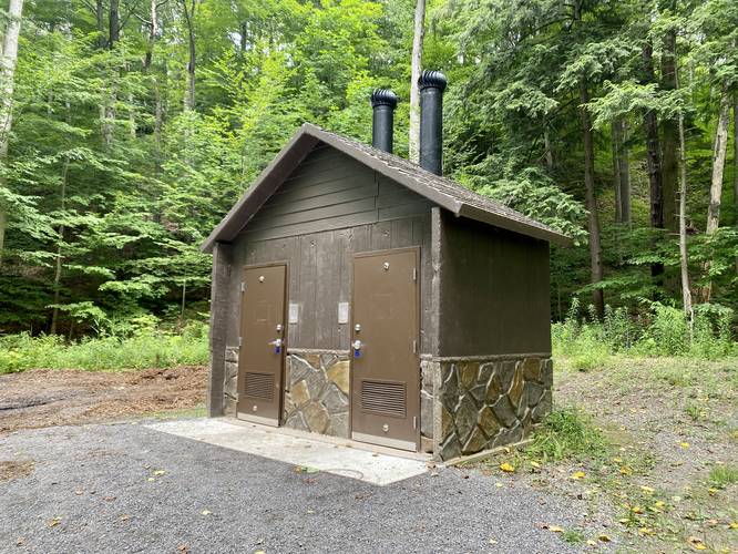
Restrooms - Mile 0.35
Note that there are restrooms located around mile 0.35, at the junction that leads to either Round Lake or Green Lake.
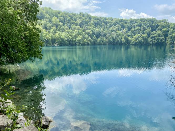
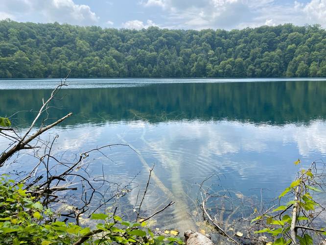
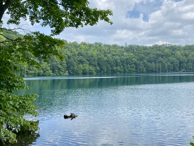
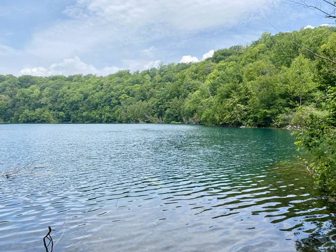
Round Lake Loop - Mile 0.4 to 1.4
At mile 0.4, hikers will reach a junction with the Round Lake Loop Trail. This GPS recording heads in a counter-clockwise direction with a nice view of Round Lake and its green and turquoise waters available near the start of the loop. The loop around Round Lake is relatively flat with a fairly-wide trail. Along this 1-mile loop, hikers will get stunning views of Round Lake's green and turquoise waters with several opportunities to sit and relax on benches. Note that some of the best views of the water, including the best color you'll find, is actually in the shade below the trees where the sunlight's refraction in the water creates the deepest turquoise colors you'll find. Most of the wide-open lake that the views along the trail provide actually reflect a lot of shimmering light back to you, which reduce the amount of color you'll see (check the pictures for more details).
Once at the end of the loop, this one-way hike is over; however, for the best lake views and kettle hole turquoise lake colors, you'll want to hike along the ultra-popular Green Lake Loop too.
Parking
The GPS coordinates for parking here will bring hikers to a quiet parking lot at Green Lakes State Park, located between Round Lake and Green Lake. There are a couple of ways to reach the lakes from this parking lot, but neither are super obvious. If you wish, you can try parking near the Green Lake beach, which is by far the most-popular spot to park, and it gets crowded there quick. If you park at the beach (follow park signs upon entry), you'll have to hike the Green Lake Loop to reach this trail instead.
Pets
Dogs are allowed only if leashed and must be cleaned up after.
Fees
As of July, 2023 there's a $10 entry fee for vehicles at Green Lakes State Park.
Water Source
Hikers will find water stations throughout the park including stores where you can also buy bottled water.
Popularity
This is by far one of the most-popular hikes in the Syracuse, NY / Fayetteville, NY area - thus you will likely see people on this trail unless you show up right when the park opens on a weekday. Weekends are generally jam-packed at Green Lakes State Park, especially during the warm months.
Hike Description
This hike begins at a quiet parking lot at Green Lakes State Park, located in between both Round Lake and Green Lake. Hikers, if starting in this exact parking lot, will find a trailhead located on the southwestern corner of the lot - the trailhead has no signage. Follow this trail as it leads to a small park store (that sell drinks, snacks, etc.). At the park store, keep left to hike downhill toward the lakes. Around mile 0.35, hikers will keep-right to head toward Round Lake.
Restrooms - Mile 0.35
Note that there are restrooms located around mile 0.35, at the junction that leads to either Round Lake or Green Lake.
Round Lake Loop - Mile 0.4 to 1.4
At mile 0.4, hikers will reach a junction with the Round Lake Loop Trail. This GPS recording heads in a counter-clockwise direction with a nice view of Round Lake and its green and turquoise waters available near the start of the loop. The loop around Round Lake is relatively flat with a fairly-wide trail. Along this 1-mile loop, hikers will get stunning views of Round Lake's green and turquoise waters with several opportunities to sit and relax on benches. Note that some of the best views of the water, including the best color you'll find, is actually in the shade below the trees where the sunlight's refraction in the water creates the deepest turquoise colors you'll find. Most of the wide-open lake that the views along the trail provide actually reflect a lot of shimmering light back to you, which reduce the amount of color you'll see (check the pictures for more details).
Once at the end of the loop, this one-way hike is over; however, for the best lake views and kettle hole turquoise lake colors, you'll want to hike along the ultra-popular Green Lake Loop too.
Parking
The GPS coordinates for parking here will bring hikers to a quiet parking lot at Green Lakes State Park, located between Round Lake and Green Lake. There are a couple of ways to reach the lakes from this parking lot, but neither are super obvious. If you wish, you can try parking near the Green Lake beach, which is by far the most-popular spot to park, and it gets crowded there quick. If you park at the beach (follow park signs upon entry), you'll have to hike the Green Lake Loop to reach this trail instead.
Pets
Dogs are allowed only if leashed and must be cleaned up after.
Fees
As of July, 2023 there's a $10 entry fee for vehicles at Green Lakes State Park.
Water Source
Hikers will find water stations throughout the park including stores where you can also buy bottled water.