Rocky Mouth Falls Trail in Sandy, Utah is a moderate 0.8-mile out-and-back hike that features the 30-foot tall canyon waterfall, Rocky Mouth Falls.
Hike Description
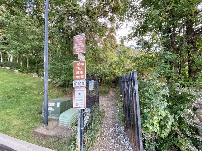
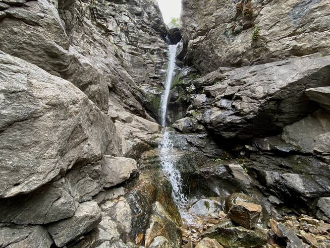
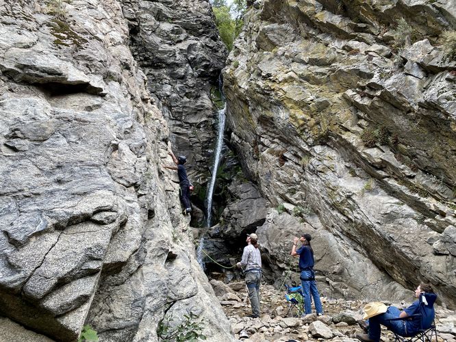
This hike begins at the main trailhead for Rocky Mouth Falls, located at the parking coordinates provided along Wasatch Blvd and follows the trail as it leads uphill along a series of stairs. Once at the top of the stairs, hikers will be on the sidewalk of Eagle View Drive. Follow this sidewalk, respective private property along the way, to find the continuation for the Rocky Mouth Falls Trail around mile 0.2, just around the bend in the road. Hikers will find a metal gate and signage for the trail, it's hard to miss. Once on the dirt footpath, the trail will climb steadily uphill, with signage for Rocky Mouth Waterfall along the way - keep left on this section of trail to reach the waterfall. Not long after passing the waterfall signage, hikers will pass a neat off-trail rock cave. Finally, after hiking up the rocky creek bed, hikers will find Rocky Mouth Falls spilling into the canyon at approximately 30-feet tall.
Rocky Mouth Falls, during early Autumn, flows steadily but is not a raging waterfall like it likely is during snow-melt season. Upon my hike here, I found a group of rock climbers testing their skills adjacent to the waterfall, so this spot is clearly good for rock climbing too.
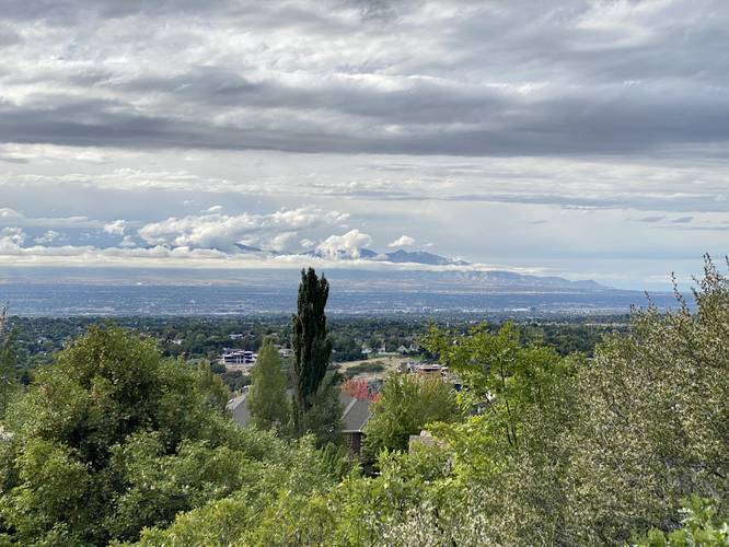
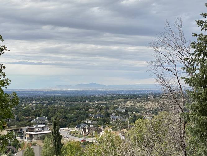
After visiting Rocky Mouth Falls, hikers will make their way back to parking. Along the way are a couple of nice views of the Salt Lake City area from the trail.
Parking
Hikers will find a small parking lot at the coordinates provided, located along Wasatch Blvd in Sandy, Utah. The lot is large enough to fit less than 10 vehicles and can be a tight squeeze.
Pets
Dogs are not allowed on this trail due to the protected watershed area. Please leave your dog(s) at home for this hike.
Hike Description
This hike begins at the main trailhead for Rocky Mouth Falls, located at the parking coordinates provided along Wasatch Blvd and follows the trail as it leads uphill along a series of stairs. Once at the top of the stairs, hikers will be on the sidewalk of Eagle View Drive. Follow this sidewalk, respective private property along the way, to find the continuation for the Rocky Mouth Falls Trail around mile 0.2, just around the bend in the road. Hikers will find a metal gate and signage for the trail, it's hard to miss. Once on the dirt footpath, the trail will climb steadily uphill, with signage for Rocky Mouth Waterfall along the way - keep left on this section of trail to reach the waterfall. Not long after passing the waterfall signage, hikers will pass a neat off-trail rock cave. Finally, after hiking up the rocky creek bed, hikers will find Rocky Mouth Falls spilling into the canyon at approximately 30-feet tall.
Rocky Mouth Falls, during early Autumn, flows steadily but is not a raging waterfall like it likely is during snow-melt season. Upon my hike here, I found a group of rock climbers testing their skills adjacent to the waterfall, so this spot is clearly good for rock climbing too.
After visiting Rocky Mouth Falls, hikers will make their way back to parking. Along the way are a couple of nice views of the Salt Lake City area from the trail.
Parking
Hikers will find a small parking lot at the coordinates provided, located along Wasatch Blvd in Sandy, Utah. The lot is large enough to fit less than 10 vehicles and can be a tight squeeze.
Pets
Dogs are not allowed on this trail due to the protected watershed area. Please leave your dog(s) at home for this hike.