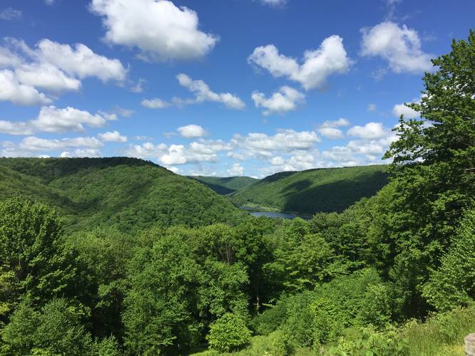
The Rock Run Trail at Lyman Run State Park in Galeton, Pennsylvania is a moderate 1.5-mile one-way trail that follows Rock Run up to an amazing lookout point high above Lyman Run Lake - the Lyman Lake Vista.
This recording starts at the parking lot and follows the signs for the Rock Run Trail, which sits about 1/4-mile down the road from the parking lot. Once you hit the actual trailhead, you'll be hiking uphill for 0.85-miles until you reach Rock Run Road, which is a dirt road that heads in both east and west directions. When you reach Rock Run Road, follow the road west until you reach the Lyman Lake Vista point.
From the Lyman Lake Vista, take in the views or enjoy a picnic before heading back down. Continue heading west along the road for about 0.4-miles until you reach the Spur Line Trail, which will head back east and connect with the Rock Run Trail again for an easy hike back to parking.
Parking: Parking can be found at the coordinates provided and sits across the street from the eastern campground. The trail starts here since there are signs to follow for the Rock Run Trail straight from the parking area. There's enough space for about 5 cars.
Pets: Dogs are allowed on leash and their waste must be carried out.
Hunting: Hunting is allowed here - wear orange to make yourself visible.
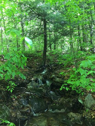
Waterfalls: There are very small cascades along Rock Run, which can be found randomly off the trail. Most of them are about 2 to 3-feet tall, which is barely considered a waterfall, but the scenery and rushing water is nice nonetheless.
Blaze colors: Follow the yellow blazes, which seem to have been painted over old blue blazes.
Bouldering: There are plenty of massive boulders along this trail - both in the woods and off of the Rock Run Road section of the trail, which makes this a great trail if you like to boulder. We did not see any boulderers that day, but there are small trails that lead to the boulders, indicating people certainly frequent them.
This recording starts at the parking lot and follows the signs for the Rock Run Trail, which sits about 1/4-mile down the road from the parking lot. Once you hit the actual trailhead, you'll be hiking uphill for 0.85-miles until you reach Rock Run Road, which is a dirt road that heads in both east and west directions. When you reach Rock Run Road, follow the road west until you reach the Lyman Lake Vista point.
From the Lyman Lake Vista, take in the views or enjoy a picnic before heading back down. Continue heading west along the road for about 0.4-miles until you reach the Spur Line Trail, which will head back east and connect with the Rock Run Trail again for an easy hike back to parking.
Parking: Parking can be found at the coordinates provided and sits across the street from the eastern campground. The trail starts here since there are signs to follow for the Rock Run Trail straight from the parking area. There's enough space for about 5 cars.
Pets: Dogs are allowed on leash and their waste must be carried out.
Hunting: Hunting is allowed here - wear orange to make yourself visible.
Waterfalls: There are very small cascades along Rock Run, which can be found randomly off the trail. Most of them are about 2 to 3-feet tall, which is barely considered a waterfall, but the scenery and rushing water is nice nonetheless.
Blaze colors: Follow the yellow blazes, which seem to have been painted over old blue blazes.
Bouldering: There are plenty of massive boulders along this trail - both in the woods and off of the Rock Run Road section of the trail, which makes this a great trail if you like to boulder. We did not see any boulderers that day, but there are small trails that lead to the boulders, indicating people certainly frequent them.