Loading...

🎉 Enjoy a Free 7-Day Supporter Trial and Unlock Exclusive Perks — No Credit Card Required. Learn more.

Rock Furnace Trail

Directions
Map
Pictures
Send to App
Distance:
3.0 Miles / 4.8 km
Type:
Out-and-Back
Difficulty:
Moderate
Time to Hike:
1 hour, ~30 minutes
Features:
Surface Type:
Dirt
Park:
Roaring Run Recreation Area
Town:
Apollo, Pennsylvania
Directions:
970 Brownstown Road, Apollo, PA, United States

40.565275, -79.517626
Added:
July 29, 2017
Updated:
March 23, 2020
Copy Trail Link Hiking this trail? Send a friend or family member a link to this trail guide for your own safety. Hike at your own risk (disclaimer)
Loading...
Loading...
296'

Total Change
588'

Ascent
587'

Descent

Download the Trail Route for Offline Use

Supporters get exclusive access to download trail routes to the MyHikes app for offline use. Stay prepared on your adventure, even without an internet connection! Become a Supporter today to unlock this feature and hike with confidence.

Send to App

Rock Furnace Trail

The Rock Furnace Trail is a moderate 3-mile out-and-back trail that runs through the scenic Roaring Run Reservation Area in Apollo, PA.

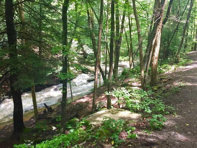
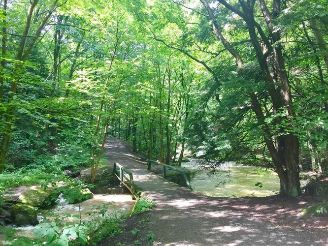
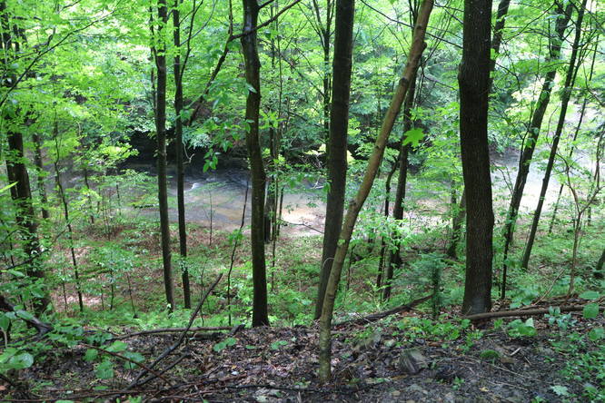
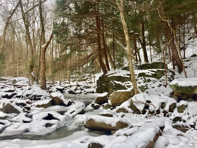
The trail leads from Brownstown Rd down to the Kiski River and follows Roaring Run Creek the entire length of the trail. There are numerous small waterfalls along the creek and after about 1-mile in on the trail you'll cross a suspension bridge.

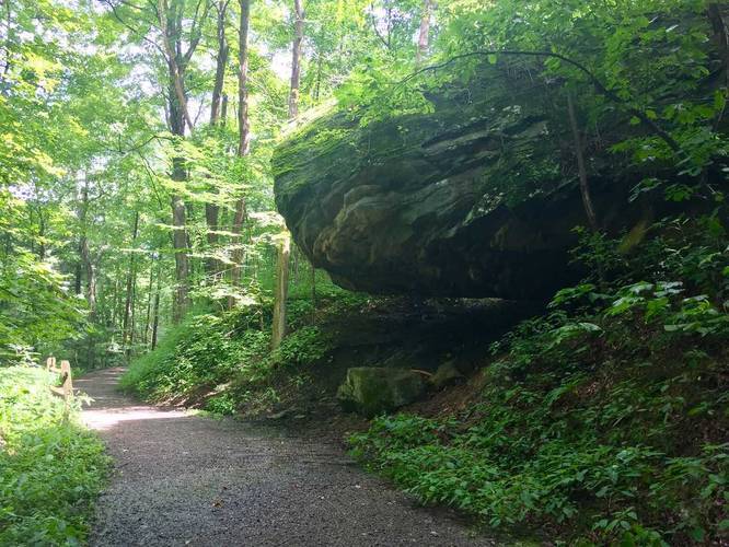
You'll also find the stonework remains of the Briddle Iron Furnace (aka Rock Furnace) which operated from 1825 to 1850. "Camel Rock" is also directly on the trail, jutting out from the side of the path with an overhang underneath.

At the end of this trail, located next to the river, is the Roaring Run Trail - a rail trail that runs from Apollo to Edmon, PA.

Pets: Dogs are allowed on this trail if leashed and their waste must be carried out with the hiker.

Biking: Biking is allowed on this trail.
Explore 191 trails near Apollo, PA
  1. Parking

    40.565275, -79.517626
  2. Main Trailhead

    40.564837, -79.518046
  3. Beautiful view of the creek

    40.560161, -79.528031
    Beautiful view of the creek
  4. Bridge creek crossing

    40.560944, -79.527206
    Bridge creek crossing
  5. Massive hanging rock jutting over part of the trail

    40.559075, -79.528786
    Massive hanging rock jutting over part of the trail
No community routes found. To add your own hike as a Community Route for this Trail guide, leave a Trip Report with an attached GPX file.

Hazards

Ticks - Lyme Disease More Info (CDC)

Season

Summer

Trip Reports

Trail Guide By:
Admin user profile picture
3.0 miles / 4.8 km
0 miles / 0 km
June 13, 2019
Visited the north (Brownstown Road) trailhead.
Hiking
1.5 miles / 2.4 km
December 16, 2017
Dogs Hiking
1.5 miles / 2.4 km
December 16, 2017
Hiked down to where the creeks converge and back to parking after a snowfall. The trail was empty and a bit slippery heading back uphill in the snow. We were looking for Jackson Falls, but only found "Keep Out" signs along where the trails to Jackson Falls lead west along the creek. Jackson Falls apparently sits on private property, so you cannot hike beyond the posted signs without explicit permission from the land owners.
Dogs Hiking
3.0 miles / 4.8 km
July 29, 2017
Dogs Hiking

Weather Forecast

In Apollo, PA

Explore Hiking Trails

You May Also Like

Colorado's Million Dollar Highway - Plan a day's drive adventure along the iconic Million Dollar Highway in Colorado. Explore the best short trails, roadside stops, waterfalls, vistas, ghost towns, and hot springs within a ~6 hour road trip.
Explore

Colorado's Million Dollar Highway

Plan a day's drive adventure along the iconic Million Dollar Highway in Colorado. Explore the best short trails, roadside stops, waterfalls, vistas, ghost towns, and hot springs within a ~6 hour road trip.

Read
New York's Best Waterfalls - Whether you're planning a day hike, roadside stop, or a leisurely short walk, this guide provides hikers, travelers, and locals alike with 63 different locations to over 100 scenic waterfalls to help plan your next adventure!
Explore

New York's Best Waterfalls

Whether you're planning a day hike, roadside stop, or a leisurely short walk, this guide provides hikers, travelers, and locals alike with 63 different locations to over 100 scenic waterfalls to help plan your next adventure!

Read

Before you boogie...

Find our trail guides useful? Consider becoming a Supporter to unlock perks!

MyHikes is an indie platform that makes exploring public trails easier for everyone. The platform has no investors, no ads, and is owned and operated by one person, Dave Miller. Dave has personally mapped and written over 1,800 trail guides on MyHikes for the public to explore. MyHikes has helped millions outdoor enthusiasts plan their next adventure.

But it takes a lot of time 🕦, money 💰, work, and espresso shots ☕ to run MyHikes, including hiking , mapping , writing , and publishing new trails with high-quality (accurate) information... along with software engineering (coding) the platform like building new features, website and mobile app development (iOS and Android), site maintainance . and much much more.

Supporters unlock website and mobile app perks with an annual one-time payment of $25 (you renew) 😎👍. Or you can simply make a Donation of your choice. Otherwise, you can support us by telling your friends about MyHikes - both quick and free 🎉

Admin user profile picture

Dave Miller
MyHikes Founder