The River Trail and Flume Falls at Adirondack Park within the Wilmington Wild Forest in Wilmington, New York is an easy 0.8-mile out-and-back hike that features several flume waterfalls and views Esther Mountain.
Hike Description
This short hike begins at the main parking lot for the Flume Trail System in Wilmington, NY right off of NY-86 and follows the River Trail from the parking lot.
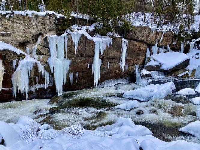
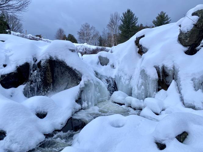
Flume Waterfalls - Mile 0.05
This track leads down the hill to the banks of the West Branch Ausable River to reach several short flume waterfalls that cascade down the river. These waterfalls are the main attraction for the River Trail, despite sitting adjacent to the parking lot. During the winter, it's more difficult to photograph these waterfalls, but from the looks of it, they're about 4 to 7-feet tall at most. Note that these are the "upper" portion of Flume Falls. To explore the lower portion, which are more interesting, but also a lot more dangerous, check out the Flume Falls guide.
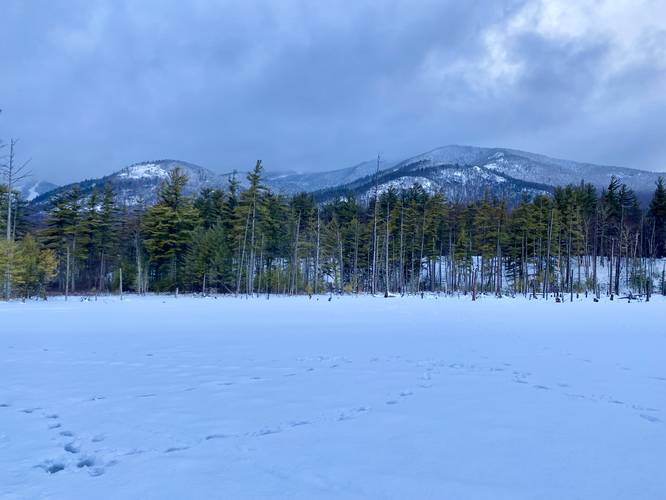
Esther Mountain View & Swamp - Mile 0.16
After visiting the Flume Waterfalls near the parking area, hikers will follow the trail as it runs alongside the West Branch Ausable River toward a swamp area. At the swamp, the trail heads southwest, skirting the water, but here sits a nice view of Esther Mountain from the valley below. Note that during the winter, this swamp is frozen over and most hikers choose to walk across the water - as shown in this GPS track - remember to hike at your own risk in this case. While the swamp may be shallow, ice can certainly give away if too thin.
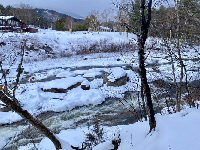
River Bank Hike
After passing the Esther Mountain view and swampy area, the trail will follow the West Branch Ausable River for a short while before reaching more trail junctions. Due to a lack of time, this GPS recording ends here; however, there are plenty of trails within the Flume Trail System that hikers can use to create their own loops.
Parking
Hikers will find a medium-sized parking lot at the coordinates provided which is the main parking area for the Flume Trail System within Adirondack Park. The lot is large enough to fit about a dozen vehicles, maximum, as of January 2023.
Pets
Dogs are allowed if leashed and their waste should be carried out by the hiker.
Hike Description
This short hike begins at the main parking lot for the Flume Trail System in Wilmington, NY right off of NY-86 and follows the River Trail from the parking lot.
Flume Waterfalls - Mile 0.05
This track leads down the hill to the banks of the West Branch Ausable River to reach several short flume waterfalls that cascade down the river. These waterfalls are the main attraction for the River Trail, despite sitting adjacent to the parking lot. During the winter, it's more difficult to photograph these waterfalls, but from the looks of it, they're about 4 to 7-feet tall at most. Note that these are the "upper" portion of Flume Falls. To explore the lower portion, which are more interesting, but also a lot more dangerous, check out the Flume Falls guide.
Esther Mountain View & Swamp - Mile 0.16
After visiting the Flume Waterfalls near the parking area, hikers will follow the trail as it runs alongside the West Branch Ausable River toward a swamp area. At the swamp, the trail heads southwest, skirting the water, but here sits a nice view of Esther Mountain from the valley below. Note that during the winter, this swamp is frozen over and most hikers choose to walk across the water - as shown in this GPS track - remember to hike at your own risk in this case. While the swamp may be shallow, ice can certainly give away if too thin.
River Bank Hike
After passing the Esther Mountain view and swampy area, the trail will follow the West Branch Ausable River for a short while before reaching more trail junctions. Due to a lack of time, this GPS recording ends here; however, there are plenty of trails within the Flume Trail System that hikers can use to create their own loops.
Parking
Hikers will find a medium-sized parking lot at the coordinates provided which is the main parking area for the Flume Trail System within Adirondack Park. The lot is large enough to fit about a dozen vehicles, maximum, as of January 2023.
Pets
Dogs are allowed if leashed and their waste should be carried out by the hiker.