Loading...

WINTER SALE! 50% OFF Supporter Accounts — now through January 31st. Learn More.

Jennings Trail

The Jennings Trail at Raccoon Creek State Park's Wildflower Reserve is a moderate 1.7-mile one-way trail that leads from the parking lot and passes through the largest portion of the wildflower reserve before ending at the Henrici Trail. You can take the Henrici Trail back for a 2.3-mile loop hike.

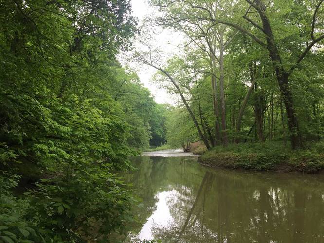
This trail starts at the southern end of the parking lot and heads downhill towards Raccoon Creek and then follows the creek for about a mile. The trail is often muddy, especially during the Spring.

You'll get views of rock ledges, Raccoon Creek, wildflowers, and a small cabin along the way.

No dogs, biking, or food allowed on the trails within the wildflower reserve.
Explore 177 trails near Clinton, PA

Know Before You Go

  • Jennings Trail is a 1.7-mile moderate trail in Raccoon Creek State Park's Wildflower Reserve, Clinton, PA, offering scenic views of the creek, wildflowers, and rock ledges.
  • It is a one-way trail that connects to the Henrici Trail, which can be used to create a 2.3-mile loop hike.
  • The trail is often muddy and prohibits dogs, biking, and food.
Interactive topographic map for Jennings Trail located in Clinton, PA. Click the "View Map" button to load GPS coordinates and trail markers.
Get directions
Distance
1.7 mi
Difficulty
Moderate
Type
One-Way
Est. Time
51 min
Elev. Gain
260'
Rating
0.0
Added
May 28, 2017
Updated
April 21, 2019

Weather Forecast

Loading...
Total Change
154'
Ascent
260'
Descent
346'
Loading...

Download the GPX Data for Offline Use

Supporters get exclusive access to download trail routes to the MyHikes app for offline use. Stay prepared on your adventure, even without an internet connection! Become a Supporter today to unlock this feature and hike with confidence.

Download Jennings Trail GPX Data to the MyHikes Mobile App

Features

Water Source

Points of interest

  1. Parking

    40.507241, -80.363989
  2. Main Trailhead

    40.507173, -80.363487

Safety information

For your own safety: plan ahead, let someone know where you'll be, and hike at your own risk.

Markers

Blaze Color

Blue

Availability

All seasons

Surface type

Dirt

Trip Reports (Reviews)

Your opinion matters! Be the first to rate this trail.

Ready to help fellow hikers? Add a trip report to share your experience and provide valuable insights for other hikers!

1.7 miles / 2.7 km
June 22, 2018
Hiking
1.7 miles / 2.7 km
May 28, 2017
Hiking
No community routes found. To add your own hike as a Community Route for this Trail guide, leave a Trip Report with an attached GPX file.

Popular categories

Scenic mountain view representing vista trails
Vista trails
Scenic gorge of cascades representing waterfall trails
Waterfall hikes
Rugged mountain terrain representing summit trails
Summit trails
Scenic mountain view representing dog-friendly trails
Dog-friendly
Scenic campsite with a view representing camping trails
Camping trails
Appalachian Trail logo representing A.T. hikes
A.T. hikes

You May Also Like

New York's Best Waterfalls - Whether you're planning a day hike, roadside stop, or a leisurely short walk, this guide provides hikers, travelers, and locals alike with 63 different locations to over 100 scenic waterfalls to help plan your next adventure!
Explore

New York's Best Waterfalls

Whether you're planning a day hike, roadside stop, or a leisurely short walk, this guide provides hikers, travelers, and locals alike with 63 different locations to over 100 scenic waterfalls to help plan your next adventure!

Read
🍪 We use cookies to learn about site usage and to serve map tiles. You may block cookies manually in the browser. By continuing you agree. Learn more