Loading...

Distance:
0.7 Miles / 1.1 km
Type:
Out-and-Back
Difficulty:
Easy
Time to Hike:
~21 minutes
Features:
Surface Type:
Dirt
Park:
Quabbin Reservoir
Town:
Ware, Massachusetts
Directions:
42.29357, -72.308907
Added:
September 04, 2017
Updated:
April 27, 2020
Loading...
Loading...
82 '

Total Change
89 '

Ascent
114 '

Descent

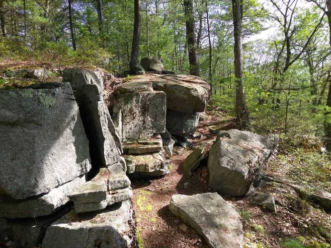
The Quabbin Nature Walk Trail is a small 0.7 out-and-back hike that starts around the corner from parking at the Goodnough Dike at Quabbin Reservoir.

This is a very easy trail but over grown and not maintained during the summer.

Dogs are not allowed at Quabbin. Parking can be found Old Ware-Enfield Rd at the Goodnough Dike lot.
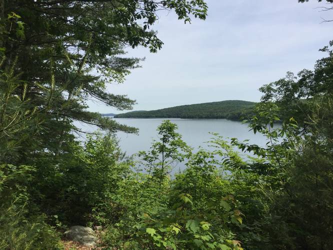
Lookout Point
As you follow the trail to the northern section of the loop, you'll find signs for a lookout point. To find it, follow the yellow blazes out to a small lookout that sits above the dike.

Parking
Parking can be found along Old Ware-Enfield Rd by the entrance to the Goodnough Dike Trail. Hikers must walk in on the Goodnough Dike Loop Trail for about 0.15 to 0.2-miles to reach this trailhead.

Pets
Dogs are not allowed on any trails at Quabbin.

Explore 203 trails near Ware, MA
  1. Parking

    42.29357, -72.308907
  2. Main Trailhead

    42.294625, -72.305682
  3. Rock outcropping

    42.296579, -72.303599
    Rock outcropping
  4. Lookout above Goodnough Dike

    42.296628, -72.302581
    Lookout above Goodnough Dike
No community routes found. To add your own hike as a Community Route for this Trail guide, leave a Trip Report with an attached GPX file.

Hazards

Ticks - Lyme Disease More Info (CDC)

Season

Summer

Photo Albums

2 Trip Reports

No Star-Ratings
Trail Guide By:
Tocra user profile picture
0.7 miles / 1.1 km
Trail added
September 04, 2017
Hiked on
September 04, 2017
Updated on
April 27, 2020
0.7 miles / 1.1 km
June 09, 2018
Hiking

Weather Forecast

In Ware, MA

Explore Hiking Trails

New Hikes

Gorge Trail (Stony Brook)
0.8 Miles
1.3 km
Moderate
One-Way
Alluvial Fan (East) Waterfall
0.4 Miles
0.6 km
Easy
Out-and-Back
Sheep Lakes Lookout
0.1 Miles
0.2 km
Easy
Out-and-Back
Many Parks Curve Trail
0.4 Miles
0.6 km
Easy
Out-and-Back

Before you boogie...

Find our trail guides useful? Consider becoming a Supporter to unlock perks!

MyHikes is an indie platform that makes exploring public trails easier for everyone. The platform has no investors, runs no ads, and is owned and operated by one person, Dave Miller. Dave has personally mapped and written over 1,600 trail guides on MyHikes for the public to explore. As of 2024, MyHikes has helped over 1,300,000 outdoor enthusiasts plan their next adventure.

But it takes a lot of time 🕦, money 💰, and work, and espresso shots ☕ to run MyHikes, including hiking , mapping , writing , and publishing new trails with high-quality (accurate) information... along with software engineering (coding) the platform like building new features, site and mobile app development for iOS and Android, site maintainance . and much much more.

Supporters unlock website and mobile app perks with an annual one-time payment of $25 (you renew) 😎👍. Or you can simply make a Donation of your choice. Otherwise, you can support us by telling your friends about MyHikes - both quick and free 🎉

Admin user profile picture

Dave Miller
MyHikes Founder