Loading...

Distance:
0.6 Miles / 1.0 km
Type:
Out-and-Back
Difficulty:
Easy
Time to Hike:
~18 minutes
Features:
Surface Type:
Dirt
Park:
Quabbin Reservoir
Town:
Ware, Massachusetts
Directions:
42.304145, -72.337293
Added:
June 05, 2019
Updated:
April 27, 2020
Loading...
Loading...
77 '

Total Change
89 '

Ascent
89 '

Descent

The Quabbin Hill Trail at Quabbin Reservoir in Ware, Massachusetts is an easy 0.4-mile out-and-back trail that leads to the top of Quabbin Hill.

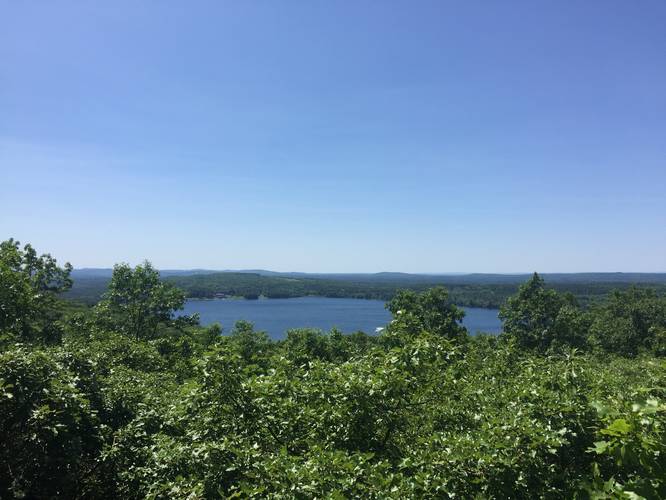
This short trail follows a wide path to the summit of Quabbin Hill. The summit provides a view of the Winsor Dam and the State Police Barracks.

The trail is unmarked, but very easy to follow and most of the entire trail is visible along the route.

Parking
Parking is available by the rotary on Administration Road and at the trail head itself.

Pets
Dogs are not allowed on any trails at Quabbin.

Biking
Biking is allowed on this trail.

Explore 203 trails near Ware, MA
  1. Parking

    42.304145, -72.337293
  2. Main Trailhead

    42.304244, -72.337442
  3. View of Quabbin from the trail

    42.303122, -72.341386
    View of Quabbin from the trail
No community routes found. To add your own hike as a Community Route for this Trail guide, leave a Trip Report with an attached GPX file.

Hazards

Ticks - Lyme Disease More Info (CDC)

Seasons

All

Photo Albums

2 Trip Reports

No Star-Ratings
Trail Guide By:
Tocra user profile picture
0.6 miles / 1.0 km
Trail added
June 05, 2019
Hiked on
May 06, 2019
Updated on
April 27, 2020
0.6 miles / 1.0 km
June 23, 2019
Great views for such a short hike. This is a little-known spot at Quabbin.
Hiking

Weather Forecast

In Ware, MA

Explore Hiking Trails

New Hikes

Conklin's Gully Loop
2.4 Miles
3.9 km
Hard
Loop
Sheep Lakes Lookout
0.1 Miles
0.2 km
Easy
Out-and-Back
Boulder Falls Trail
0.2 Miles
0.3 km
Moderate
Out-and-Back
West Rim Trail (Stony Brook)
0.7 Miles
1.1 km
Moderate
One-Way

Before you boogie...

Find our trail guides useful? Consider becoming a Supporter to unlock perks!

MyHikes is an indie platform that makes exploring public trails easier for everyone. The platform has no investors, runs no ads, and is owned and operated by one person, Dave Miller. Dave has personally mapped and written over 1,600 trail guides on MyHikes for the public to explore. As of 2024, MyHikes has helped over 1,300,000 outdoor enthusiasts plan their next adventure.

But it takes a lot of time 🕦, money 💰, and work, and espresso shots ☕ to run MyHikes, including hiking , mapping , writing , and publishing new trails with high-quality (accurate) information... along with software engineering (coding) the platform like building new features, site and mobile app development for iOS and Android, site maintainance . and much much more.

Supporters unlock website and mobile app perks with an annual one-time payment of $25 (you renew) 😎👍. Or you can simply make a Donation of your choice. Otherwise, you can support us by telling your friends about MyHikes - both quick and free 🎉

Admin user profile picture

Dave Miller
MyHikes Founder