Loading...

Distance:
1.6 Miles
Type:
Out-and-Back
Difficulty:
Easy
Time to Hike:
~48 minutes
Features:
Surface Type:
Dirt
Park:
Quabbin Reservoir
Town:
Belchertown, Massachusetts
Directions:
42.291745, -72.371483
1
Added:
August 05, 2018
Updated:
April 27, 2020

Gate 3A at Quabbin Reservoir in Belchertown, Massachusetts is an easy 1.6 mile out-and-back hike down to Quabbin from the end of Warner St.

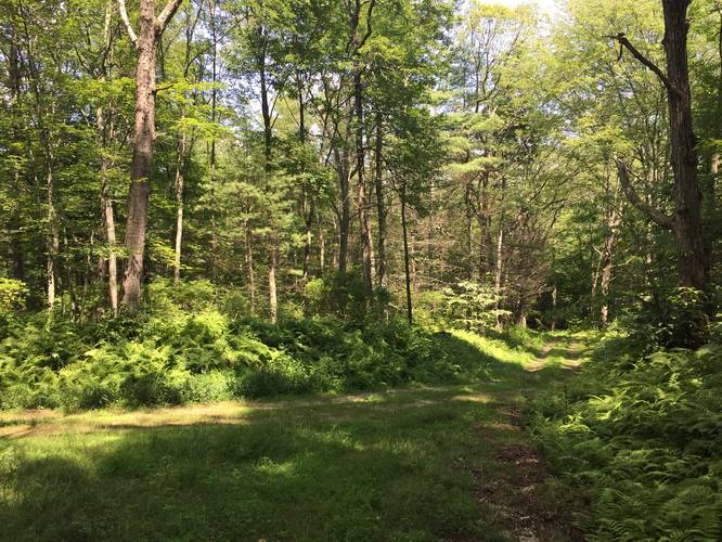
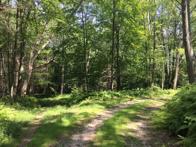
The trail starts off flat and then heads downhill along a gradual slope towards the water. Around mile 0.55 you'll hit a fork in the trail - stay right. Directly after the first fork, there will be a 2nd fork in the trail - stay left at this fork and you'll hit the water after about 0.1 miles.

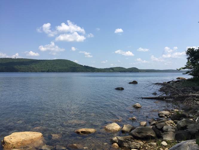
From the shores of Quabbin you can see the Winsor Dam Trail to the southeast along with western views of the reservoir.

Parking
Parking for this gate can be found at the dead end of Warner St - do not park in front of the gate.

Pets
Dogs are not allowed on any trails at Quabbin.

Explore 201 trails near Belchertown, MA

Hazards

Ticks - Lyme Disease More Info (CDC)

Seasons

All
Loading...
Loading...
159 '

Total Change
203 '

Ascent
200 '

Descent
Gate 3A default picture

Photo Albums

1 Trip Report

No Star-Ratings
Trail added
August 05, 2018
Updated on
April 27, 2020

Find Hiking Trails Near Me:

Map of MyHikes' trails in North America

Weather Forecast

In Belchertown, MA
Find your quest with MyHikes

Explore Hiking Trails

New Hikes

2
Porcupine Rock Lookout Hike
7.5 Miles
Hard Out-and-Back
1
Mt. Kearsarge Loop
2.7 Miles
Moderate Loop
1
Mt. Minsi via Appalachian Trail
4.7 Miles
Moderate Loop
Monadnock Sunapee & Eliza Adams Gorge Hike
4 Miles
Easy Out-and-Back

Before you leave...

MyHikes is an indie web platform aimed to make exploring public trails easier for everyone. The site has no investors and is owned and operated by one person, Dave Miller / Admin. As the main contributor and doer-of-all-things for MyHikes, I share my experiences from hikes and backpacking trips on MyHikes for fun on a volunteer basis and I believe that public trail information should be available to everyone.

It takes a lot of time 🕦, money 💰, and effort (including espresso shots ☕) to run MyHikes, including hiking , mapping , writing , and publishing new trails with high-quality content... along with building new features, moderating, and site maintainance . I simply ask that if you find our content helpful or useful when planning your next adventure that you consider making a small donation to help keep the site running.

You can become a Supporter* (*MyHikes user account required) to unlock perks for as little as $0.83/month with a 1-time non-recurring payment 👍 Or you can simply Donate any amount without a MyHikes user account. Otherwise, telling your friends about MyHikes is the next-best thing to a donation - both quick and free 😄

Thanks for visiting MyHikes and have a great hike! ✌

Admin user profile picture

Dave Miller
MyHikes Founder & Admin