Loading...

WINTER SALE! 50% OFF Supporter Accounts — now through January 31st. Learn More.

H. H. Jackson to Robert Frost Spur Trail

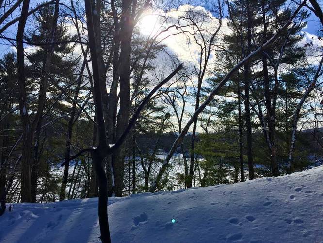
This tiny connector trail at the Puffer's Pond Conservation Area in Amherst, Massachusetts is a 0.2 mile one-way hike that connects the top of the H. H. Jackson Trail to the Robert Frost Trail and is an easy way to wrap up a short loop hike at Puffer's Pond. At the beginning of this trail is a small overlook, during colder months, when no leaves are on the trees; however, it's nothing special. You can see UMass and the Holyoke Range through the trees before heading downhill towards the Robert Frost Trail. There are no blazes to follow.

You can also park on Pulpit Hill Road where the H. H. Jackson Trail ends/begins.
Explore 209 trails near Amherst, MA

Know Before You Go

  • Short connector trail (0.2 miles) linking H. H. Jackson Trail to Robert Frost Trail at Puffer's Pond.
  • Offers a limited, seasonal overlook with views of UMass and the Holyoke Range.
  • Lacks trail blazes, but connects two established trails for loop hiking options.
Interactive topographic map for H. H. Jackson to Robert Frost Spur Trail located in Amherst, MA. Click the "View Map" button to load GPS coordinates and trail markers.
Get directions
Distance
0.2 mi
Difficulty
Easy
Type
One-Way
Est. Time
6 min
Elev. Gain
0'
Rating
0.0
Added
December 31, 2017
Updated
October 25, 2018

Weather Forecast

Loading...
Total Change
46'
Ascent
0'
Descent
10'
Loading...

Download the GPX Data for Offline Use

Supporters get exclusive access to download trail routes to the MyHikes app for offline use. Stay prepared on your adventure, even without an internet connection! Become a Supporter today to unlock this feature and hike with confidence.

Download H. H. Jackson to Robert Frost Spur Trail GPX Data to the MyHikes Mobile App

Features

Dogs
Biking

Points of interest

  1. Parking

    42.416095, -72.514826
  2. Main Trailhead

    42.418449, -72.517549

Safety information

For your own safety: plan ahead, let someone know where you'll be, and hike at your own risk.

Availability

All seasons

Surface type

Dirt

Trip Reports (Reviews)

Your opinion matters! Be the first to rate this trail.

Ready to help fellow hikers? Add a trip report to share your experience and provide valuable insights for other hikers!

0.2 miles / 0.3 km
December 28, 2017
Hiking
No community routes found. To add your own hike as a Community Route for this Trail guide, leave a Trip Report with an attached GPX file.

Popular categories

Scenic mountain view representing vista trails
Vista trails
Scenic gorge of cascades representing waterfall trails
Waterfall hikes
Rugged mountain terrain representing summit trails
Summit trails
Scenic mountain view representing dog-friendly trails
Dog-friendly
Scenic campsite with a view representing camping trails
Camping trails
Appalachian Trail logo representing A.T. hikes
A.T. hikes

You May Also Like

Colorado's Million Dollar Highway - Plan a day's drive adventure along the iconic Million Dollar Highway in Colorado. Explore the best short trails, roadside stops, waterfalls, vistas, ghost towns, and hot springs within a ~6 hour road trip.
Explore

Colorado's Million Dollar Highway

Plan a day's drive adventure along the iconic Million Dollar Highway in Colorado. Explore the best short trails, roadside stops, waterfalls, vistas, ghost towns, and hot springs within a ~6 hour road trip.

Read
Glacier's Going-to-the-Sun Road - Discover the breathtaking beauty of Glacier National Park along the iconic Going-to-the-Sun Road. From stunning roadside stops to picturesque waterfalls and vistas, this engineering marvel offers endless opportunities for exploration.
Explore

Glacier's Going-to-the-Sun Road

Discover the breathtaking beauty of Glacier National Park along the iconic Going-to-the-Sun Road. From stunning roadside stops to picturesque waterfalls and vistas, this engineering marvel offers endless opportunities for exploration.

Read
🍪 We use cookies to learn about site usage and to serve map tiles. You may block cookies manually in the browser. By continuing you agree. Learn more