The Potato Hill Summit Trail in Draper, Utah is a moderate 0.3-mile out-and-back hike that leads to the Potato Hollow Overlook and the summit of Potato Hill and features beautiful mountain views.
Hike
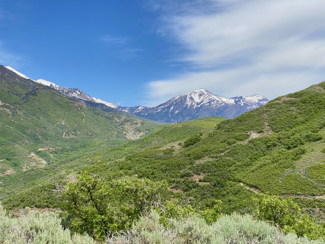
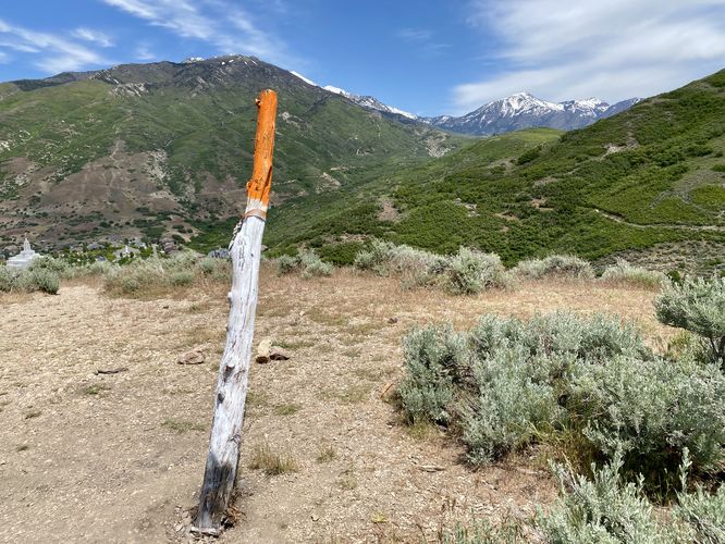
This very short hike begins at the main parking lot for Potato Hill and the Potato Hollow Overlook. The walk leads in along a smooth crushed gravel trail before reaching the Potato Hollow Overlook, located around mile 0.06 (just 300-feet from the trailhead). From the Potato Hollow Overlook, you'll find views of Draper, Utah, into Bluffdale, and north toward Salt Lake City.
After exploring the Potato Hollow Overlook, you might want to explore the top of Potato Hill while you're here. The eastward views from the top, in my opinion, are worth the extra time and energy. The trail leading to the top of Potato Hill is much more rugged than the trail that lead to the overlook. This trail is fairly steep and full of rocks and tripping hazards, but the short path ends quickly after a ~90-foot climb in just 400-feet of hiking. From the top of Potato Hill, you'll find the best north-facing views which includes the Draper Temple in the valley below along with Box Elder Peak towering overhead to the east. The views from the top of Potato Hill, in my opinion, were well-worth the hike up along this very short trail. After exploring the summit, the hike back to parking follows the same path for a quick 0.3-mile out-and-back hike.
Universal Access
This route includes a very short section of trail that's universally-accessible. From the parking lot until the turn up to the Potato Hill Summit, the trail follows a smooth and mostly-flat crushed gravel substrate. This smooth trail ends just before the Potato Hollow Overlook, labeled on the map; however, the view from where the universally-accessible path ends is just as good as from the official overlook.
Parking
Hikers will find a large parking lot at the coordinates provided. As of May 2024, the lot is large enough to fit just over a dozen vehicles.
Pets
Dogs are allowed only if leashed and must be cleaned up after.
Hike
This very short hike begins at the main parking lot for Potato Hill and the Potato Hollow Overlook. The walk leads in along a smooth crushed gravel trail before reaching the Potato Hollow Overlook, located around mile 0.06 (just 300-feet from the trailhead). From the Potato Hollow Overlook, you'll find views of Draper, Utah, into Bluffdale, and north toward Salt Lake City.
After exploring the Potato Hollow Overlook, you might want to explore the top of Potato Hill while you're here. The eastward views from the top, in my opinion, are worth the extra time and energy. The trail leading to the top of Potato Hill is much more rugged than the trail that lead to the overlook. This trail is fairly steep and full of rocks and tripping hazards, but the short path ends quickly after a ~90-foot climb in just 400-feet of hiking. From the top of Potato Hill, you'll find the best north-facing views which includes the Draper Temple in the valley below along with Box Elder Peak towering overhead to the east. The views from the top of Potato Hill, in my opinion, were well-worth the hike up along this very short trail. After exploring the summit, the hike back to parking follows the same path for a quick 0.3-mile out-and-back hike.
Universal Access
This route includes a very short section of trail that's universally-accessible. From the parking lot until the turn up to the Potato Hill Summit, the trail follows a smooth and mostly-flat crushed gravel substrate. This smooth trail ends just before the Potato Hollow Overlook, labeled on the map; however, the view from where the universally-accessible path ends is just as good as from the official overlook.
Parking
Hikers will find a large parking lot at the coordinates provided. As of May 2024, the lot is large enough to fit just over a dozen vehicles.
Pets
Dogs are allowed only if leashed and must be cleaned up after.