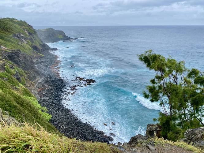
The Pohakupule Lookout in Honokohau, Hawaii (Maui) is a 0.1-mile out-and-back roadside lookout that features views of Maui's rugged northern coastline.
This is not a hike, but rather a short walk to a seaside cliff vista. Visitors will walk to the top of a rock ledge that provides views of the shoreline with beautiful blue and turquoise waters below.
Parking
Visitors will find a large parking turnout at the coordinates provided. The lot is large enough to fit less than 10 vehicles.
Pets
Dogs are allowed if leashed and cleaned up after.
Warnings
Cliffs: This short trail leads out to seaside cliffs that plunge well-over 50-feet to the ocean below. Stay back from the ledge to keep it safe and hike at your own risk.
Respecting the Land
Hawaiian land is considered sacred to native Hawaiians and many locals, so please stay on-trail, take nothing but photos, and leave nothing but footprints. Respect the locals - don't stay for long and have a backup hike planned in case the parking lot is full.