Loading...

❄️ WINTER SALE! 50% OFF on Supporter Accounts — now through January 31st. Unlock a full year of exclusive website & app perks. Learn More.

Brien Palmer Trail

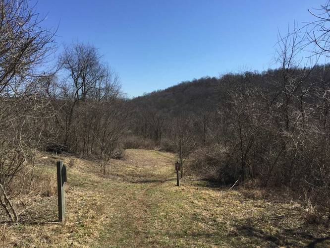
The Brien Palmer Trail at Pleasant Valley Park in Murrysville, Pennsylvania is an easy 0.8 mile one-way trail that runs along the eastern slopes of the park. The trail itself sits above a fairly large ravine with a creek at the bottom.

The trail winds around the edges of the ravine before reaching the Hemlock Trail and Red Oak Trail.

Dogs and biking are both allowed on this trail.

Traffic: During the weekends, this trail is a moderately trafficked trail.
Explore 215 trails near Murrysville, PA

Know Before You Go

  • Brien Palmer Trail is a short, easy, 0.8-mile trail in Murrysville, PA.
  • The trail follows a ravine within Pleasant Valley Park, connecting to other trails.
  • It's dog and bike-friendly and moderately busy on weekends.
Interactive topographic map for Brien Palmer Trail located in Murrysville, PA. Click the "View Map" button to load GPS coordinates and trail markers.
Get directions
Distance
0.8 mi
Difficulty
Easy
Type
One-Way
Est. Time
24 min
Elev. Gain
93'
Rating
0.0
Added
March 20, 2018
Updated
June 10, 2018

Weather Forecast

Loading...
Total Change
84'
Ascent
93'
Descent
106'
Loading...

Download the GPX Data for Offline Use

Supporters get exclusive access to download trail routes to the MyHikes app for offline use. Stay prepared on your adventure, even without an internet connection! Become a Supporter today to unlock this feature and hike with confidence.

Download Brien Palmer Trail GPX Data to the MyHikes Mobile App

Features

Dogs
Biking

Points of interest

  1. Parking

    40.410273, -79.68983
  2. Main Trailhead

    40.404325, -79.6861

Safety information

For your own safety: plan ahead, let someone know where you'll be, and hike at your own risk.

Availability

All seasons

Surface type

Dirt

Trip Reports (Reviews)

Your opinion matters! Be the first to rate this trail.

Ready to help fellow hikers? Add a trip report to share your experience and provide valuable insights for other hikers!

0.8 miles / 1.3 km
August 31, 2020
Hiking
0.8 miles / 1.3 km
March 18, 2018
Dogs Hiking
No community routes found. To add your own hike as a Community Route for this Trail guide, leave a Trip Report with an attached GPX file.

Popular categories

Scenic mountain view representing vista trails
Vista trails
Scenic gorge of cascades representing waterfall trails
Waterfall hikes
Rugged mountain terrain representing summit trails
Summit trails
Scenic mountain view representing dog-friendly trails
Dog-friendly
Scenic campsite with a view representing camping trails
Camping trails
Appalachian Trail logo representing A.T. hikes
A.T. hikes

You May Also Like

New York's Best Waterfalls - Whether you're planning a day hike, roadside stop, or a leisurely short walk, this guide provides hikers, travelers, and locals alike with 63 different locations to over 100 scenic waterfalls to help plan your next adventure!
Explore

New York's Best Waterfalls

Whether you're planning a day hike, roadside stop, or a leisurely short walk, this guide provides hikers, travelers, and locals alike with 63 different locations to over 100 scenic waterfalls to help plan your next adventure!

Read
🍪 We use cookies to learn about site usage and to serve map tiles. You may block cookies manually in the browser. By continuing you agree. Learn more