The Pinnacle Green-Yellow Loop at Pinnacle State Park in Addison, New York is a moderate 2.4-mile loop that features views, an old cemetery, and an abandoned truck.
Trails
This hike follows several named trails in the following clockwise loop order: Crystal Hills Trail (orange blazes), Green Loop (green blazes), Yellow Loop (yellow blazes), Green Loop (green blazes), and finally, the Crystal Hills Trail (orange blazes) to reach the parking area.
Hike Description
This hike begins along Dininny Road in Addison, NY and follows the orange blazes of the Crystal Hills Trail (part of the Finger Lakes Trail / FLT) through the service road gate at the trailhead. Immediately after the service road gate, hikers will leave the orange blazes of the Crystal Hills Trail to follow the green blazes of the Green Loop Trail as it begins the first ascent uphill.
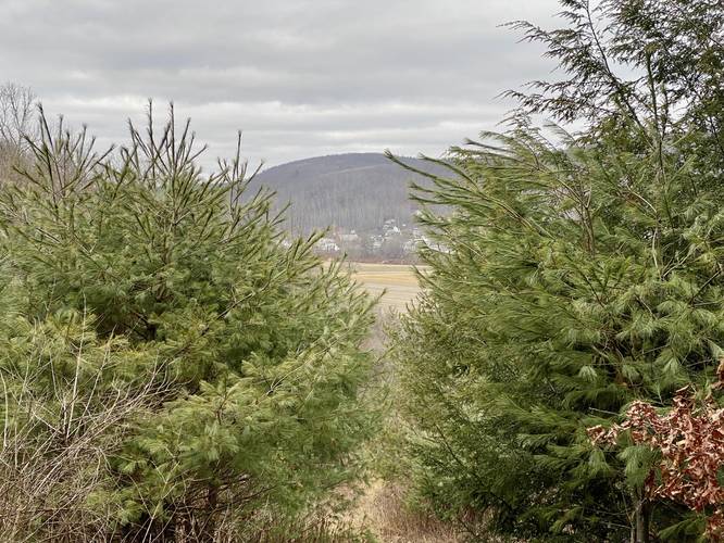
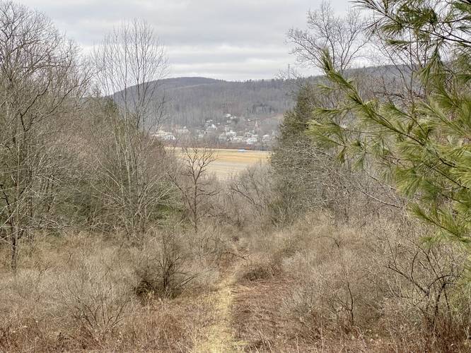
Along the way up the mountain, hikers will find small rock ledges along the trail (including larger ledges further up the hillside) as the trail winds its way around the steep mountainside. During the winter and colder months, hikers can get glimpses of Addison, NY through the pine forest. This section of the trail feels like an old logging grade that may have once been used to haul timber from the mountainside circa the late 1800s.
Left-Hand Turn (Yellow Loop) - Mile 0.6
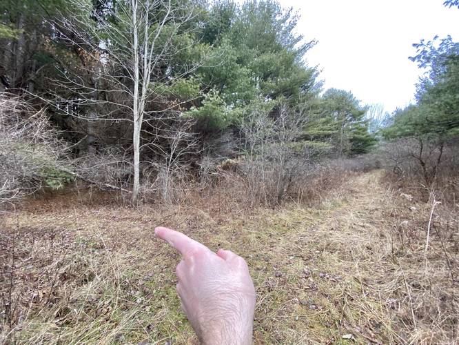
At mile 0.6, hikers will finally reach the first trail junction - a left-hand turn that leads onto the Yellow Loop.
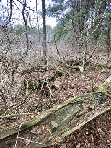
Abandoned Stone Grill - Mile 0.68
Just after turning onto the Yellow Loop, a keen-eyed hiker may notice the neat pile of stones located on the left-hand side (western side) of the Yellow Loop. This appears to be an abandoned stone campfire grill. As to how old it is, it's extremely hard to say whether the Pinnacle State Park had once built this or if it's simply an artifact from the past leftover from when the state of New York acquired the land.
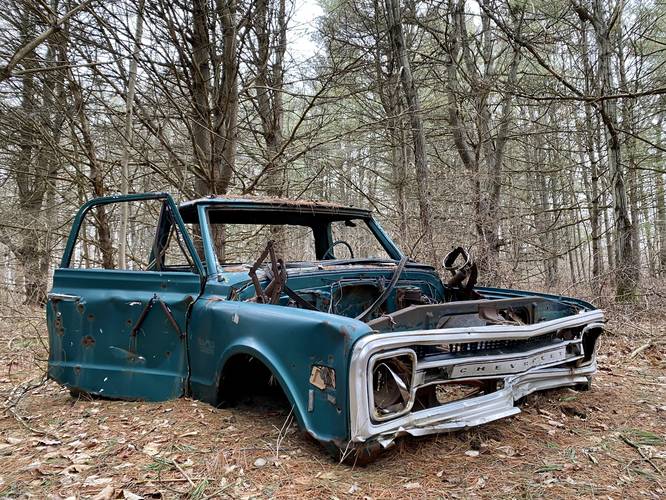
Abandoned Truck - Mile 0.9
At mile 0.9, hikers will reach an abandoned truck located just off-trail on the left-hand side. This turquoise vehicle is another interesting abandoned vehicle find at Pinnacle State Park as the Addison Vista Loop has another abandoned vehicle that hikers can explore.
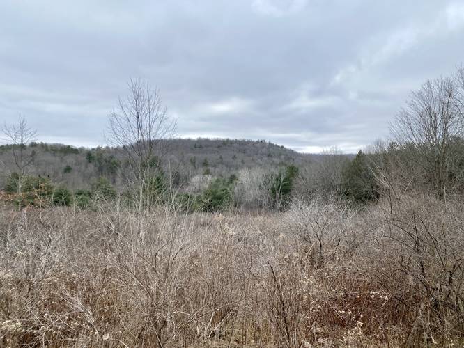
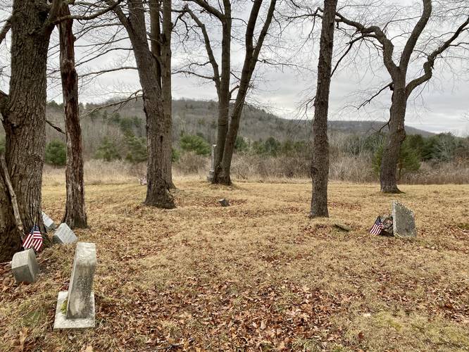
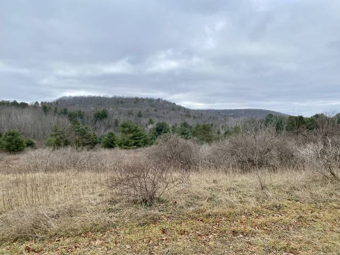
Views and Cemetery - Mile 1.1 to 1.2
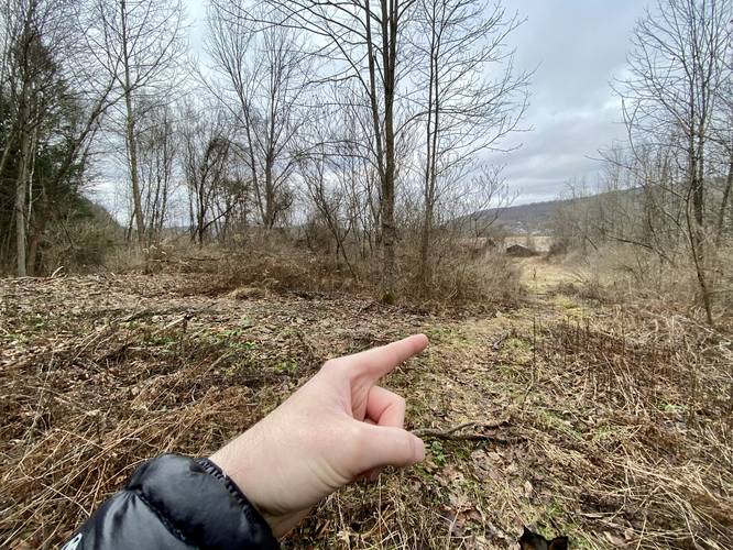
From miles 1.1 to 1.2, hikers will get nice views of the surrounding mountaintops as they hover above the open pine forest in the mountain hollow below. Additionally, this open field has a very old cemetery located at mile 1.14. The graves in the cemetery date back to the late 1800s and early 1900s. Some of the headstones have been replaced with newer headstones, while a lot of the originals still stand - which are arguably difficult to read at times.
Right-Hand Turn - Mile 1.2
Just after the cemetery, hikers will want to keep right to stay on the Yellow Loop as it heads toward the Green Loop. Note that this section of the hike becomes muddy from here and throughout a good portion of the Green Loop as it heads downhill.
Right-Hand Turn (Green Loop) - Mile 1.37
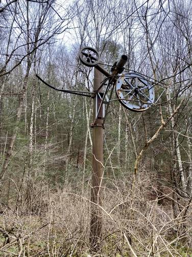
At mile 1.37, hikers will reach a right-hand turn onto the Green Loop as it leads hikers down the mountain. Note that this right-hand turn is the 2nd right-hand turn after leaving the cemetery area and follows the southern-most section of the Green Loop. The Green Loop, as noted earlier, can be very muddy and as of January 2023 is a bit overgrown, so watch your step. Eventually the trail will become steeper, after it passes another junction with the Yellow Loop once more. Along the way, a keen-eyed hiker may notice a view things: large brown metal pipes leading up and down the mountain (which likely carry electrical cables), a decent view of Addison, NY (more-so during cold months), and a large metal pully system located near the bottom of the mountain which looks like a ski lift pully, but was likely used back in the day to haul equipment or heavy items up the mountain to the golf resort.
Right-Hand Turn (Crystal Hills Trail / Orange Blazes) - Mile 2.1
Finally, hikers will reach the bottom of the mountain where they'll find the orange blazes for the Crystal Hills Trail. Take this right-hand turn to hike toward a couple of barn-like buildings. Then look for another immediate right-hand turn before the buildings. Here, hikers will follow the flat path back to parking, following both Orange and Green blazes along the way.
Parking
Hikers will find a small parking turnout at the coordinates provided. The turnout is large enough to fit a few vehicles. Please do not block the service road gate.
Pets
Dogs are allowed if leashed and their waste should be carried out by the hiker.
Seasonal Waterfalls
Note that there are some very small (3-foot) waterfalls located around mile 1.9 of this hike along the Green Loop. I did not take any photos since they were dried up, but during the Spring after the snow melts, there should be some small cascades to view in the creek here. All other seasons, especially during the summer, this creek is mostly just a trickle and thus no waterfalls flowing.
Trails
This hike follows several named trails in the following clockwise loop order: Crystal Hills Trail (orange blazes), Green Loop (green blazes), Yellow Loop (yellow blazes), Green Loop (green blazes), and finally, the Crystal Hills Trail (orange blazes) to reach the parking area.
Hike Description
This hike begins along Dininny Road in Addison, NY and follows the orange blazes of the Crystal Hills Trail (part of the Finger Lakes Trail / FLT) through the service road gate at the trailhead. Immediately after the service road gate, hikers will leave the orange blazes of the Crystal Hills Trail to follow the green blazes of the Green Loop Trail as it begins the first ascent uphill.
Along the way up the mountain, hikers will find small rock ledges along the trail (including larger ledges further up the hillside) as the trail winds its way around the steep mountainside. During the winter and colder months, hikers can get glimpses of Addison, NY through the pine forest. This section of the trail feels like an old logging grade that may have once been used to haul timber from the mountainside circa the late 1800s.
Left-Hand Turn (Yellow Loop) - Mile 0.6
At mile 0.6, hikers will finally reach the first trail junction - a left-hand turn that leads onto the Yellow Loop.
Abandoned Stone Grill - Mile 0.68
Just after turning onto the Yellow Loop, a keen-eyed hiker may notice the neat pile of stones located on the left-hand side (western side) of the Yellow Loop. This appears to be an abandoned stone campfire grill. As to how old it is, it's extremely hard to say whether the Pinnacle State Park had once built this or if it's simply an artifact from the past leftover from when the state of New York acquired the land.
Abandoned Truck - Mile 0.9
At mile 0.9, hikers will reach an abandoned truck located just off-trail on the left-hand side. This turquoise vehicle is another interesting abandoned vehicle find at Pinnacle State Park as the Addison Vista Loop has another abandoned vehicle that hikers can explore.
Views and Cemetery - Mile 1.1 to 1.2
From miles 1.1 to 1.2, hikers will get nice views of the surrounding mountaintops as they hover above the open pine forest in the mountain hollow below. Additionally, this open field has a very old cemetery located at mile 1.14. The graves in the cemetery date back to the late 1800s and early 1900s. Some of the headstones have been replaced with newer headstones, while a lot of the originals still stand - which are arguably difficult to read at times.
Right-Hand Turn - Mile 1.2
Just after the cemetery, hikers will want to keep right to stay on the Yellow Loop as it heads toward the Green Loop. Note that this section of the hike becomes muddy from here and throughout a good portion of the Green Loop as it heads downhill.
Right-Hand Turn (Green Loop) - Mile 1.37
At mile 1.37, hikers will reach a right-hand turn onto the Green Loop as it leads hikers down the mountain. Note that this right-hand turn is the 2nd right-hand turn after leaving the cemetery area and follows the southern-most section of the Green Loop. The Green Loop, as noted earlier, can be very muddy and as of January 2023 is a bit overgrown, so watch your step. Eventually the trail will become steeper, after it passes another junction with the Yellow Loop once more. Along the way, a keen-eyed hiker may notice a view things: large brown metal pipes leading up and down the mountain (which likely carry electrical cables), a decent view of Addison, NY (more-so during cold months), and a large metal pully system located near the bottom of the mountain which looks like a ski lift pully, but was likely used back in the day to haul equipment or heavy items up the mountain to the golf resort.
Right-Hand Turn (Crystal Hills Trail / Orange Blazes) - Mile 2.1
Finally, hikers will reach the bottom of the mountain where they'll find the orange blazes for the Crystal Hills Trail. Take this right-hand turn to hike toward a couple of barn-like buildings. Then look for another immediate right-hand turn before the buildings. Here, hikers will follow the flat path back to parking, following both Orange and Green blazes along the way.
Parking
Hikers will find a small parking turnout at the coordinates provided. The turnout is large enough to fit a few vehicles. Please do not block the service road gate.
Pets
Dogs are allowed if leashed and their waste should be carried out by the hiker.
Seasonal Waterfalls
Note that there are some very small (3-foot) waterfalls located around mile 1.9 of this hike along the Green Loop. I did not take any photos since they were dried up, but during the Spring after the snow melts, there should be some small cascades to view in the creek here. All other seasons, especially during the summer, this creek is mostly just a trickle and thus no waterfalls flowing.